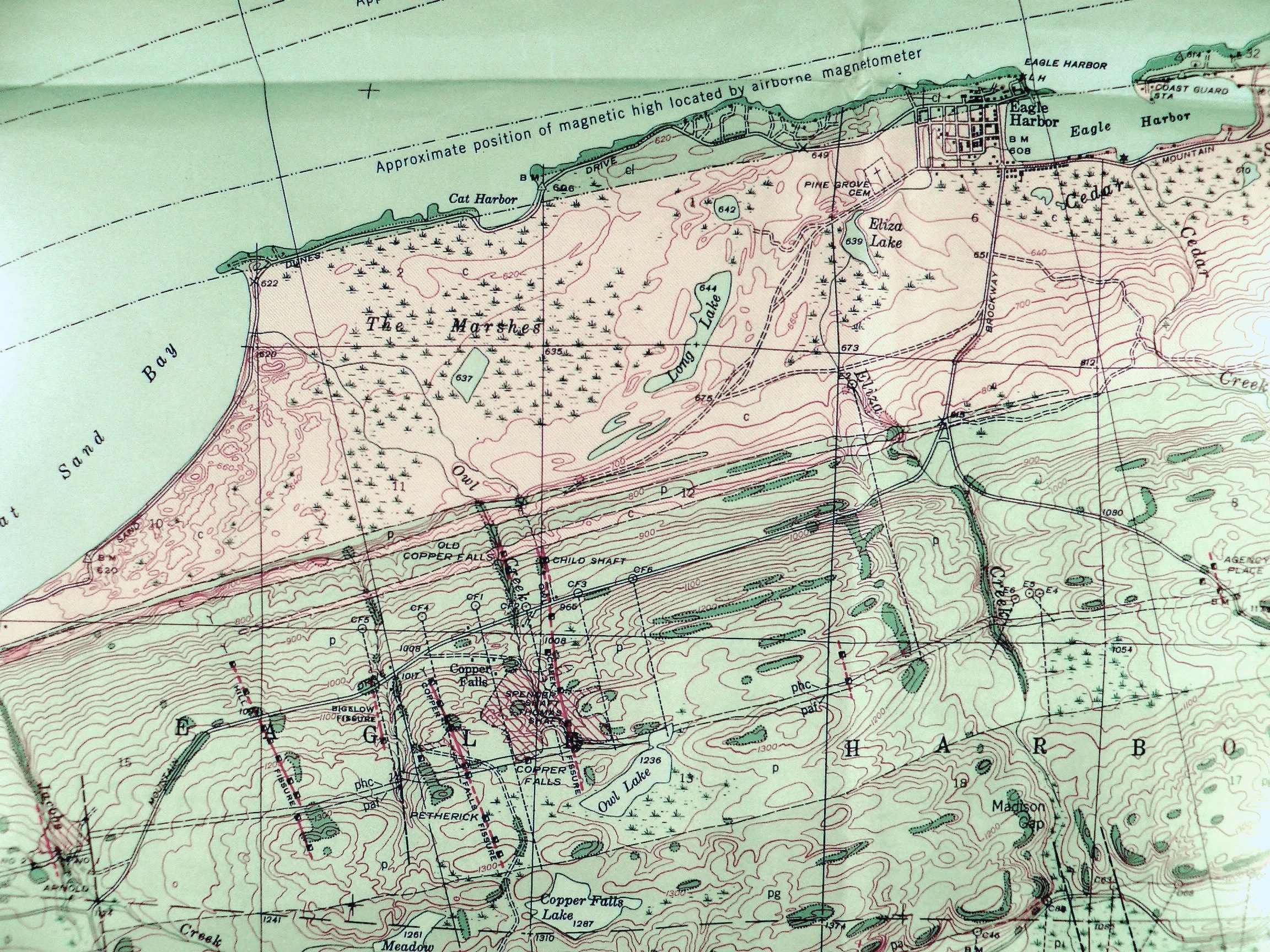
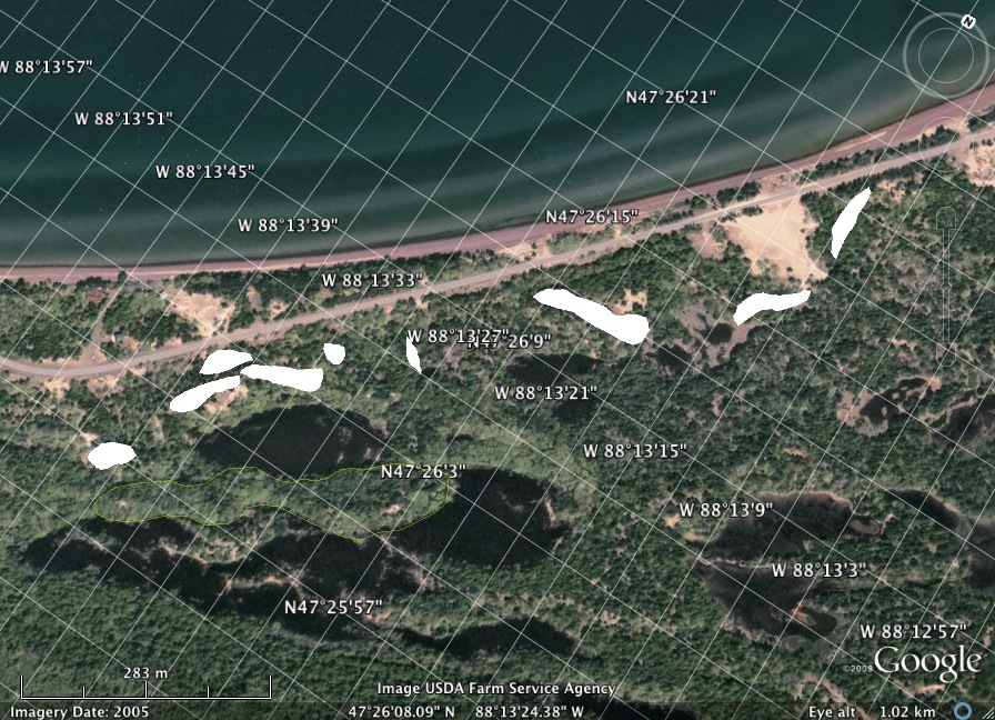
Right: Geologic map showing Portage Lake Volcanics (Green) and Copper Harbor Conglomerate (White). Outcrops are shown by darker colored areas (i.e. dark green is an actual exposure of the Portage Lake Volcanics) with dotted outlines.

Maps & Photos

Eagle Harbor Quad

Google Earth View


Data from Today

            Dunes Mapped


Excel Files

            Pothole Scaling

            Grainsize Presentation

            Grainsize Distribution Worksheet

            Grainsize Distributions of different environments

            Terminal Velocity

            Weather data

            Scale of dunes


Web links

            Potholes & Flow

                        Missoula Flood Potholes

                        Missoula Floor Potholes: Truck for scale

                        Potholes provide information about bedrock channels

                        The power of bubbles - video

                        Cavitation and Bubble Dynamics - online book

                        Glacier Garden Potholes

                        Bonas Defeat Gorge

                        St. Croix River Potholes

                        Dry Meadow Creek

                        Distinguished Gentleman by Mammoth Pothole

                        River Pothole images

                        Spatial patterns & effectiveness of potholes

                        Ice Age Floods
                                   
Missoula Flood - Paper w/ great images

                        Formation & Development of stream potholes

                       ZenGeologyPotholes.pdf


Dunes

Michigan Sand Dunes

Protecting Michigan Sand Dunes

Sleeping Bear Dunes National Lakeshore

Complete Guide to Dunes

Sand Dune Protection Act

Types of Dunes

Dune Animations

Shape and motion of dunes

Dune Types

Factors that determine dune types

What is a sand Dune?

Ecology of Michigan Dunes

Sedimentary Structures

Saltation

Great Sand Dunes: Saltation

Saltation Discussion

Global Climate animations

Sedimentation animations

Booming Sands Nova Movie

Desert animations

Dune Class exercises


Great Lakes

Great Lakes Science Center

Introduction to the Great Lakes

EPA Atlas: Great Lakes

Lake Superior Resources

Coast Watch: Superior

Lake Superior Overview

Lake Superior Facts & Figures

Origin of Lakes

Formation of Lakes


Beach Processes, Longshore Currents

Animations and movies

Visualizing Longshore Drift

Visualizing Waves

Ripcurrents (Registrtaion Required)

Coastal Basics


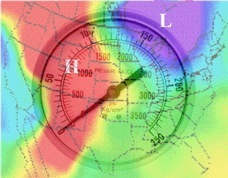
Atmospheric Pressure and Wind

Visualizing Atmospheric Pressure & Winds

Introduction to the Atmosphere: Pressure

Introduction to the Atmosphere: Wind

Forces and Wind

Atmospheric Pressure

Introduction to the Atmosphere: Local & Regional Patterns

Today’s 300 mb Contours

Today’s 500 mb Contours

Today’s 700 mb Contours


Temperature and Heating

Atmosphere: Composition & Structure

Seasons Movie

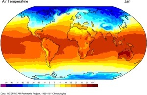
Global Surface Temperature Distribution

Seasonal & Daily Temperatures

Radiation & the Diurnal Cycle

Effects of Clouds and Moisture on the Diurnal Cycle

Energy and Matter: Energy, Temp & Heat

Energy and Matter: Nature of Radiation

Energy and Matter: Earth-Sun Geometry

Energy and Matter: Earth-Sun Relationships

Introduction to the Atmosphere: Global Heat Balance

Introduction to the Atmosphere: Concept of Temperature

Wikipedia: Latent_heat