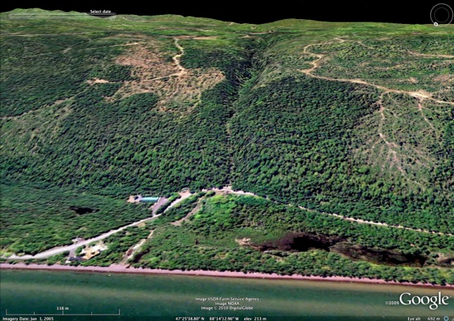
Along Jacobs Creek the river flows right down the dipslope of the lava flows toward Lake Superior making a number of waterfalls. In the 1970’s the creek here experienced a beaver dam breakage after a very heavy rain. The dam held a reservoir of mud which flowed with the water downslope, following the dipslopes which offered a frictionless rapid descent all the way to lake level. At that time there was a small tourist motel below the falls by the road, and it was inundated and destroyed by a mudflow. The waterfall seen at the M-26 crossing was bankfull with mud, trees and boulders during that event and this spot remains a hazard zone in spite of subsequent development on top of the mudflow deposit.


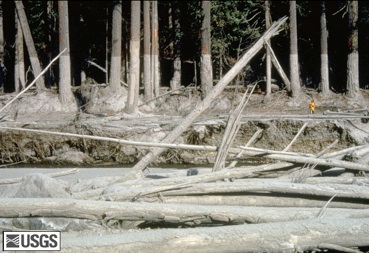
Mudflows can carry big boulders and trees along with them which creates high damage potential. At left, note the high mud levels shown on the trees, which shows that the mudflow went on downhill after it passed this point. The straight path of Jacob’s Creek, right down the dipslope, is shown in the Google Earth image below. This means the mudflow can accelerate until it reaches the break in slope near the road.