
The clay and sandy, gravelly and bouldery materials that cover the Keweenaw and Isle Royale are the result of climate conditions in the Pleistocene, which ended about 10,000 years ago. These deposits are gifts for building materials and were only interpreted as glacial deposits in the 1800s, because the glaciers have mainly disappeared from North America. Realization that climates have changed enough in such a short time to have resulted in withdrawal of a two mile thick ice covering for half of our whole continent was mind blowing. This section of our web materials on the Keweenaw and Isle Royale considers the causes and implications of this great discovery and the evidence that geologists assembled--evidence that can still be seen in the field sites (see below). The hypothesis of Continental Glaciation was proposed by Louis Agassiz in 1840.
Glaciers covered us completely, not long ago....

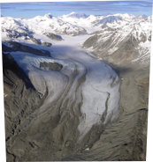


Wolverine Glacier, Alaska
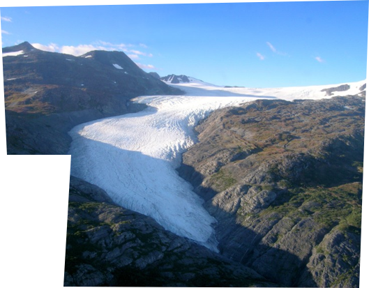
S Cascade Glacier
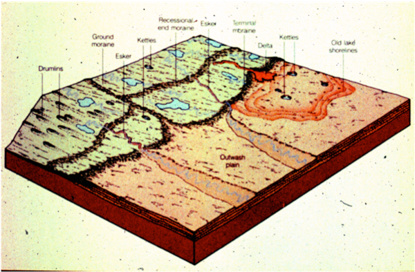
The diagram below, from AN Strahler’s Physical Geography, shows many of the geological features that Agassiz saw. Other explanations for many of these features did not survive testing, but the glacial idea has gained support worldwide at explaining things and demonstrating that the whole earth’s surface was substantially cooler in the geological past.
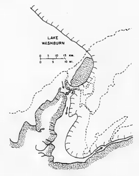
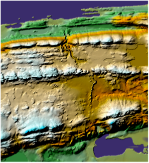
At right, the topographic map of the Keweenaw shows a prominent esker near Mandan. This feature forms as a subglacial river, with gravels on top of a ridge. With a glacier, it makes sense--otherwise?


Michigan was completely covered by glaciers 10,000 years ago and this has affected the landscapes profoundly. The Michigan Tech Campus is the result of glacial outwash. The Portage Lake “canal” is the result of an outlet to a post glacial lake called Lake Duluth, now gone. Most of the smaller lakes and ponds in Michigan are kettle lakes. Sand and gravel and landfill sites in Michigan are in glacial deposits and so are many groundwater aquifers.


Michigan Geo Map sources:
Warren, 1981
When Glaciers covered Michigan Mich DNR
Dorr & Eschman (1970) Good geo ref for Michigan!
Gillespie et al (2008) Recent Michigan Geo Source
Isle Royale and Glaciers: Huber 1973
Farrand: Michigan Glacial Lakes

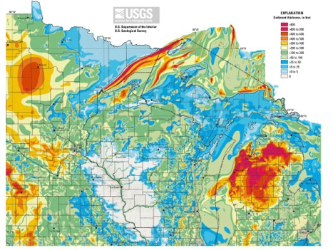
New Map showing Glacial deposit thickness above bedrock surface. Note that compared to the northern lower peninsula, thickness of glacial material is much less in the UP.
Soller, D.R., and Garrity, C.P., 2018, Quaternary sediment thickness and bedrock topography of the glaciated United States east of the Rocky Mountains: U.S. Geological Survey Scientific Investigations Map 3392, 2 sheets, scale 1:5,000,000.
https://doi.org/10.3133/sim3392.