
| The
Quest for Oil: Turpening Receives DOE Grant Story from Michigan Tech's Tech Topics Newsletter June 21, 2005 (Update July 7, 2005) |
|
|
Oil hides underground in porous places, and finding them has always been a problem. Research professor Roger Turpening (GMES) has received a $144,000 grant from the U.S. Department of Energy in hopes of making it a little easier.
“At the moment the best we can do is to make a point measurement, not an image, by taking a piece of rock out of a hole that one is drilling. “We have no idea what the permeability is between holes,” he says. Fragments of theory seem to indicate that the more permeable the earth is, the more seismic energy it will soak up. Proving this experimentally has not been simple; in fact, all investigative aspects (theory, lab experiments and field data) of the problem need a lot of work. "But you can see if you were an oil company and you could make such images, it would be incredibly valuable,” Turpening said. "In an oil field, you could drill a crooked borehole and hit just the sweet spots.” The field data portion of the problem could be improved significantly by using a site where Turpening and his longtime research colleague Wayne Pennington, chair of the geological and mining engineering and sciences department, have been conducting studies for years.
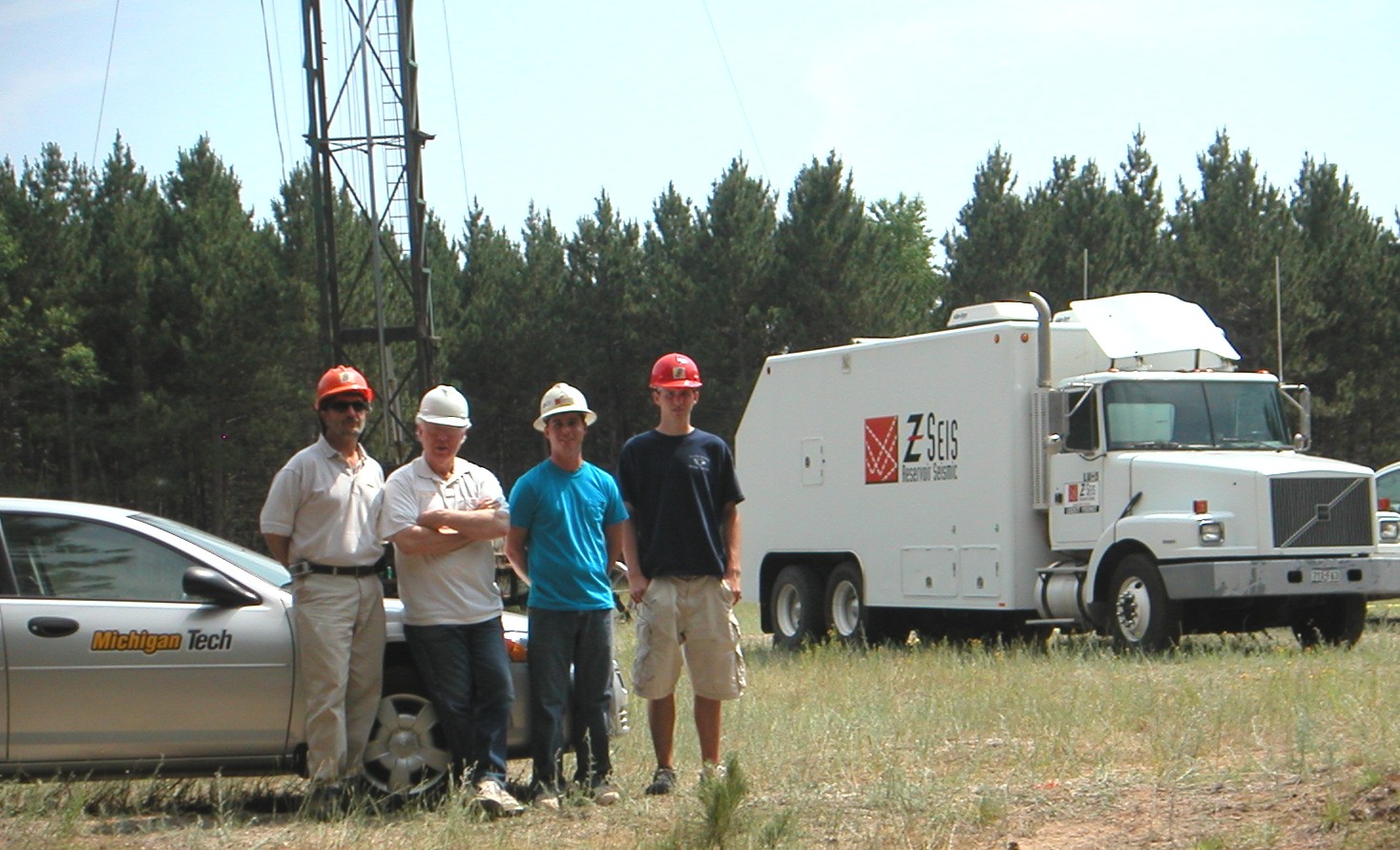
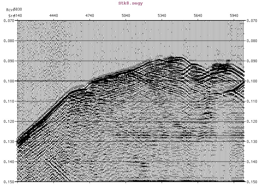
This grant will be used to determine where the new holes should be drilled and how deep they have to be. "We'll need additional funding to drill the holes and acquire the seismic data,” he added. In August Turpening will join other experts in the field, Steve Pride of Lawrence Berkeley National Lab and Professor Jerry Harris of Stanford University, to present their research program to ExxonMobil in Houston. If you could image the earth's permeable places, Turpening said, "you'd be king." Related projects -- Field data acquisition has just been completed on the first phase of a project to image facies and fluid distribution within carbonate reefs, using crosswell seismic amplitude-versus-offset studies. The pictures to the left are from the field, near Traverse City, in late June. That project is supported by the Tulsa office of the National Energy Technology Laboratory of the Department of Energy. |


Back To News page
Department of Geological & Mining Engineering & Sciences
Michigan Technological University
1400 Townsend Drive - Houghton, MI 49931-1295
(906) 487-2531