HOME
Links
introduces Remote Sensing, GPS and GIS; includes lesson plans within National Education Standards and educational links.
 Classic
CZCS Scenes
Classic
CZCS Scenes
a tutorial of images from around the world with
explanations of what is shown, how the images were acquired and what their
significance is.
SeaWiFS
Teacher Resource
a diverse list of educational links about Remote
Sensing and Ocean Color with online presentations and a "Show and Tell"
link of images around the world.
Earth
Observatory
NASA's observatory includes recent satellite
imagery and scientific publications focusing on Earth's climate and environmental
change.
Remote
Sensing Tutorial
a comprehensive guide to the history, science
and the many applications of remote sensing, contains information on image
processing and interpretation.
Learning
from Satellites
NASA's educational overview of Remote Sensing,
includes info on satellite resolution and visible and infrared images.
the
COOL room
home of Under Water Weather for the New Jersey
Coast, includes useful applications of remote sensing for fisherman, sailors
and surfers.
Public
Use of Remote Sensing data
contains examples of k-12 classroom applications
of remote sensing with contact information.
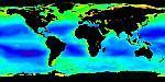
SeaWiFS
Project Homepage
an overview of the SeaWiFS project with helpful
links.
SeaWiFS
Movie Gallery
choose from a dozen rotating images of the Earth
highlighting different features observed from space.
Canada
Centre for Remote Sensing
has access to many tutorials and teacher's guides;
directed mainly towards upper level highschool students.
Earth
Oberservatory Newsroom
the latest news regarding earth observation and
remote sensing.
Remote
Sensing Online Guides
consists of educational guides on earth observing
satellites and radar imagery with in-depth information about the operation
of remote sensing satellites and the interpretation of images.
 Basics
of Remote Sensing
Basics
of Remote Sensing
NOAA's tutorial focuses on how to interpret satellite
imagery on the internet, also contains information on how radiation and
image enhancement are used in remote sensing.
Virtual
Hawaii
has access to remote sensing tutorials concentrating
on radar or visible and infrared imaging.

Earth Science
Enterprise
an overview of the various ways NASA studies
the earth, designed for student use.
Great Lakes Website | Remote Sensing Institute | R/V Lake Guardian | R/V Agassiz | Lesson Plans | Teachers' Guide | AVHRR Tutorial | Judy Budd's Page
This
page was created by Katie Kerfoot
Email
questions about the content of this web page to : Judy
Budd