Pilgrim River

Pilgrim River Watershed--Brief Geologic Background
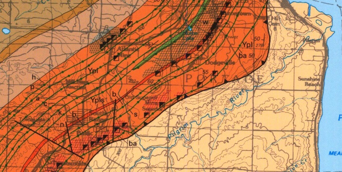
The Pilgrim River closely parallels the Keweenaw Fault (Fig 1), running about 0.5 to about 1 mile S of the fault line, on the sandstone side. It also shows that the river, like many rivers follows a path which takes advantage of a natural zone of weakness. The offset to the south is expected because the sandstone is weaker and more easily eroded than the basalt. The valley is steeper on the Northern side because of the harder basalt rock which underlies that side. On the basalt side are many old mines which are aligned along layers in the basalt where there were copper-rich amygdaloids (lava flow tops).
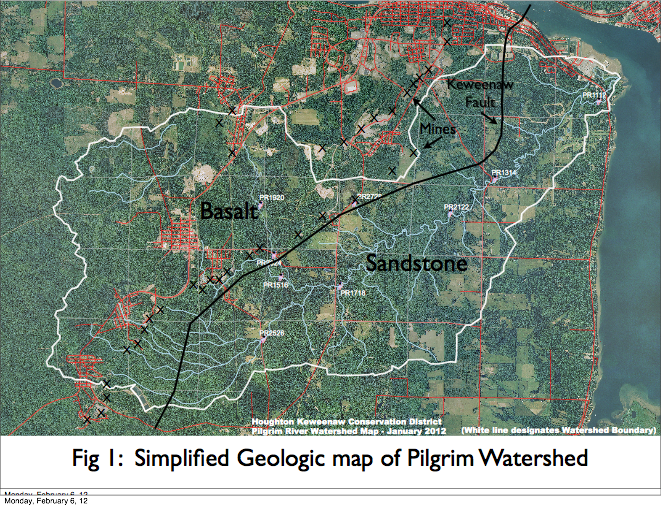
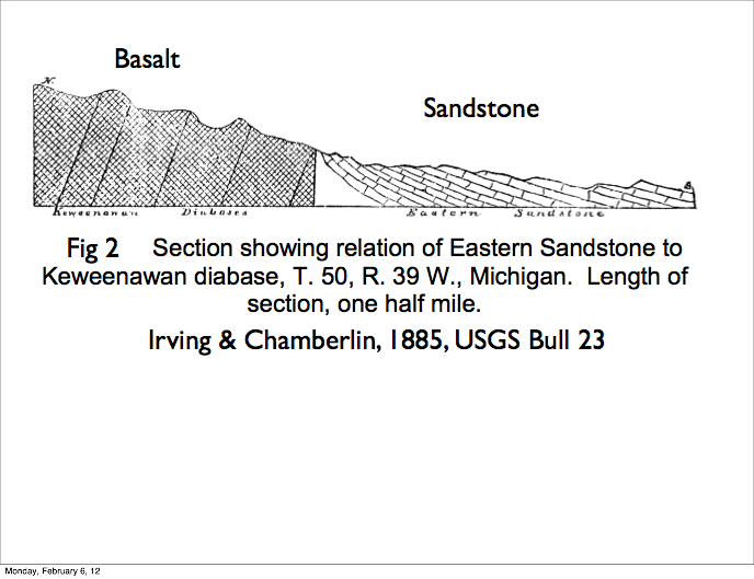
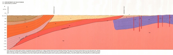
The Keweenaw Fault is a geologic wonder which records a great geological thrusting event that ended the Keweenaw rifting of 1.1 by ago. It is thought to have been caused by a great continental collision (called the Grenville Orogeny by geologists) which broke apart the continent and thrust the basalt section radically upward, with an offset of thousands of feet. The sense and strength of this geological feature rivals any on Earth, but it has no seismicity associated with it now. It is a great fossil fault, with its former tectonic driver now impotent. The fault itself is a line that can be drawn on a map (Fig1) and the dramatic sense of its movement visualized (Fig 2) but it is hard to see in person. There are a few places (The Natural Wall on the edge of the Traprock Valley, on Bete Gris beach, Douglas Houghton Falls, on Peepsock Creek near the SDC) where it can be fingered, but it general it is marked best by steep slopes where the edge of the sandstone is deeply eroded and basalt from the north side of the fault tumbles down to the river.
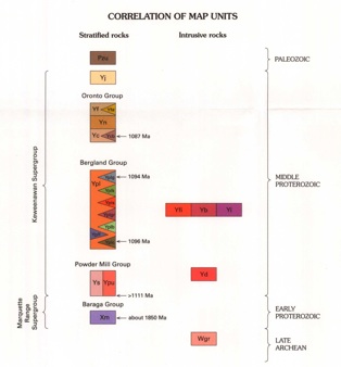
All of the rock below the watershed is likely older than 1 billion years. The Basalt is a sequence of up to about 400 lava flows, one on top of the other, all dipping to the Northwest at steep angles of 45 degrees or more (Fig 2). There are a few layers of conglomerates in the otherwise monotonous dark grey lava rock sequence. The lavas have mineralized flow tops (amygdaloids) which contain copper and a variety of colored minerals. The most highly mineralized layers are the sites of shafts and mines, many of which are plotted in Figure 1. The shafts have mine dumps where mineralized waste rock has been piled. In many cases these waste piles have now been removed for construction use. The mine waste has only minor environmental impact because the minerals do not produce highly toxic or acid drainage. The south side of the watershed is made up of fewer and shorter tributaries which flow to the Pilgrim over very low slopes, while the north side is steeper and marked by more and longer streams. The south part of the watershed is underlain by sandstone and the north by basalt. The geochemistry of the two rock types and their porosity permeability contrasts are marked. The Jacobsville sandstone is a porous aquifer, marked by sulfide minerals and uranium occurrences. The Basalts of the Portage Lake Volcanics are relatively impermeable, and have geochemical signatures which mimic the copper deposits. The sandstone layers are nearly horizontal, probably dipping a few degrees to the south, while the basalts dip steeply N (Fig 2). The distinct differences of the two sides of the watershed and its relatively undisturbed environmental condition and location near the university make it advantageous for geoenvironmental watershed research.

In this more modern view of the Fault, there is splitting and more irregularity. Thrusting ocurred on several different fault planes.