Pilgrim Valley Edge--Fault finding

Pilgrim Valley Edge


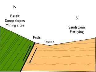
The soil and ground conditions change in other ways too. There is much more water in the ground at and below the fault. Seeps are common near the fault and the first 100 meters or so below the fault is often wetter. Clay-rich material may be found right along the fault at the surface (likely a fault gouge). Landowners have learned that well sitings drilled just upslope from the fault can yield plentiful flow when they start in basalt, cross the fault gouge (aquiclude) and penetrate the Jacobsville below (aquifer). Well sites too far north or west from the Fault don’t flow because they do not intersect this favorable geometry.


Well
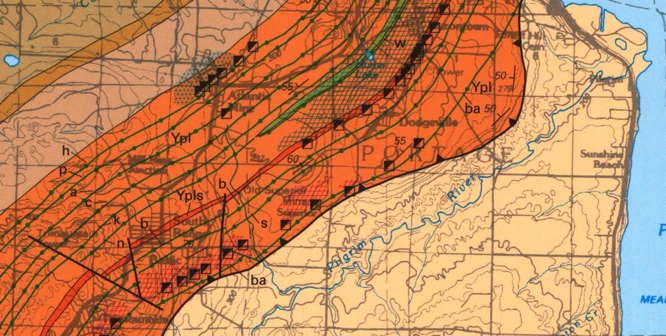
The Keweenaw Fault follows along the top part of a sloping surface parallel to the Pilgrim River south of Houghton. Mostly you cannot see the fault directly, but there are many clues that can be used to locate it. North of the fault is mainly basalt, although there are conglomerate layers here, most notably the “unnamed conglomerate” and the Baltic (#3) conglomerate. So mostly, where there is no outcrop, basalt is the dominant rock you see as pebbles and cobbles in the surface soil. South of the fault is mainly sandstone, although basalt does trickle down by gravity.
Successful well geometry along the Keweenaw Fault near Haapapuura Rd. Well (red line) starts in Basalt, crosses the fault gouge and ends in the Jacobsville.
The surface location of the Keweenaw Fault bends from Nearly N-S to WSW south of Houghton near the Paradise Road, making a shape that is convex to the SE. This bend restricts the movement of faulted material and must have squeezed and fractured it more with each quake event. This geometry could result in focus or restriction of fluid movement.