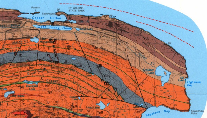
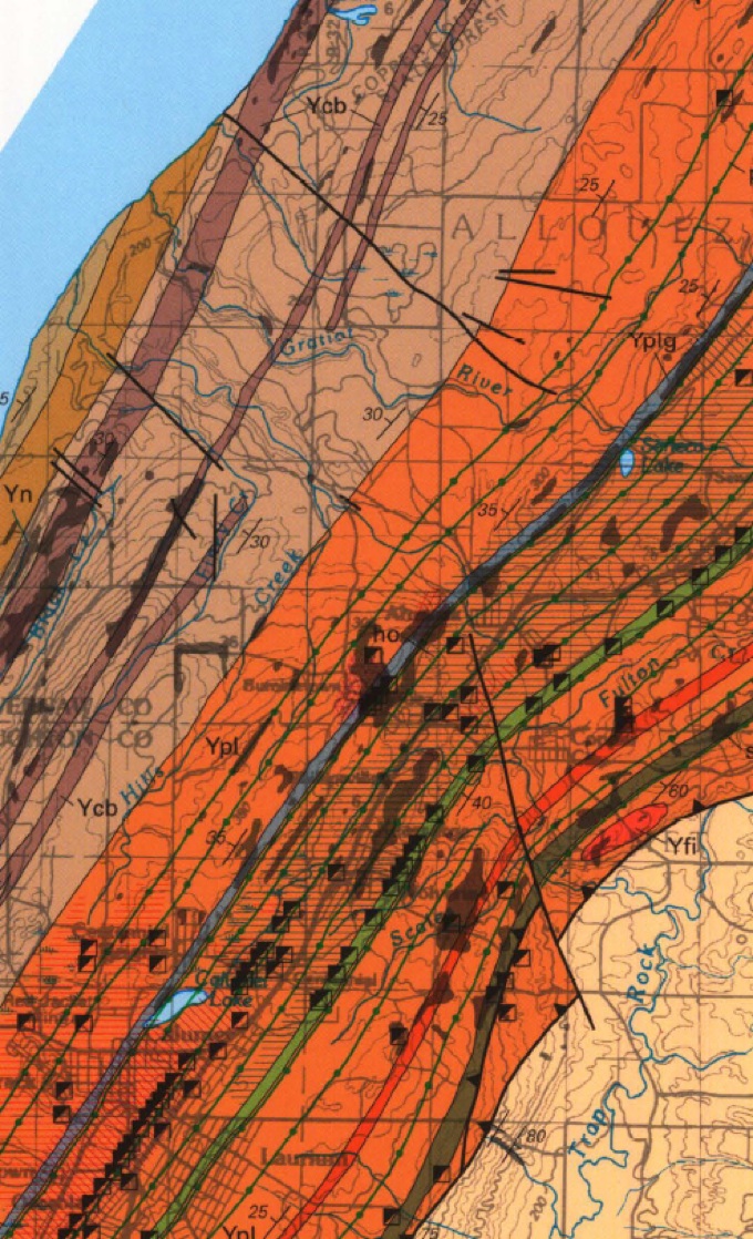
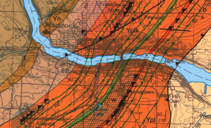
The layers of lava flows that make up the Portage Lake Volcanics are crosscut by faults which are at or nearly perpendicular to the Keweenaw Fault. Many of these faults are prominent, including the Houghton/Hancock Canal, the Quincy Fault, the Allouez Gap and McCargoe Cove. Less prominent cross faults shown above are south of Copper Harbor. There are very small crosscut faults also, including ones you can see along many shorelines, which influence vein directions (see below).
Cross Fault
Cross Fault


http://www.superiorwatersheds.org/shorelineviewer

These cross-cutting features could be related to the subsidence of the rift basin during filling, where the layers fractured as they bent. It is also possible that they could have formed during the thrusting associated with the Keweenaw Fault and the Grenville collision, when bending of layers and fracturing would have been likely. Withuhn-Rolf, 1997 has made an important study of these crosscut features on both sides of the rift.
Portage Lake Volcanics
Copper Harbor Conglomerate
Jacobsville Sandstone
Allouez
Gap
Fault
On Isle Royale, crosscutting faults are very conspicuous also. On both sides of the rift, these faults strongly influence the topography and form river valleys and fiord-like features like McCargoe Cove.
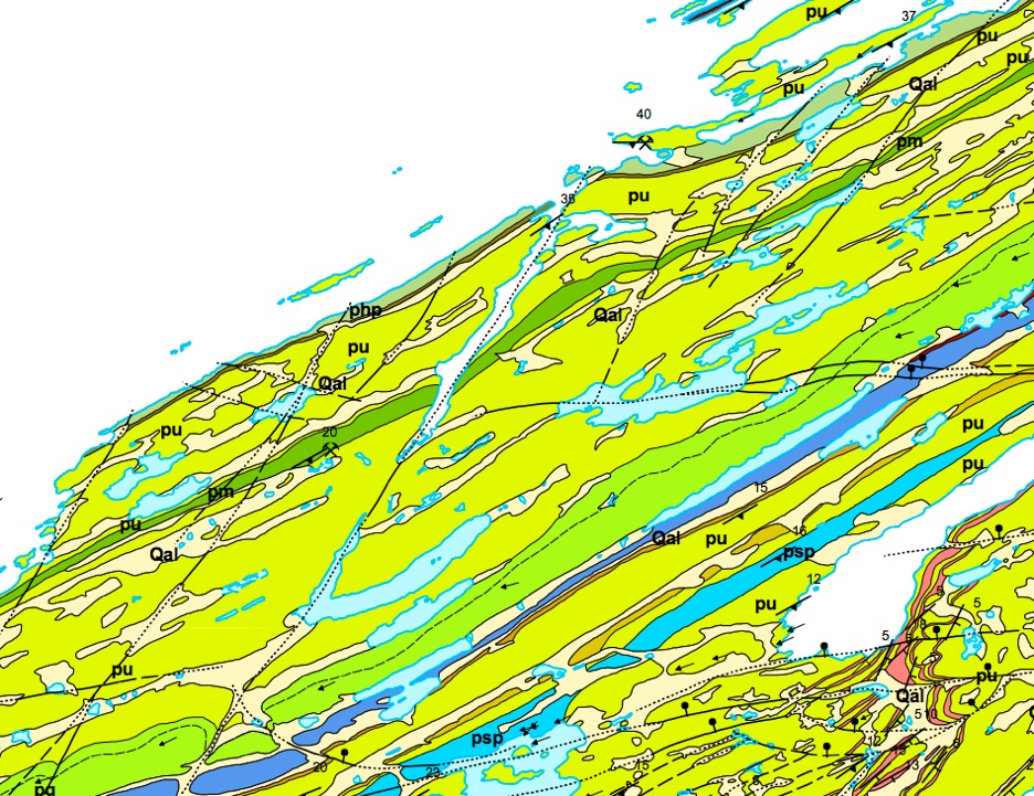


Geologic Map of Isle Royale (Huber, 1973)
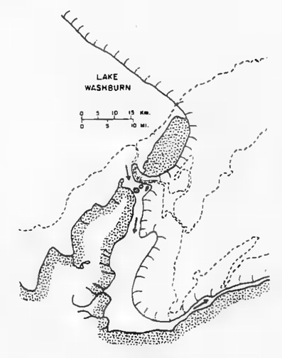
The word Keweenaw is said to originate from Anishinaabe language meaning “canoe portage”. The portage they referred to is the “canal” that exists between Houghton and Hancock. This feature is likely underlain by a fault, but the fault is covered by the waterway. At critical stages during glacial retreat, the outlet of Lake Washburn drained out of this valley and erosion associated with the withdrawing tongue of the glacier and then the huge volumes of melt water deepened the channelway.


The map at left is from Warren (1981) who did research on the depth and origin of the channelway, and then proposed various possible geometries for old outlets.
The outlet for Lake Washburn (also called Lake Duluth) was apparently located west off the current waterway, and then along the Waterway, so during this period, substantial erosion of the Keweenaw Waterway likely happened. Flow would have been from west to east, driven by gravity from the higher Lake Washburn.
Ice Sheet
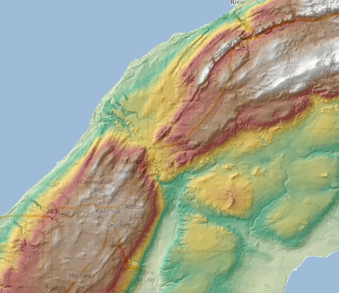

The map above shows how the crossfaulting has affected erosion of the region. The Allouez gap is the site of a valley filled by the Gratiot River drainage and there are also abundant outwash features here along the north flowing river, and drainage southward by Scales Creek into the Traprock River.


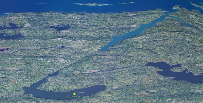
McCargoe Cove
Apple Maps Image
The Keweenaw Waterway crosscuts the lava flows in a very dramatic way, so geologists think that, even though they have never seen direct evidence for a fault which parallels the waterway (almost E-W) that there is indeed a fault which resulted in softer rock under the waterway, guiding the erosional energy which happened as the glaciers melted and withdrew (see below). So there could be mineralization along that buried fault, by analogy with the Hancock Fault and the Quincy Mine!