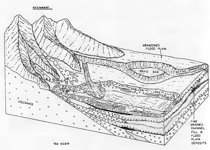
The Copper Harbor Conglomerate is partly made up of alluvial fans. The alluvial fans are more obvious on the Keweenaw than on Isle Royale, where the sandy and silty units and more abundant and cobble sizes are generally less. This alluvial fan hypothesis was proposed by Douglas Elmore in 1984. Many people have debated it and most support it. We make hypotheses like this to help us understand the conditions of formation of this remarkable rock formation. There are some mind stretching implications: 1. It implies a mountain on one side. Where is that mountain now? 2. It suggests desert conditions. Without land plants, it is likely that the Neoproterozoic may have been a “wet” desert.
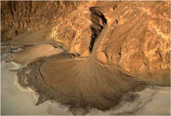
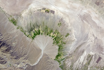
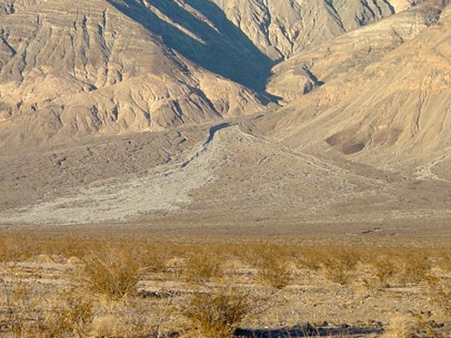
This Alluvial fan near Stovepipe wells in Death Valley CA is 9.5 km wide
The Copper Harbor Conglomerate occurs along the north shore of the Keweenaw and in the SW sector of Isle Royale. It is made up of sediments that mostly came from the rift lavas (basalts and rhyolites) and the continent itself (the Huron Mountains and the Mesabi Range), which were carried into the rift by rivers. Conglomerates occur between some of the lavas of the Portage Lake, but they become dominant after the lavas stopped. The coarsest conglomerates are mainly alluvial fans, and as the rift filled these became less common and finer grained river sands took over. The Conglomerates were studied by Wolf & Huber, USGS OFR 754-B., who provide the following introductory comments:
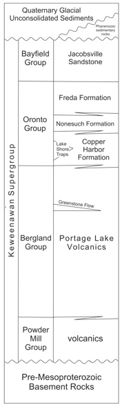
Approximately four-fifths of Isle Royale is underlain by volcanic flows and minor clastic rocks of the Portage Lake Volcanics, which dip 10°-20° to the southeast in the vicinity of their contact with the overlying Copper Harbor Conglomerate (Wolf & Huber, 1973). The Copper Harbor Conglomerate underlies the remaining one-fifth of Isle Royale and is confined to the southwestern part of the archipelago; it dips 5°-28° to the southeast. The contact between the Copper Harbor Conglomerate and the Portage Lake Volcanics appears to be conformable; the top of the Copper Harbor Conglomerate, however, is not exposed. If the Nonesuch Shale and other formations that overlie the Copper Harbor Conglomerate on the Keweenaw Peninsula are present in the Isle Royale area, they lie beneath Lake Superior to the southeast.
Consisting of fluvial subaerial sandstones, siltstones and conglomerates, The CHC shows transport directions that generally spill into the rift valley (see below). Huber gives many details of the CHC on Isle Royale in his OFR.
Michigan Geo Map sources:
Debris flow deposits on an alluvial fan in Panamint Valley at the base of Panamint Butte in the Cottonwood Mountains in Death Valley National Park (Inyo County). Note how the stream channel is incised near the top of the fan, but the debris flow deposit is spread out on the lower fan surface.
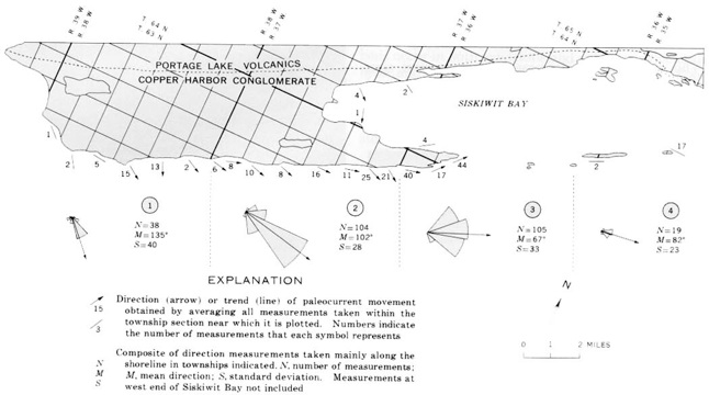
Sketch map from Elmore (1984) showing the sedimentary environment of the Copper Harbor Conglomerate.
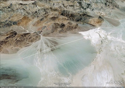
Death Valley
Death Valley
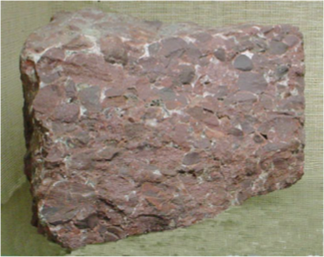
Copper Harbor Conglomerate
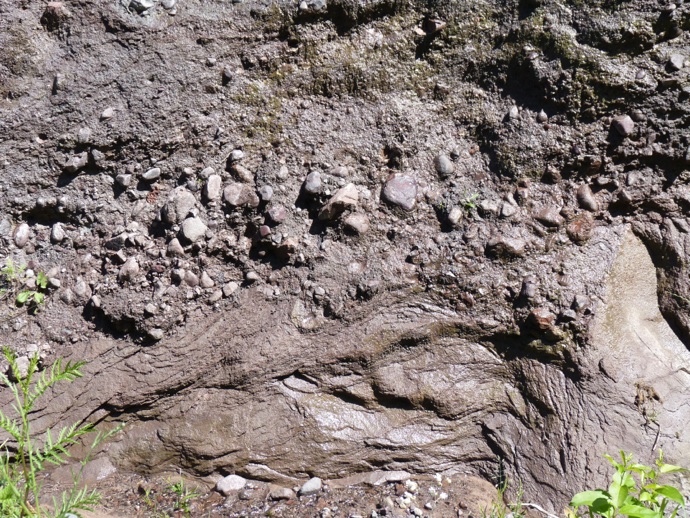
Copper Harbor Conglomerate with sandstone and conglomerate beds, west Houghton
excerpt from: GEOLOGIC MAP OF THE KEWEENAW PENINSULA AND ADJACENT AREA, MICHIGAN By William F. Cannon and Suzanne W. Nicholson
The sedimentary units of the Copper Harbor Conglomerate form a fining-upward sequence dominated by coarse conglomerate near the base and grading to sandstone toward the top. Conglomerates are dominantly pebbles to boulders of Keweenawan volcanic rocks eroded from the flanks of the rift. Clasts are mostly rhyolite with lesser mafic and intermediate volcanic rocks. Clasts of pre-Keweenawan rocks are rare except near the tip of the Keweenaw Peninsula and on Manitou Island where clasts of quartzite are common. Sandstones are lithic arenites and likewise are composed in large part of Keweenawan volcanic rocks. Details of lithology and facies relations were summarized by Daniels (1982).