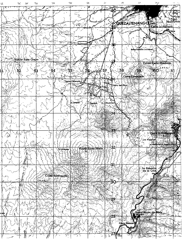
Access to Santiaguito is possible from the Mirador de Magermann (32.4 x 52.4), a place 2 km NW of the dome, that is accessible by poor 4WD dirt road from Llano del Pinal, via Tierra Colorado. One junction along this road leads to the rim of Siete Orejas volcano, where television transmission towers are located, the road to Magermann is the left, less traveled fork. A locked gate with a gatekeeper must be negotiated, permission is needed, so allow extra time. Walks to Santiaguito can begin from a parking spot about 0.5 km N of Mirador de Magermann. You follow a ridge, possibly an old crater rim, southward, then you drop off the ridge and come to the talus slope of Santiaguito itself. Routes up the dome are best from this northwest side. The hike from near Magermanns to the foot of the talus slope is 2 hours. You should take a guide, because the frequent fog makes it very easy to become disoriented. The danger of being lost on this volcano is extreme. There is another route to Santiaguito from the north, which skirts the 2800 m contour line of Santa María and arrives at a point called the Mirador (31.9 x 54.3), before descending a stream valley to the foot of the dome. This route can be started either from the same place as the Santa Maria ascent, or from a point along the dirt road to Magermann, near the military training camp. An expert guide for groups to Santiaguito is Pedro Perez Lopez, who lives near the church in Llano del Pinal. He has been to Santa María and Santiaguito hundreds of times.
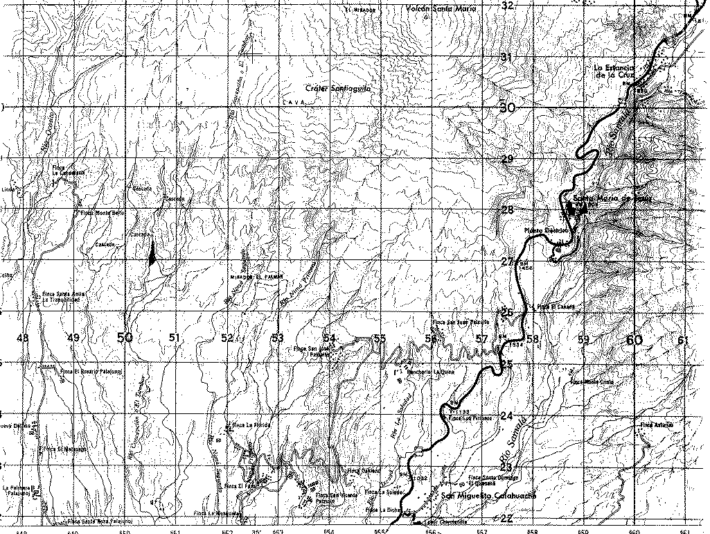
Access to Santiaguito from the south side is poor. There is a trail that goes N from the Mirador of the Finca El Faro (27.4 x 53.6), along the ridge to the canyon cut through the 1902 crater. Access to the dome itself is unsafe because of rockfalls and precipitous canyon walls. A bushwacking access can be made to the west side of the dome from the Finca Monte Bello (28.0 x 49.2), but allow plenty of time and take a local guide.
An excellent source on access to Guatemalan volcanoes by hikers is: C.E. Prahl, 1990, GUIA DE LOS VOLCANOES DE GUATEMALA, 124 p. (published by Club Andino Guatemalteca).