This command is used to register a Terascan data file to a map projection. This command is rather straightforward to use, just enter the input filename, give it an output filemname (by convention I use the input name with a .reg suffix), and the name of the master file which contains the map projection parameters. Use the defaults for the other answers.
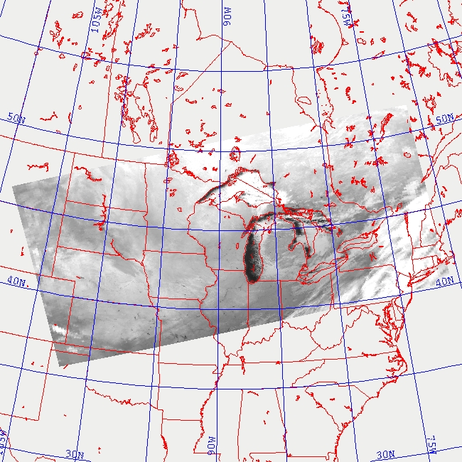
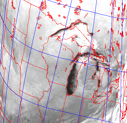
As the satellite passes over the earth, it scans the surface beneath it at an angle of +/- 63 degrees. As a result, the spatial resolution varies from 1.1 km directly beneath the satellite, to 5.5 km at the edge of the swath. This causes geometric distortions to occur. The image on the left shows an example of the unrectified data. In our processing, we use an automated routine that utilizes satellite tracking information to determine where the satellite was when it acquired the data. Once the position of the satellite is known, the data can be registered to and earth location. This registered data, can then be rectified to any map projection. The image on the right is the rectified version of the image shown on the left.