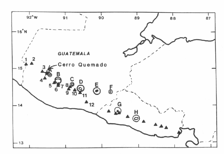
Northern section of the Central American volcanic arc showing Cerro Quemado, arc-front stratovolcanoes, and back-arc silicic calderas. Late Quaternary through Holocene-age stratovolcanoes include: (1) Tacaná; (2) Tajamulco; (3) Siete Orejas; (4) Santa María (and Santiaguito); (5) San Pedro; (6) Atitlán; (7) Tolimán; (8) Acatenango; (9) Fuego; (10) Agua; (11) Pacaya; (12) Tecuamburro. Late silicic calderas include: (A) Almolonga; (B) Atitlán; (C) Barahona; (D) Amatitlán; (E) Ayarza; (F) Retana; (G) Coatepeque; (H) Ilopongo.
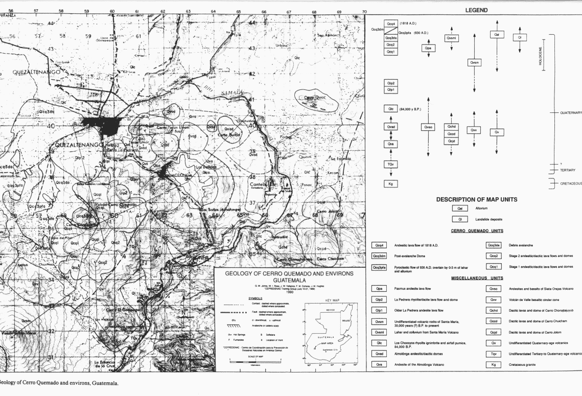
Cerro Quemado is located in a back-arc volcanic field in the northern Guatemalan Highlands. The field, referred to here as the Almolonga Volcanic field, lies on the southern margin of what may be an older silicic caldera that comprises the Quezaltenango valley.
The northern section of the Central American arc is about 120 km above a well-defined Benioff zone dipping 40°. The volcanic arc trends west-northwest, parallel to the Central American coast, and consists of mafic stratovolcanoes and associated back-arc silicic volcanic centers. The Quaternary volcanoes of northern Guatemala overlie Tertiary calc-alkaline volcanic rocks, Cretaceous plutons, and Paleozoic metamorphic rocks.
Structures of northern Guatemala include NW- and NE-trending normal faults. Locally, the Zuñil fault controls the Río Samalá drainage. Cerro Quemado, Santa María Volcano (3772 m), and Santiaguito Dome (2500 m) to the southwest, make up a N40E-trending volcanic lineament. At present, activity is centered at Santiaguito, where dome growth began in 1922.

- Geology of Cerro Quemado and environs, Guatemala.
Guatemala's second largest city, Quezaltenango (population more than 125,000), is located just 5 km north of the volcano.