DOMES AND FLOWS


Geology of Cerro Quemado and environs.

The exogenous dome complex covers an area of 12 km² and has a total volume of about 1.9 km³. Steep-fronted blocky lava flows erupted during stages I, II, and IV dominate the complex.
Approximate areas and volumes of volcanic units of Cerro Quemado.

The 1818 A.D. lava flow, typical of Cerro Quemado, is 2.5 km long and about 120 m thick. The flow erupted over six months with an average extrusion rate of 0.9 x 10^6 m³/day, a rate similar to exogenous growth stages of the lava dome at Mount St.Helens, but significantly greater than that observed at the dacitic Santiaguito dome. The flow surface is composed of blocks tens of meters in diameter, small spines, and rugged flow ridges oriented perpendicular to the flow direction.
Map of the 1818 A.D. lava flow showing local direction and the distribution of flow features.

One unusual feature of this flow is that it climbed tens of meters up a gentle slope (about 5 to 1O°) along its eastern margin before coming to rest. Apparently, the gravitational momentum of the body of the flow pushed the front of the flow uphill.

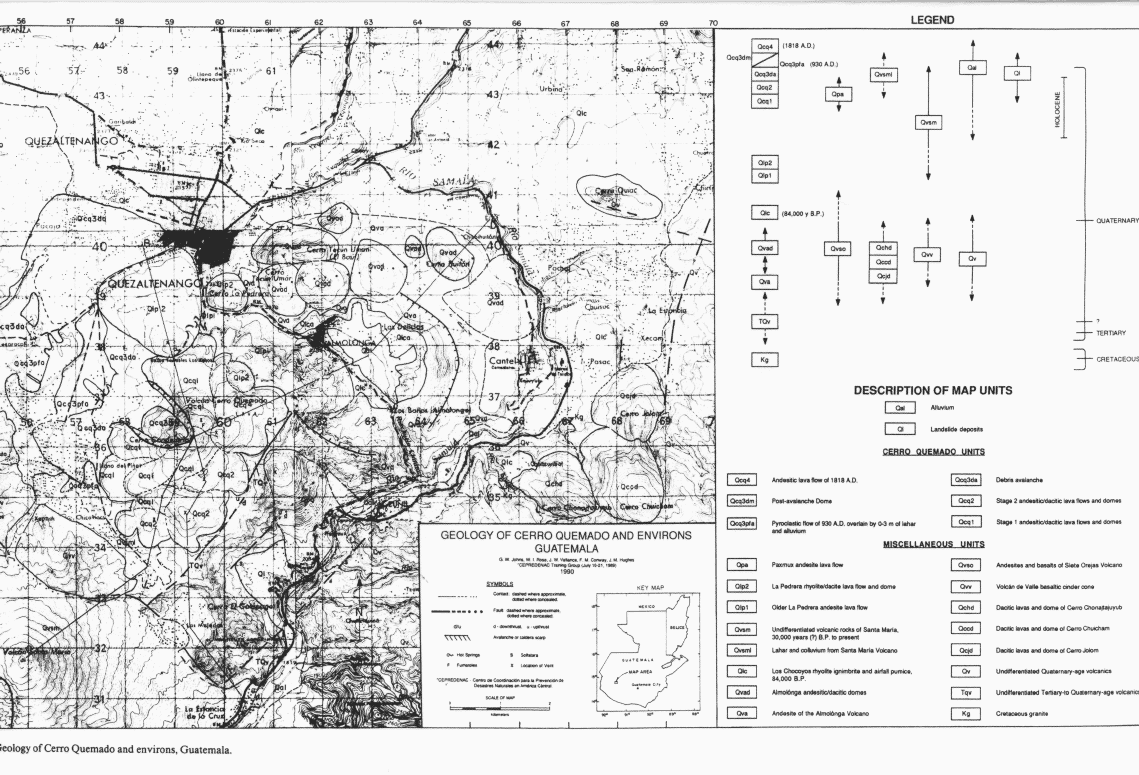
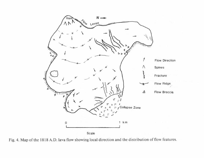
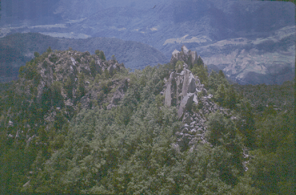
Steep walled, semi-circular, plug domes (to 500 m in diameter) crowned with prismatic Peleéan spines (up to 25 m high) characterize the vent area. The endogenous configuration of plug domes suggests that the magma weas largely degassed at the time of emplacement.


Telephoto view of spines on the Cerro Quemado summit, as viewed from Santa María. Photo by Bill Rose.
Most modern andesitic to dacitic domes, Mount St. Helens, and Bezymianny, exhibit extended periods of predominantly endogenous growth. At Cerro Quemado, however, growth typically has been exogenous with endogenous activity apparently limited to the latter stages of an eruptive event. According to Fink, factors that contribute to exogenous growth include a high eruption rate, flowage on a steep slope, and low yield strength of lavas. Of these, high eruption rate is the only factor that clearly favors exogenous growth at Cerro Quemado. Another factor at Cerro Quemado, however, is the possibility that hot mafic magmas mixed with cooler silicic magmas to generate superheated and fluidized intermediate melts just prior to extrusion. The presence of resorbed phenocryst phases in Cerro Quemado lavas suport this hypothesis. Superheated melts would possess viscosities and yield strengths considerably less than other dacites and would be a major factor in controlling the nature and style of eruption.
(Conway et al., 1992)

HAZARDS DUE TO LAVA FLOW EXTRUSION AND DOME GROWTH

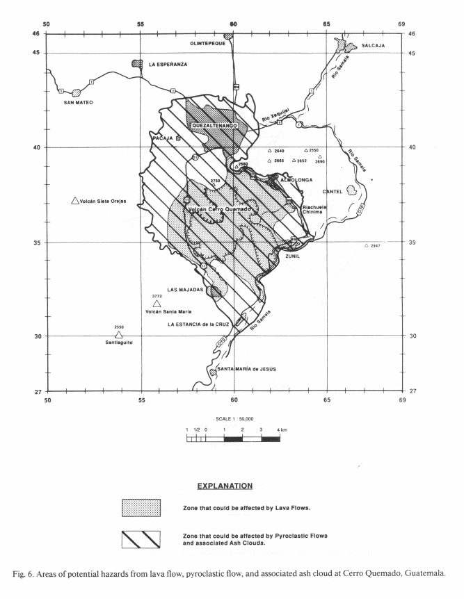
The nucleus of Cerro Quemado is made of lava domes and flows so this is the kind of activity that will most likely recur should the dome again become active. Slow moving, viscous lava flows are realy life-threatening but can destroy property- crushing and burning building and destroying crops. A related hazard is te potential damming of the Río Samalá by lava flows, as occured during the eruption of Paxmux flow. Damming of the river, moreover, could precipitate down-valley floods and debris flows during later dam-breaking events.

Hot-rock avalanche and pyroclastic flow with ash cloud surge are commonly generated during collapse of lava flow fronts and represent hazards associated with exogenous dome growth. Small-volume hot-rock avalanches are common at the front of advancing silicic flows and danger from such events is typically confined to valley bottoms. More explosive block-and-ash flow and associated ash cloud surge can cover a much larger area and commonly overwhelm nearby ridges. During collapse of a lava flow and dome at Mt. Unzen 41 people were killed with they were overtaken by a detached surge. The principal danger is from burial or impact with rock fragments and from asphyxiation from breathing hot ash. In addition, hot, high-velocity winds from ash clouds can level or burn buildings, forests, and crops.
(Conway et al., 1992)

Future dome growth at Cerro Quemado will probably be limited to the central dome complex. The hazard zone for lava flows extends from the central dome complex outward approximately 2.5 km, commensurate with the longest flows erupted at the dome. Topography strongly controls lava flow distribution so local topographic highs, La Pedrera (275) and Cerro El Galapago (2572), are excluded from the hazard zone.


Areas of potential hazards from lava flow, pyroclastic flow, and associated ash cloud at Cerro Quemado, Guatemala.

(Conway et al., 1994)