AVHRR Satellite Images
The raw AVHRR data was acquired via NOAA's
Satellite Active Archive
and processed by
Dave Schneider at Michigan Tech.
The estimates of silicate mass and effective radius were conducted using the
technique of Wen and Rose.
For more information about the discrimination of volcanic
clouds using AVHRR click
here.
Note: All of the processed images are the intellectual property of
Dave Schneider. They may be downloaded, but they may not be published or
cited without his permission.
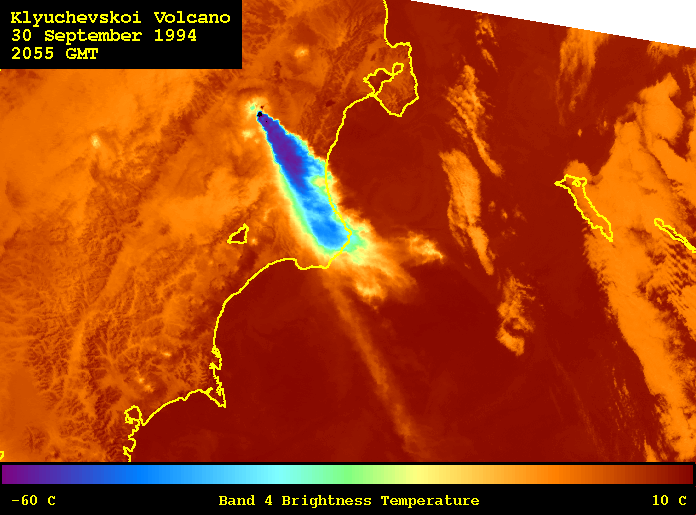
Band 4 Image: 30 September at 2054 GMT
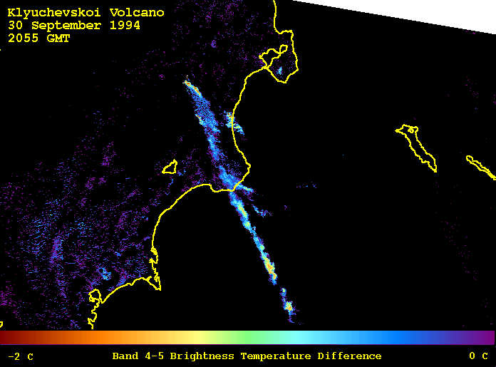
Band 4 -5 Image: 30 September at 2054 GMT
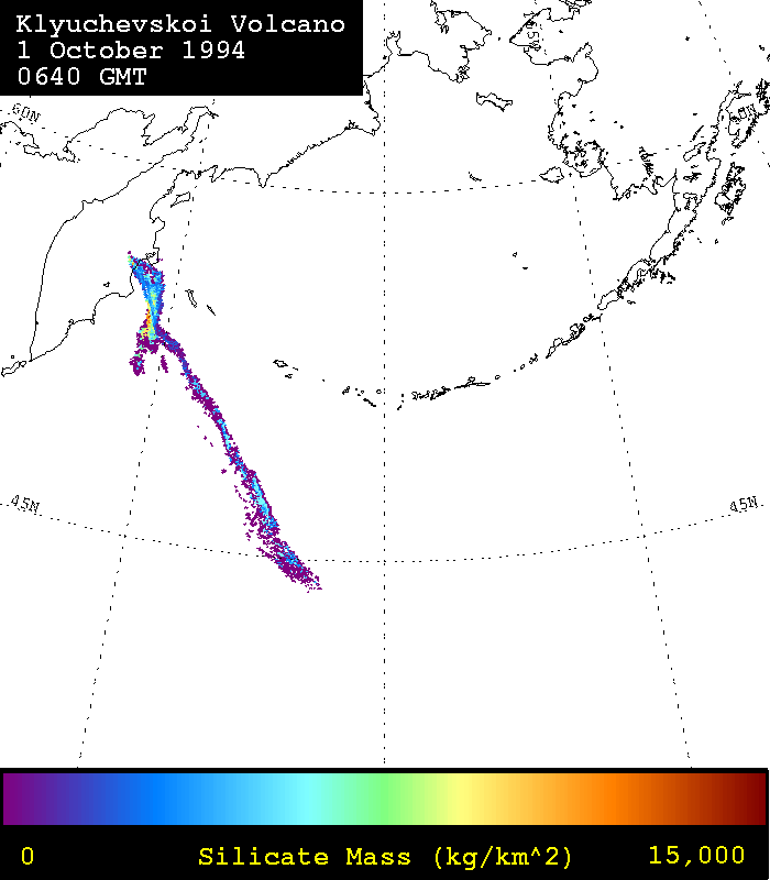
Silicate Mass Retreival: 1 October at 0630 GMT
Effective Radius Retrieval:1 October at 0630 GMT
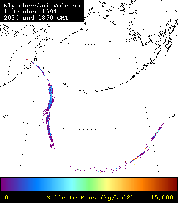
Silicate Mass Retreival: 1 October at 1851 and
2029 GMT
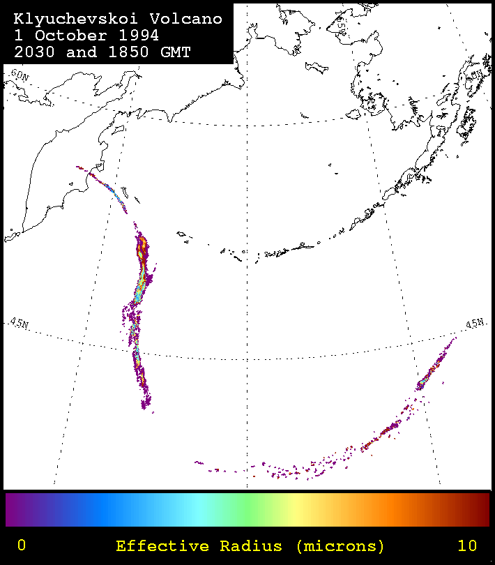
Effective Radius Retrieval:1 October at 1851
and 2029 GMT
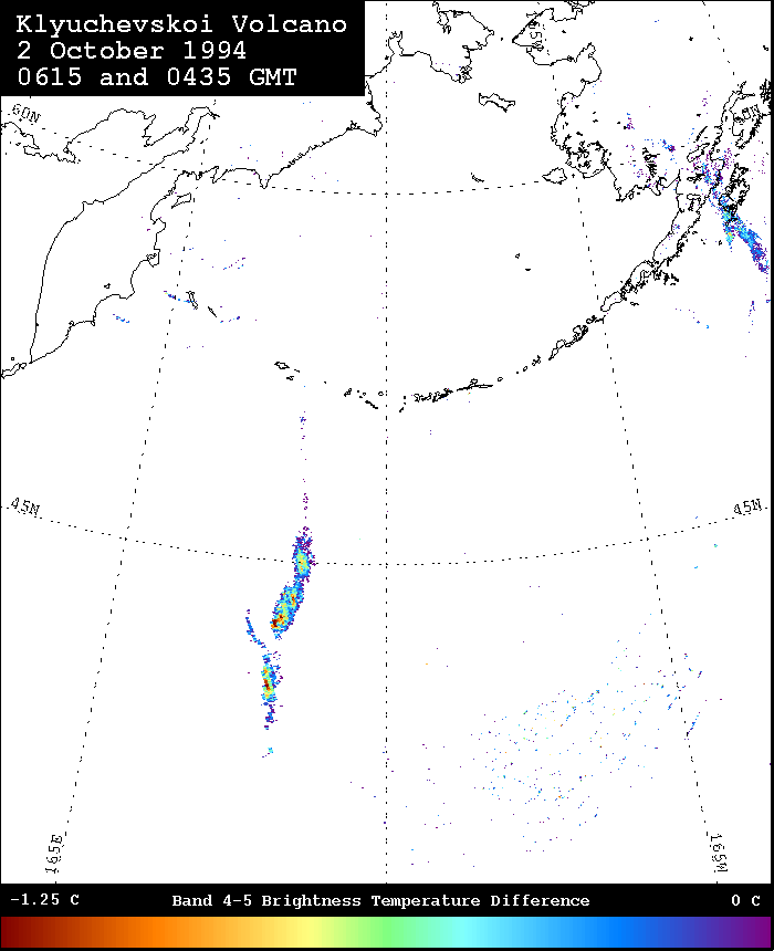
Band 4 -5 Image: 2 October at 0435 and 0615 GMT
Shuttle Images
- Images acquired from NASA-JSC Digital Image Collection.
- Still photos taken during mission STS-068 showing the eruption clouds of
Septemebr 30 and October 1.
sts-068-214-004
sts-068-214-005
sts-068-214-006
sts-068-214-007
sts-068-214-008
sts-068-214-009
sts-068-214-010
sts-068-214-011
sts-068-214-012
sts-068-214-013
sts-068-214-014
sts-068-214-015
sts-068-214-016
sts-068-214-017
sts-068-214-033
sts-068-214-034
sts-068-214-035
sts-068-214-036
sts-068-214-037
sts-068-214-038
sts-068-214-039
sts-068-214-040
sts-068-214-041
sts-068-214-042
sts-068-214-043
sts-068-214-044
sts-068-214-045
sts-068-214-046
sts-068-214-047
sts-068-214-048
sts-068-214-049
sts-068-218-006
sts-068-218-007
sts-068-218-008
sts-068-273-033
- Images from video collected during the during mission STS-068.
- sts068-s-012 Taken during October 2-3 1994 eruption (JPG - 78K)
- sts068-s-013 Taken during October 2-3 1994 eruption (JPG - 83K)
- sts068-s-014 Taken during October 2-3 1994 eruption (JPG - 74K)
- sts068-s-015 Taken during October 2-3 1994 eruption (JPG - 75K)
- sts068-s-016 Taken during October 2-3 1994 eruption (JPG - 23K)
- Images collected during the during mission STS-042.
- sts042-02032 Taken with the Hercules hi-res b/w camera. View is from the south. From top to bottom are Bezymianny (horse-shoe), Kamen (tall half cone), and Klyuchevskoi. (JPG - 234)
- sts042-77-004 Color photo - Clouds shrouding the flanks of Tolbalchik (lower left with hole), Bezymianny-Kamen-Klyuchevskoi near right-center. (JPG - 164K)
SIR-C/X-Sar Radar images from NASA-JPL
- Shuttle Radar Image taken on 14 October 1994
- Optical/Radar Comparison based on Space Shuttle SIRCXSAR-radar and hand held photography