IMAGES
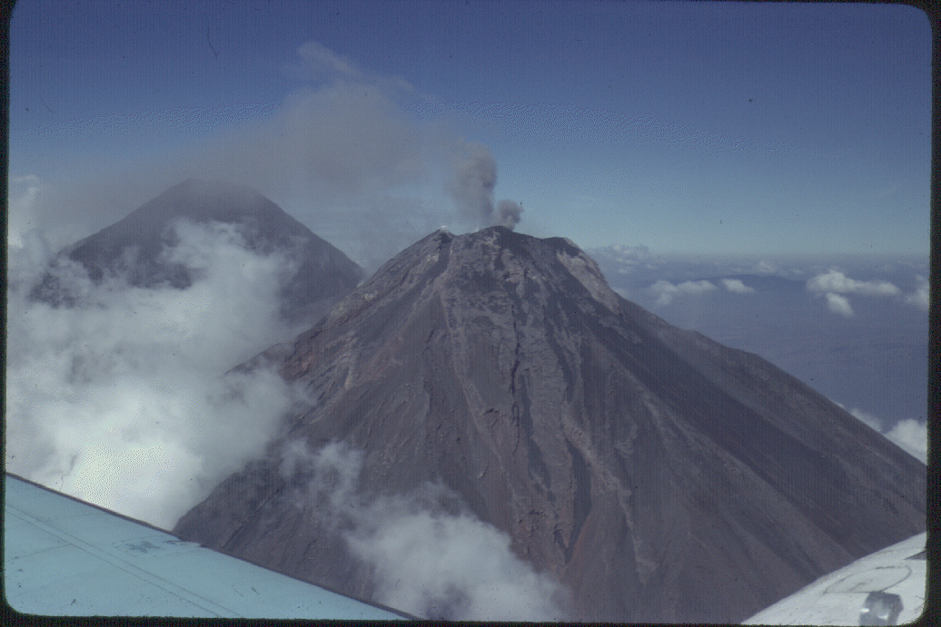
1
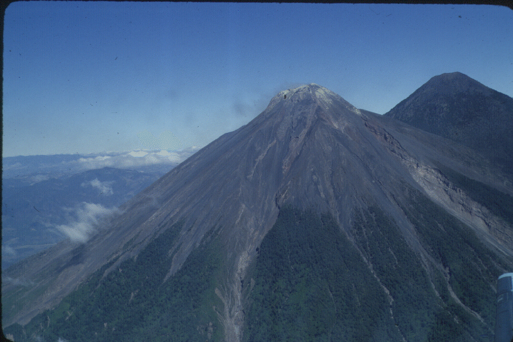
- Aerial view of Fuego (left) and Acatenango (right), viewed from the SE. Note the gas fumes from Fuego's summit and the discolored fumarolic deposits. The barrancas descending the cone channel are the block and ash flows that are the earmark of Fuego's activity. Photo by Bill Rose, 19xx.
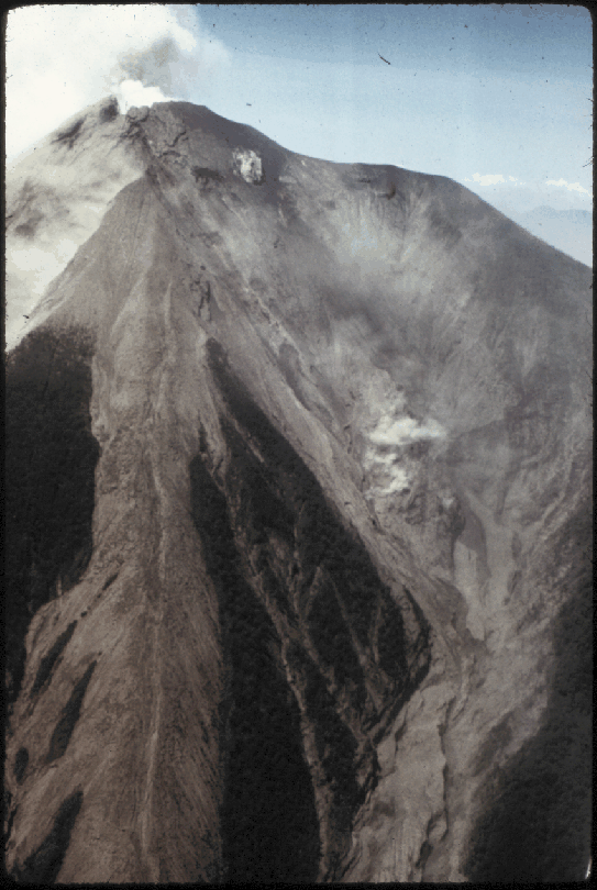
2
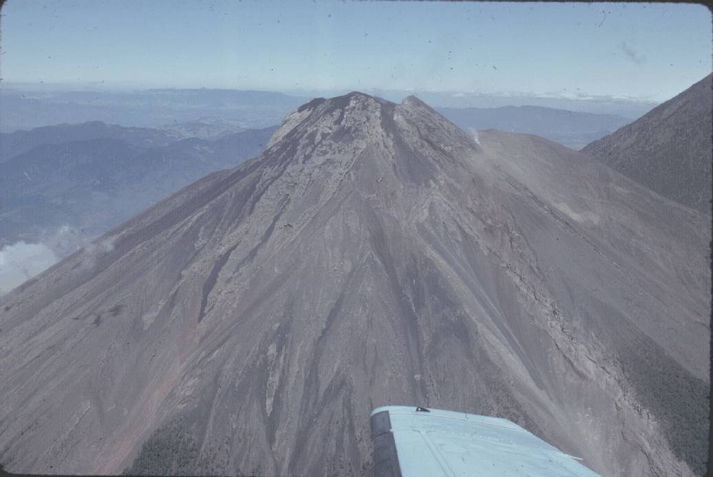
- Aerial view of Fuego's summit, viewed from the SE. The extreme right shows the slope of Acatenango, while to the right of Fuego is the "shoulder" that marks the Meseta, an older collapsed cone of Fuego. Note the large fumarolie on the left edge of the Meseta, where it intersects the modern Fuego cone. Photo by Bill Rose, 1980.
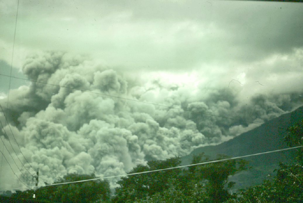
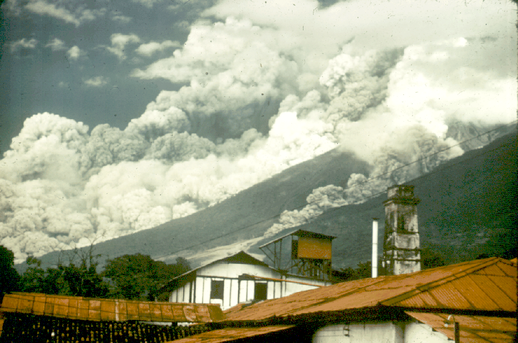
3
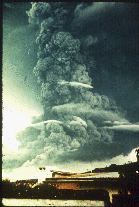
- Fuego eruption of 14 October 1974, as viewed from the Finca Capetillo, 8 km ENE of the summit. The vertical eruption column reached stratospheric levels, and numerous block and ash flows descended from the column into barrancas on all flanks of the cone. Photo by W.C. Buell.
4
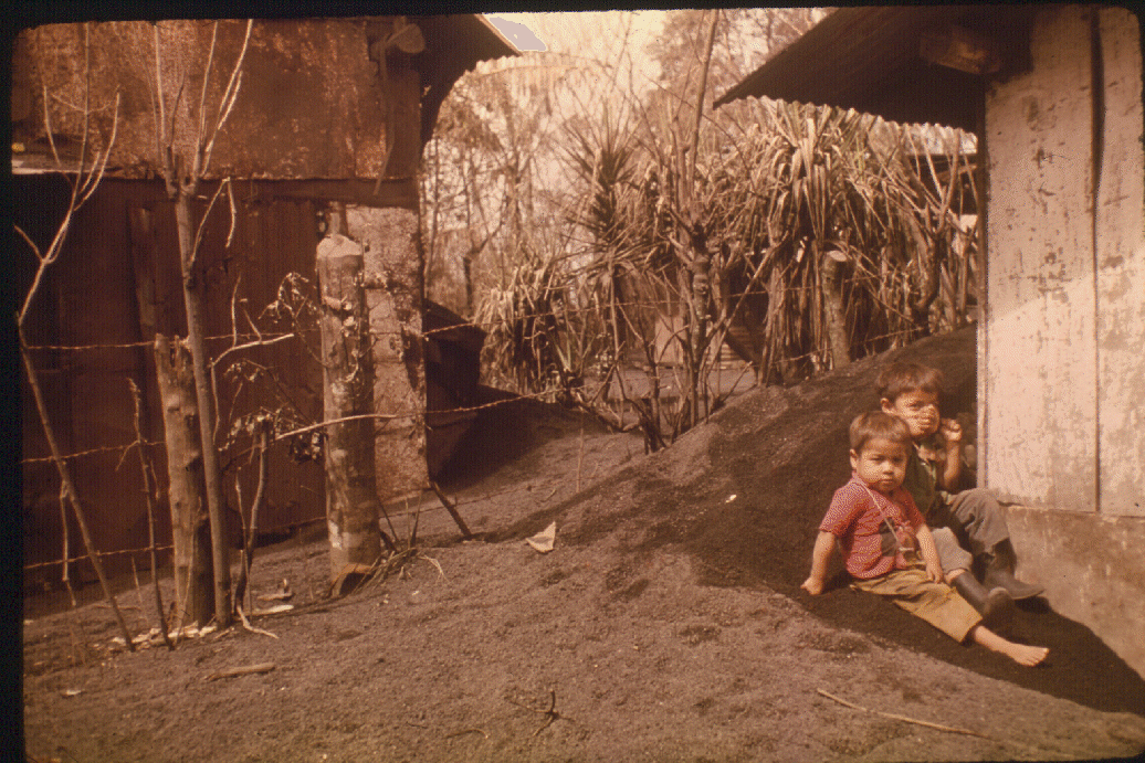
- Ash fall at Yepocapa, about 8.5 km WNW of Fuego's summit, following the 1974 eruption of Fuego. Many roofs collapsed from the weight of basaltic ash. Photo by Sam Bonis.
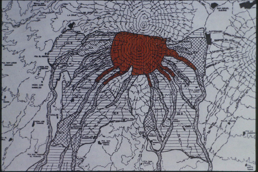
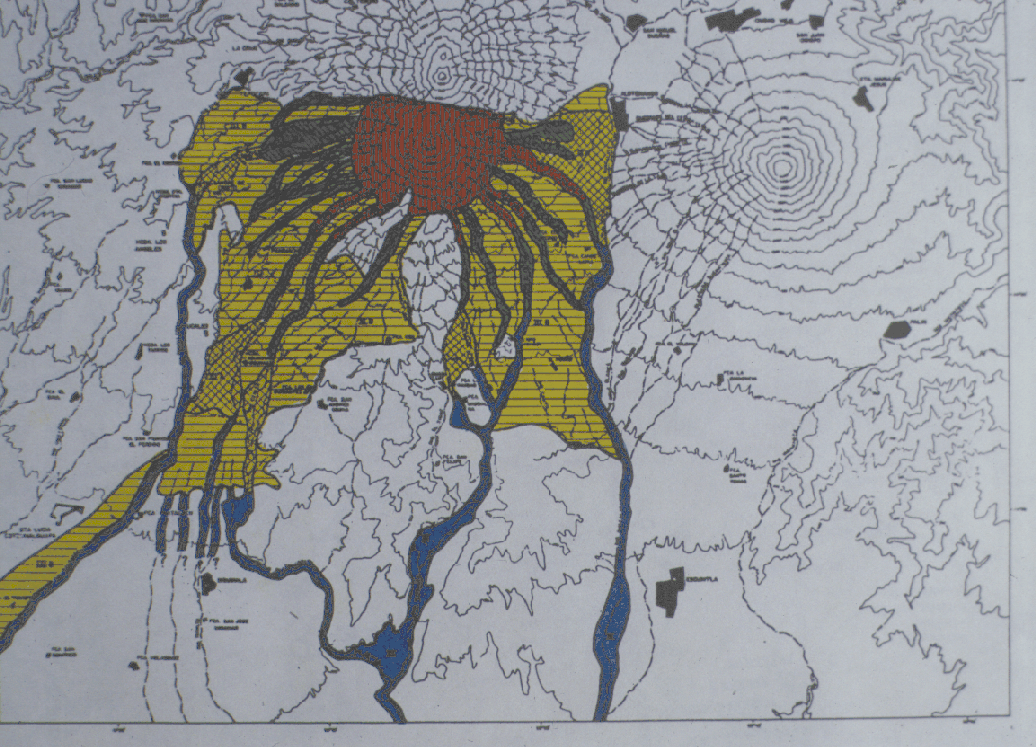
5
- Detail of hazard map of Fuego, showing the zone of extreme hazard due to falling bombs, blocks, avalanches, lava flows, and glowing avalanches. It includes areas within 3 km of the summit, on steep slopes and within barrancas that have channeled recent avalanches and block and ash flows. Photo by Rose et al., 1987.
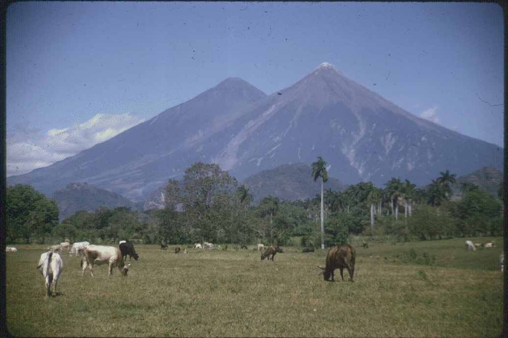
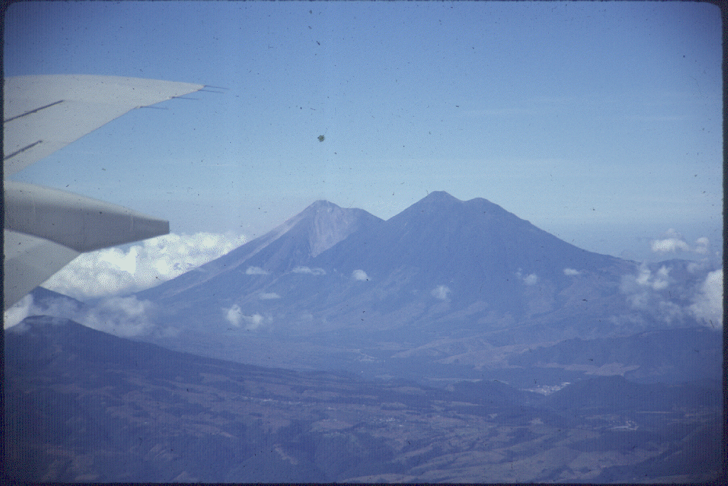
6
- Fuego (right) and Acatenango (left) as seen from the highway along the coastal plain SSW of the volcano. The foreground is volcanic alluvial fan material derived from floods and lahars from Fuego. Photo by Bill Rose, 1978.
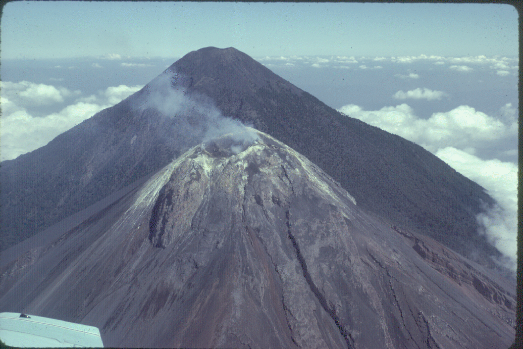
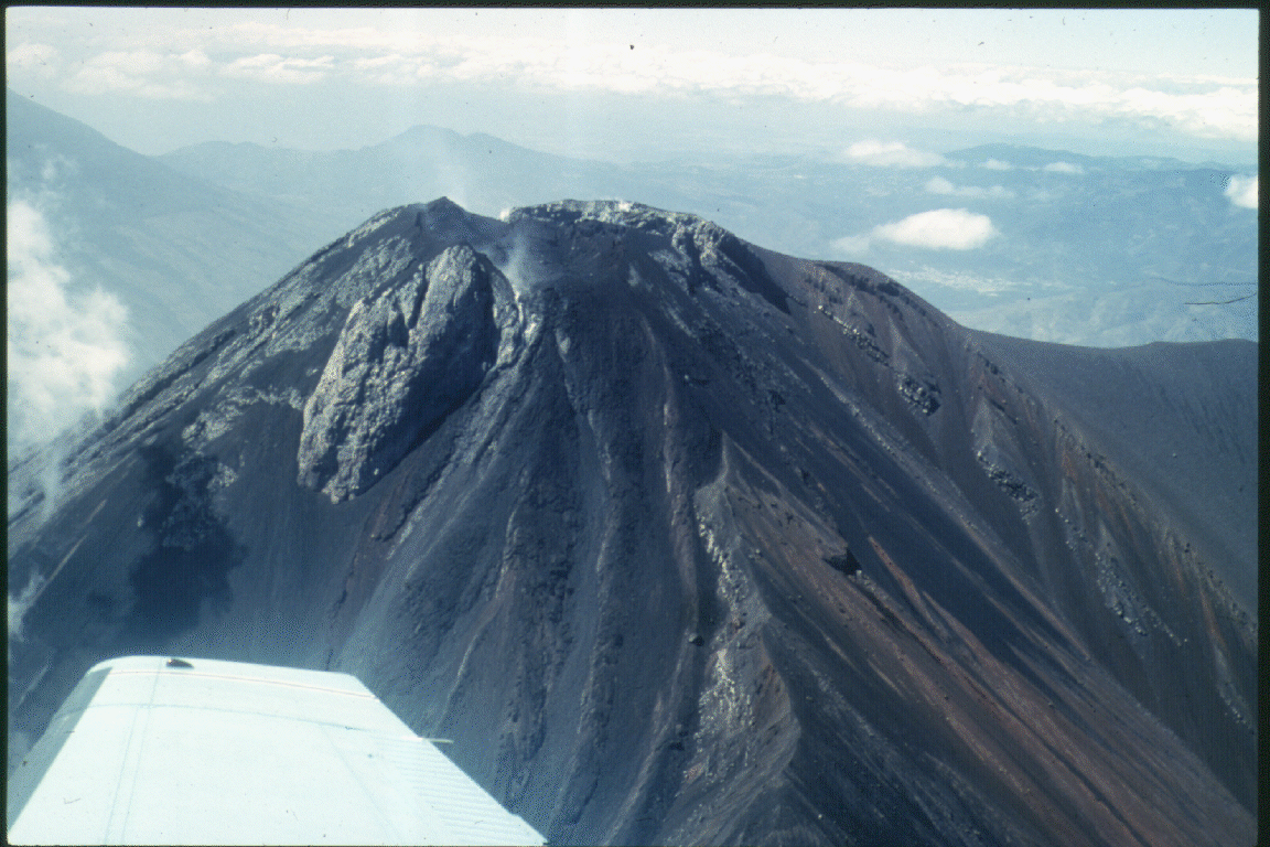
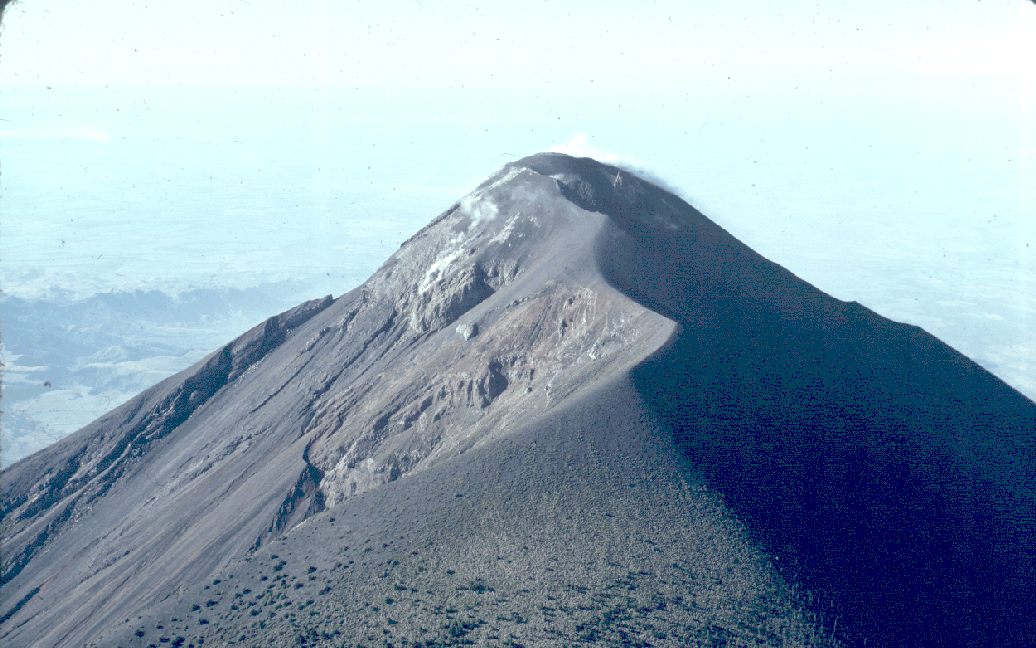
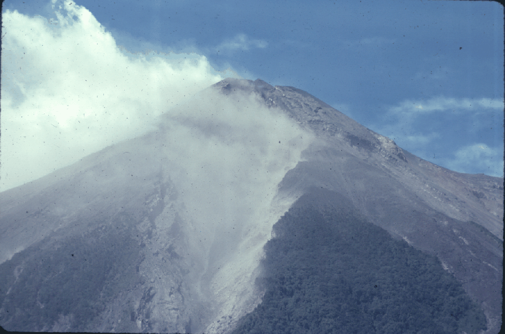
7
- Close-up aerial view of actively fuming crater of Fuego. View is directly from the south, with Acatenango in the background. Photo by Bill Rose, 1980.
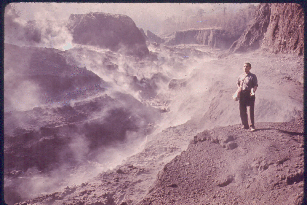
8
- Steaming hot mudflow materials in Barranca Honda, east of Fuego's summit. Photo by Sam Bonis, October 1974.
9
- Aerial view of Fuego summit from the SW, showing weak ash eruptions. Photo by Bill Rose, 1978.
10
- Aerial view of the four summits of (from left to right) Fuego, Meseta, Acatenango, and Yepocapa, from a point above Amatitlan, about 40 km ENE. Photo by Bill Rose, 1987.
11
- Fuego's summit, viewed from the East. Photo by Bill Rose, 1980.
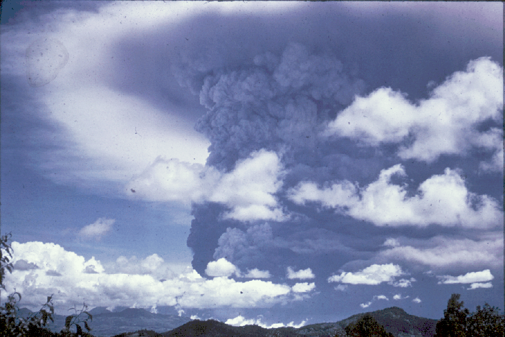
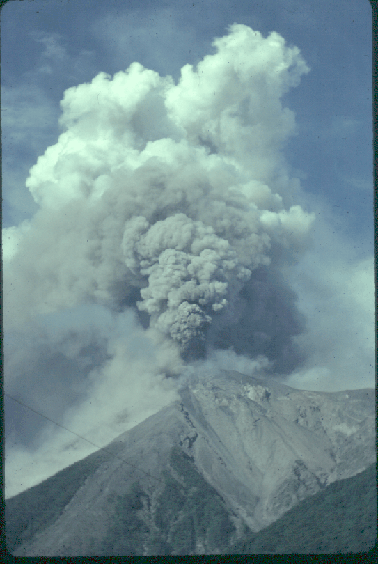
12
- Vertical eruption cloud from Fuego, seen from the NW on August 12, 1966. The prevailing winds during this eruption were from the east (left in the picture). At the top of the photo is the tropopause at about 12 km, where diffusion rings can be seen. Fuego's eruptions are typically energetic vertical explosions of relatively short (a few hours) duration. Photo by Bill Rose.
13
- Pyroclastic flow descending Fuego's west flank, 14 October 1974. Photo by W.C. Buell.
14
- West flank of Fuego following the 1974 eruption. Note the debris on Fuego's slopes and the barrancas which channel the pyroclastic flows and avalanches.
15
- Small-scale vertical eruptions from Fuego's summit crater, viewed from the NE. Photo by Bill Rose, November 1978.
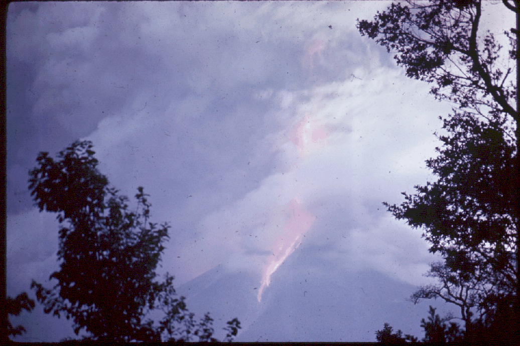
16
- Twilight photo of Fuego eruptions of 1966, showing incandescent block and ash flow materials descending the barrancas.
17
18
19
20
21
22
23
24
25
26