HOW TO GET THERE
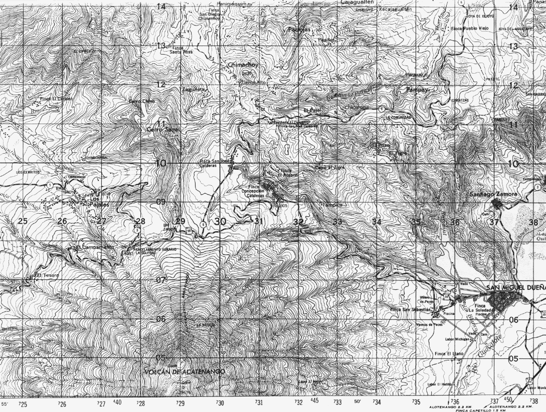
There are two possible routes to the summit crater. One starts near La Soledad (28.2 x 7.8) located on the north flank of Acatenango at an elevation of about 2400 m, and accessible by dirt road (Route 10 from Ciudad Vieja to Yepocapa. Ths route ascends Acatenango (3976 m) first, then descends to the col between (3280 m) before ascending again to Fuego. Most people spend the night on Acatenango, after using the first day (4-6 hours) ascending it, they they get up early for the climb from Acatenango to Fuego.

- Portion of the Chimaltenango 1:50,000 quadrangle, showing access route to Acatenango summit, on the way to Fuego.
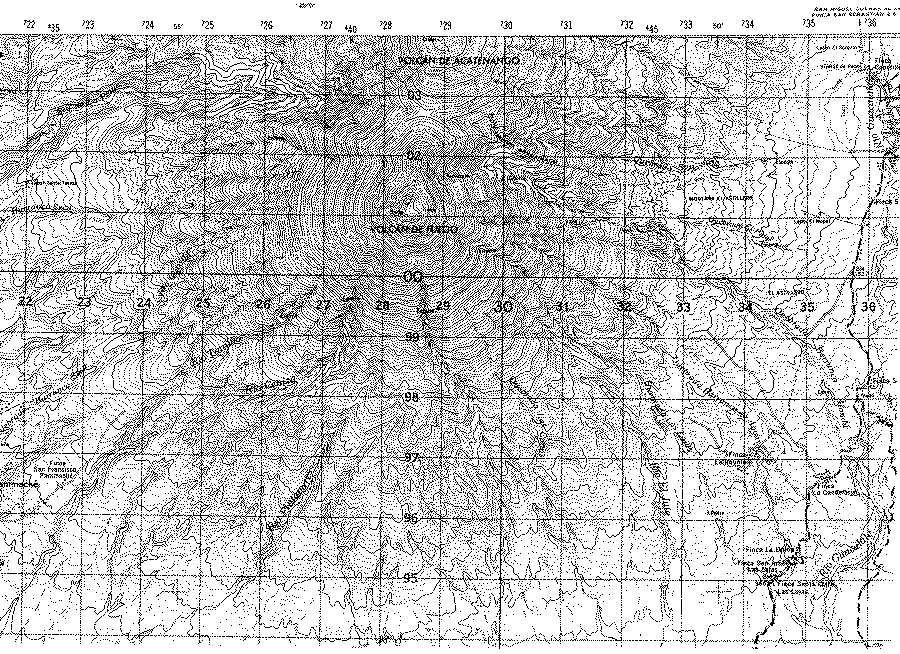
The other climbing route is arduous to ascend, because it starts at 1400 m near Alotenango ( about 36 x 2) and ascends to Fuego's summit in about 9 km traversing along the Quebrada San Jose, along a trail that appears on the topo map. It takes 8-10 hours of hard work.
Many climbers go up by the first route and then descend by the second.

- Portion of the Alotenango 1:50,000 quadrangle, showing the access route to Fuego from Alotenango.
Climbers going up Fuego should take warm clothes and lots of water! It sometimes snows on these summits and water is very hard to find unless it rains.
An excellent source on access to Guatemalan volcanoes by hikers is: C.E. Prahl, 1990, GUIA DE LOS VOLCANOES DE GUATEMALA, 124 p. (published by Club Andino Guatemalteca).