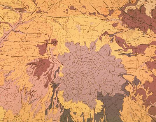
Location/Geological Setting
Latitude: 13.853 N
Longitude: 89.630 W
Elevation: 2181 m.a.s.l
San Vicente volcano or, as is known in Nahuatl language, Chichontepec (mountain of two breasts) is located approximately 60 km east of the city of San Salvador> To the east of the volcano lies the Lempa river valley and to the west is lake Ilopango. The coastal plains are found to the south of San Vicente and the Apastepeque volcanic field is to the north.
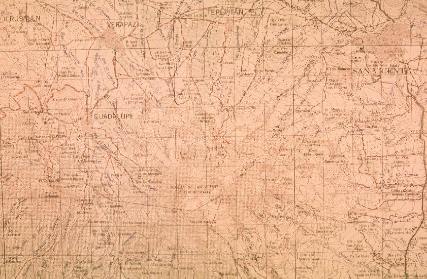
To see a topographic map of the San Vicente area click here.
The city of San Vicente (population ~100,000) is approximately 10 km northeast of the summit, while 10 km south of the summit, the city of Zacatecoluca of a similar size, is a center for commercial and agricultural activity. At least ten additional villages are found surrounding the volcano. Agriculture can be divided into three areas: at elevations below 600 m, cattle grazing, sugar cane, corn and other grains are common. Between elevations of 600-1700 m coffee is the most important crop, while at higher elevations dense cloud forests cover the summit.
Geologically, San Vicente volcano lies on the southern fault of the Central American graben, which in this part of the country runs E-W and has a width of about 8-10 km. The northern graben faults are easily identified just north of the town of Tepetitan, were the Pan American highway was built.