The city of Santa Ana, which is the second largest city en El Salvador with an estimated population of 400,000 lies 10 km north of the caldera, while 20 km to the southwest is Sonsonate with a population of 100,000. All areas around the caldera are densely populated due to the rich fertile soils that are ideal for agriculture. As is the case for most of El Salvador, coffee is grown at elevations between 600-1700 m, while below 600 m a mix of sugar cane and grains are the main crops. Dairy farming is very important in the area around Sonsonate.
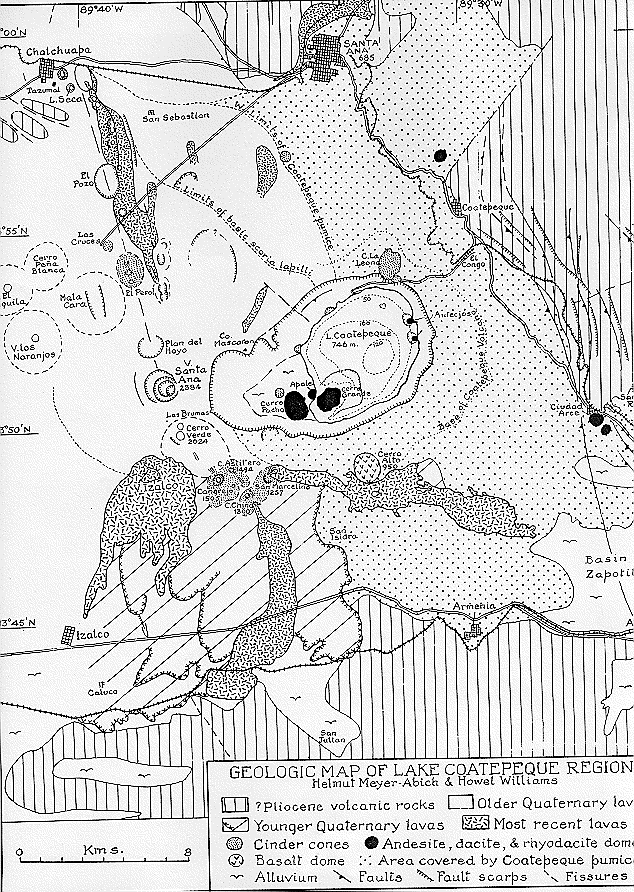
The Coatepeque caldera is found within the Central American graben, however in this region of the country its boundaries are not clearly evident. It is assumed that the alignment of volcanoes constitutes the southern graben faults.
To the northwest of Coatepeque a semicircular structure by the name of Chilamatal encloses the Coatepeque caldera. Several silicic domes are found outside and within the structure. Thick deposits of andesitic ignimbrites cover the northern slopes of the structure. CEL (1992) suggest that it is associated with the formation of the Central American graben.
East of the Coatepeque caldera, the Santa Ana volcano dominates the landscape. The collapse of the caldera cut into part of the Santa Ana edifice, and for this reason it is believed to be contemporaneous. Recent lavas fron Santa Ana have flowed into the caldera on its southwestern side.
The image below is from "Los Volcanes Activos de Guatemala y El Salvador" written by H. Meyer-Abich (1956).