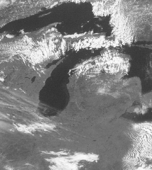
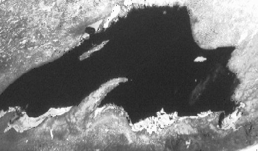
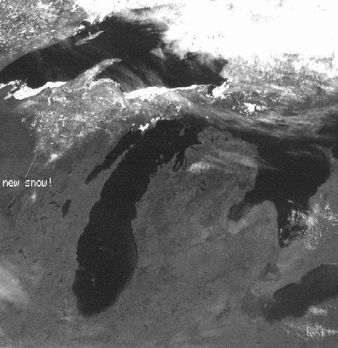
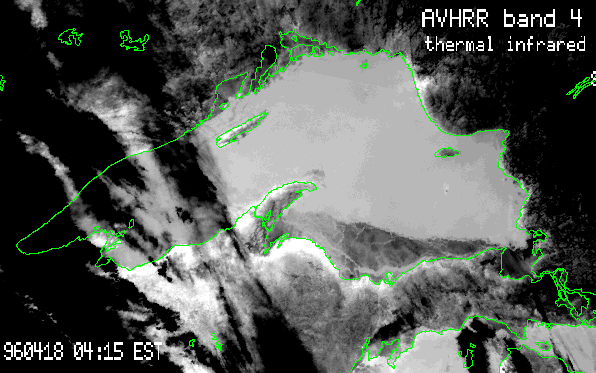
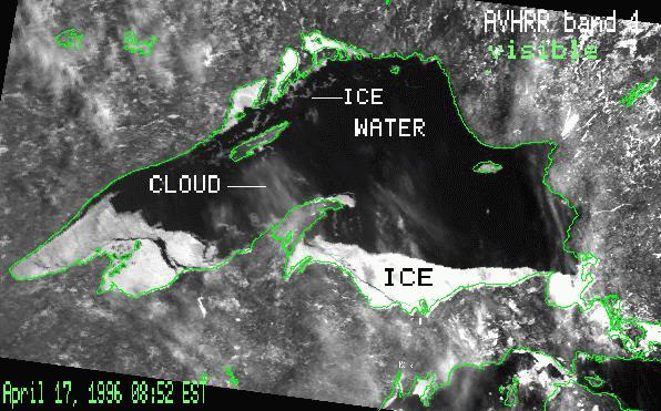
This page is a collection of interesting AVHRR and GOES8 images of Lake Superior from Spring, 1996.
They show:
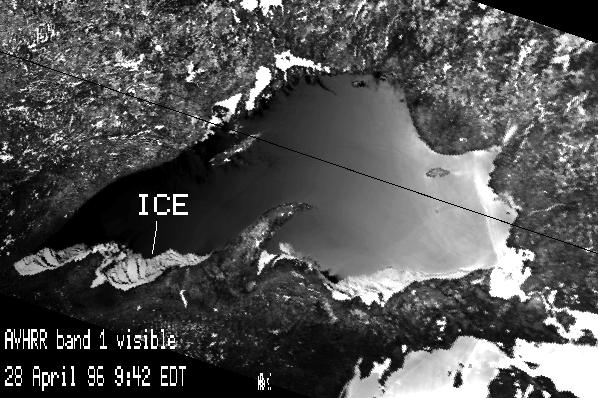
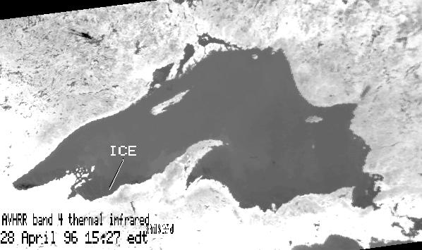
Wow! Sunniest day we've seen in a while. Most of the lake is ice free, with the exception of the entire south shore, and protected bays and inlets.
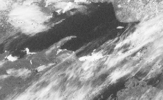
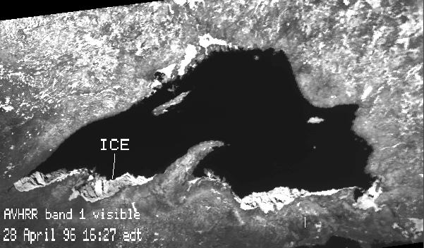
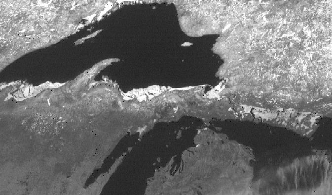
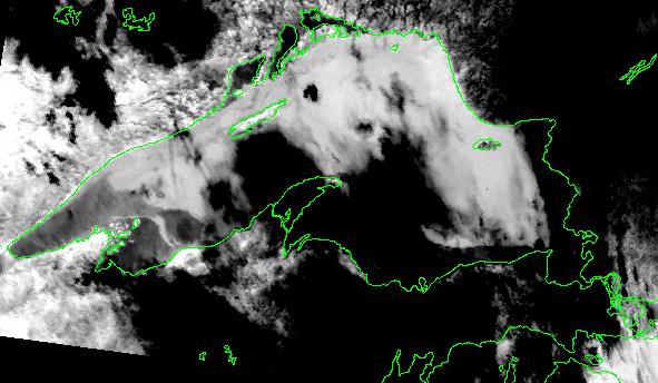
These images are from the next day, from the GOES geostationary weather satellite and again from AVHRR. Note how a large shore lead has opened up along the south shore of Lake Superior. Southerly and easterly winds produce a shear stress on the ice surface, causing the ice pack to pull away from shore.
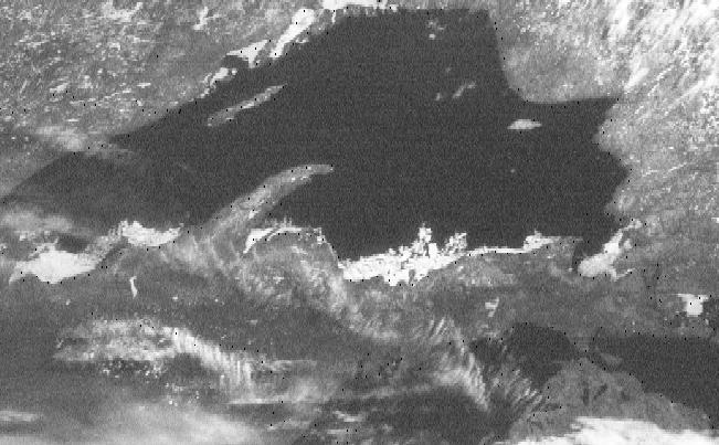
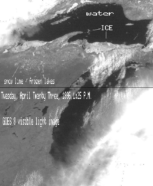
Most of the lake is ice free (in contrast with February 4, 1996). Pack ice is confined primarily to the south shore. Drifting ice appears in various places (north and northeast of Isle Royale, south and east of the Keweenaw Peninsula). Major east-west trending leads transect the pack ice between Ontonogan-Apostle Islands, and Keweewnaw Peninsula (Point Louis) - Marquette. The ice north of these leads is likely to decouple from the shorefast ice in the event of a strong and persistent southerly winds.
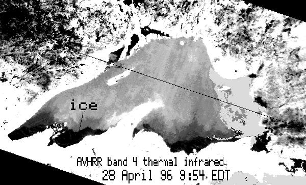
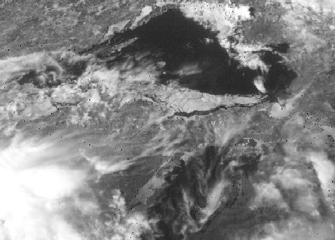
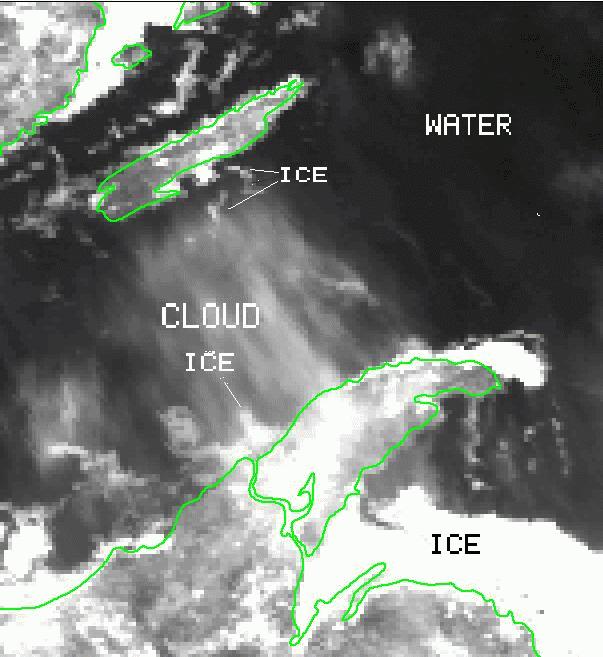
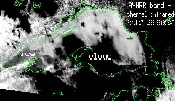
The imagery used here is from the AVHRR sensor, a NOAA weather satellite. The sensor "sees" in the visible and thermal infrared portions of the spectrum. Both images types are presented above.
For those of you that care about such statistics, here's the Top Ten list
of snowiest winters in the Keweenaw. These snowfalls are measured at the
Houghton County Airport weather station (CMX) and not the snow themometer
on US41. The "record" there is 390.4" and it is measured in Delaware (MI
that is.)
Snowfall totals at CMX:
Average annual snowfall: 229"
10. 1950-51 257.00"
9. 1975-76 259.20"
8. 1981-82 260.10"
7. 1964-65 268.50"
6. 1970-71 279.70"
5. 1985-86 286.69"
4. 1971-72 287.90"
3. 1988-89 322.10"
2. 1995-96 327.50" (as of 10:25am 05/01/96)
1. 1978-79 355.90"
Source: Daily Mining Gazette Snowfall Chart, based on readings at the weather station at Houghton County Memorial Airport.
 Remote Sensing of Great Lakes Snow and Ice