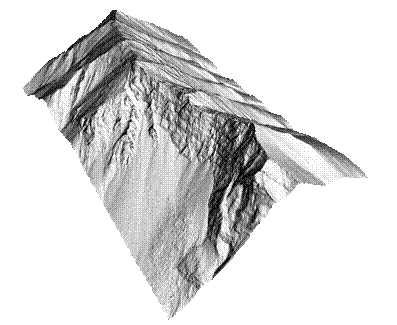
Turtle Mountain LiDAR
DEM(images showing bare earth and
full feature DEM)
Above is an example of a
high resolution DEM (0.5 m) generated from the LiDAR data for the South Peak
of Turtle Mountain that has allowed to viewing of structural features and
mapping.As well these views have
highlighted potential failure modes previously not appreciated.