


PHOTOGRAMMETRY
(Airborne)
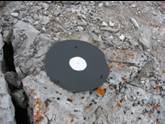


• A
series of 24 photogrammetric targets were installed in 1981 and flown for four years, then discontinued
•The area was re-flown in September 2005
•Deformation rates ranging between < 1 mm/year and 3.5 mm/year were observed.