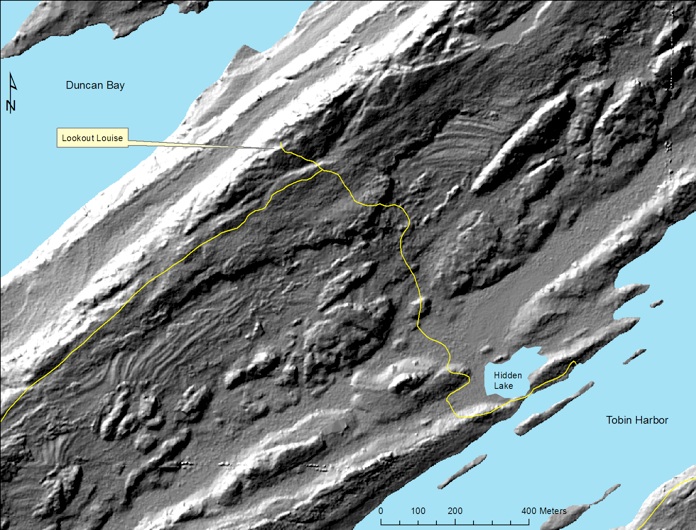
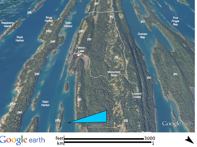
Lookout Louise
 

Lookout Louise

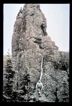
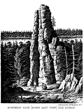
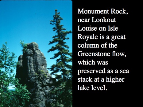
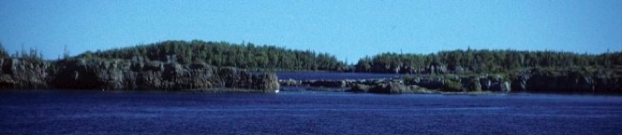
From Hidden Lake to Lookout Louise, we will hike about 1.6 km (1 mi)  long and 85 m (280ft.) up. We will begin on the Tobin Harbor flow, but after passing the lake we will walk on the Greenstone flow, following a dip slope up to Lookout Louise. At about the halfway point, the trail passes Monument Rock, an individual column from the colonnade of the upper ophite that is exposed as an erosional remnant. Huber (1983, see especially pp 47-55) suggests that Monument Rock was formed by wave cut shoreline processes along a former  "raised" shoreline, which he associates with glacial Lake Minong, about 10 Ka. From Lookout Louise we will look over the steep, anti-dip slope of the lower ophite and see Five Finger Bay, Duncan Narrows, and Amygdaloid Island.

LIDAR survey of all of Isle Royale, with a nominal resolution of about 2 m is newly available for study. The image below came from Seth De Pasqual, at Isle Royale National Park. It reveals a striking topography which shows the dipping lava beds.  Prominent large lava flows, like the Greenstone flow (pg) are obvious features in this image. Differential erosion of lava flows occurs when soft material, like what is found in the amygdaloidal flow tops and along faults is preferentially removed and makes a topographic low, while the massive flow interiors resist erosion and become topographic highs. In this image we can also see the different layers of the Greenstone flow, including the Upper Ophite, the Pegmatite and the Lower Ophite.

Post glacial shorelines can be seen in parts of this image also, and these shorelines are located in the vicinity of Monument Rock. This proximity suggests that the freestanding form of Monument Rock reflects its formation as a “sea stack”, and a remnant of the upper ophite, which is mostly eroded from this place. This interpretation was first suggested by NK Huber.  Trails are shown in yellow.

pth
pth
lower ophite
upper
ophite
pg
pegmatite
old shorelines
old shorelines
upper
ophite
Monument Rock