How do these boulders relate to each other? They each represent a piece of a puzzle that the glacier scrambled. But they can be rearranged and put together again, which reveals the geometry of the rift. This is a useful exercise for students.


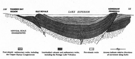
This diagram, from N King Huber, shows the cross section of the Keweenaw Rift, with lavas and sediments in 3 dimensions.
The rift extends from Kansas to Toledo, bending through Lake Superior. It contains the same combination of lavas and sediments, in the form of a syncline or trough, which follows a line that bisects the western limb of Lake Superior between the Keweenaw and Isle Royale. This line is called the rift axis and the shape of the Keweenaw is controlled by the bending of this axis. The shape of the whole lake is also controlled by it.
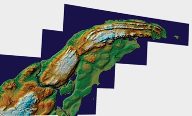
Arrange the boulders of the garden into plausible positions on this geomorphological map of the Keweenaw. Think about the process of rifting and the events that must have happened to produce this geometry.
Bill Rose
Professor of Petrology
15 November 2010