Lava Stratigraphy

In Eastern Iceland there are many cliffs exposing cross sections of rift-generated basaltic lava flow sequences. These are instructive for geologists, because in the Keweenaw and Isle Royale we usually find only scattered outcrops and rarely see them this way. It helps to visualize the tabular nature of the flows. Many dikes are exposed also, and dikes are rarely observed in the Keweenaw or Isle Royale.
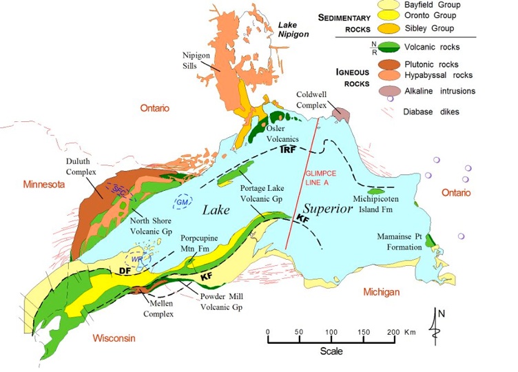
On this map, green-colored areas are volcanic rocks. Note that the Portage Lake Volcanics extend along the Keweenaw to the Porcupine Mts and beyond (J Miller).
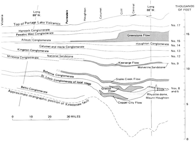
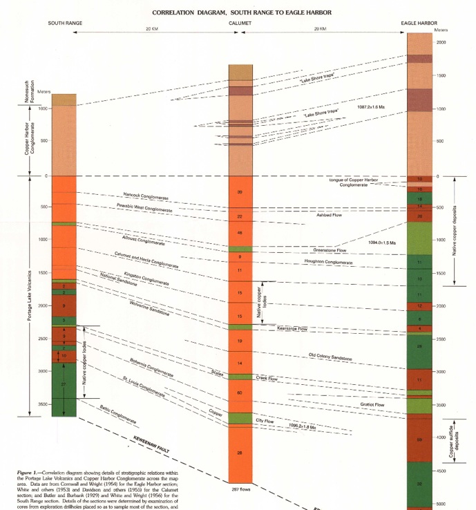
In the cross-sectional view below, a part of the Portage Lake Volcanics extending SW from Keweenaw Point (right in the figure) to Victoria (left) about 80 miles is shown. Note that conglomerate units are numbered and there are 17 of these among hundreds of lava flows. Thicker lava flows such as the Greenstone flow are shaded. Arbitrarily the Allouez (#15) Conglomerate is plotted as a straight horizontal line while other layers thin and thicken based on geologic thickness.
The red line shows the location of the Eagle Harbor cross section plotted in detail below.

Eagle Harbor section
Keweenaw Isle Royale
Missing
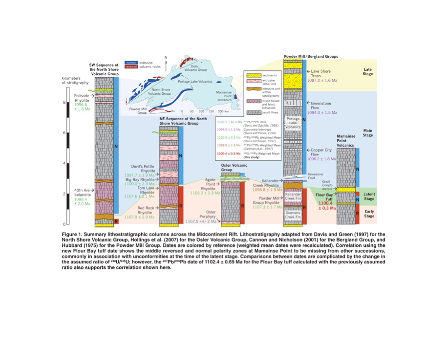
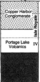
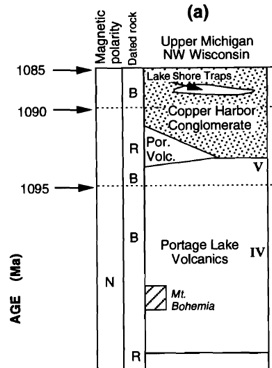
The diagram to the left shows how the Portage Lake Volcanics and Copper Harbor Conglomerate formations correlate between Isle Royale and the Keweenaw, oposite sides of the syncline. Note that the lower part of the Keweenaw sequence is missing on Isle Royale. Also note ages based on U-Pb zircon dates, rocks of normal magnetic polarity (N) and approximate stratigraphic positions for dated basalts (B) and rhyolites (R) from the Keweenaw. Modified from Nicolson, et al., 1997, USGS.


N K Huber, 1973a, p C14
psp
pei
pmp
pli
pth
pwi
pp
pg
pgi
pp
pm
ph
php
pp
pai


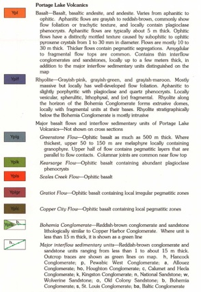
Conglomerate
Amygdaloid
Amygdaloid
Amygdaloid
Amygdaloid

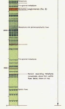
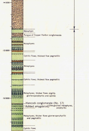
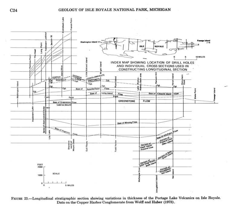
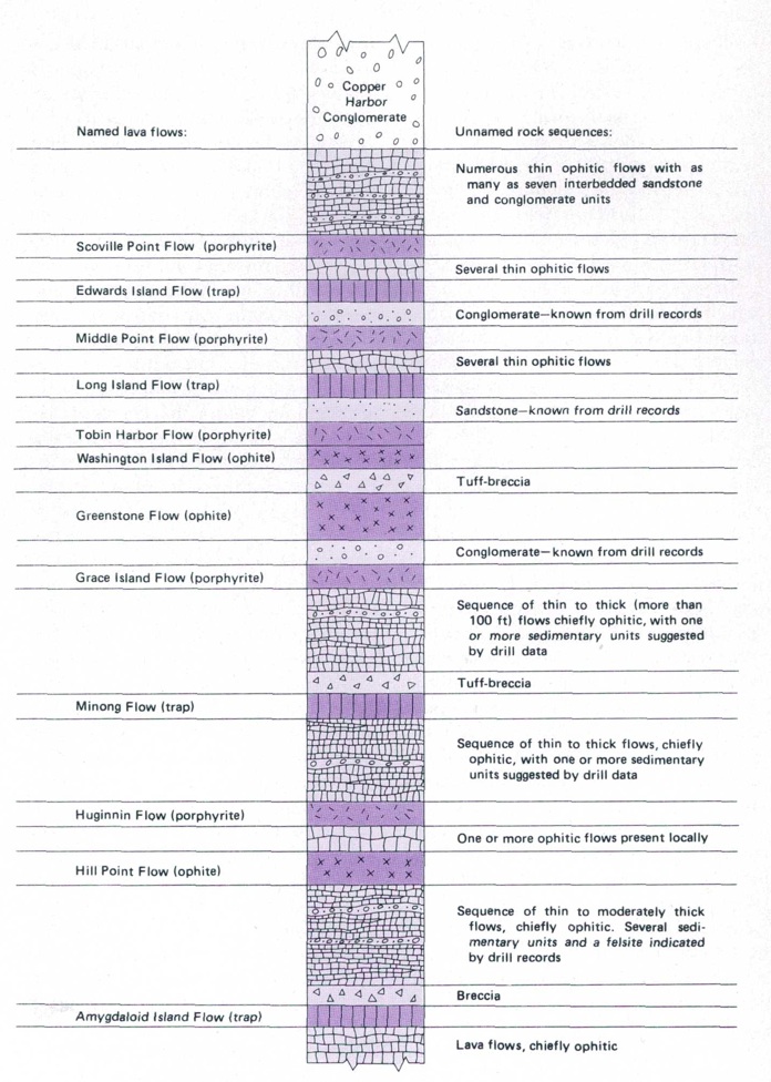
Cross section (below) of the Portage Lake Volcanics as seen on Isle Royale. This section (which matches the blue line, above) includes all the named lava flows found there along with their geologic symbols and textural types. The Isle Royale sequence is believed to be correlative with the upper part of the Keweenaw Peninsula, with the Greenstone flow being found on both sides of the rift and the Hill Point flow on Isle Royale correlating with the Scales Creek flow on the Keweenaw.
The thickness and number of lava flows decreases from Eagle Harbor to South Range.
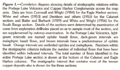
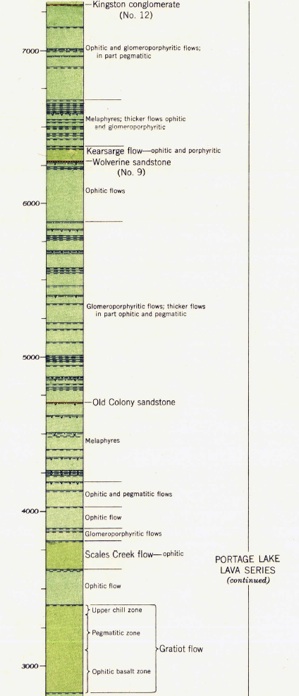
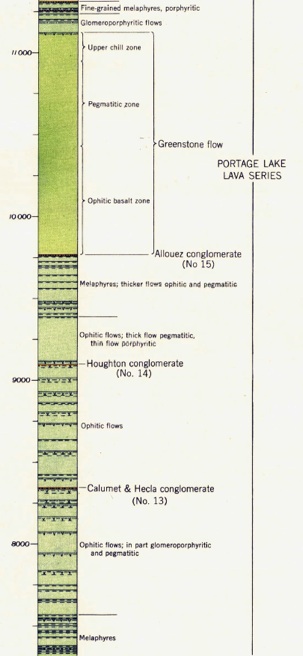
This cross section shows the named flows and conglomerates as well as the amygdaloidal flow tops of the Portage Lake Volcanics in one section across the Keweenaw Peninsula within the Eagle Harbor Quadrangle, located about 14 km west of Copper Harbor and about 48 km NE of Houghton. There are hundreds of lava flows and at least 17 conglomerates in the section, which is more than 14,000 feet thick. The section matches the red line across the figures above. Named units continue to both E and W. The named lava flows (Greenstone, Kearsarge, Scales Creek and Gratiot) are ponded, unusually thick flows which likely remained as magma ponds for centuries, while developing pegmatitic layers, segregation cylinders and vesicle sheets.
Map from J Miller:
http://www.largeigneousprovinces.org/07nov
Michigan Geo Map sources:
Swanson-Hysell et al, 2014, Geology 42: 475-478.