Text

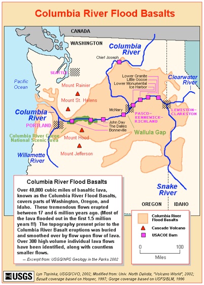
Flood Basalts are high volume eruptions that flood vast areas of the Earth, covering broad regions with flat lying lava surfaces. They are said to be the result of mantle convection through hot spots, which occur sporadically in time and place. In the USA we are familar with the Columbia River Flood basalts, which represent hundreds of black basalt lava layers which cover eastern Washington and parts of Idaho and Oregon (see map at right), erupted 15-17 my ago.
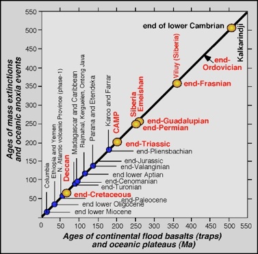
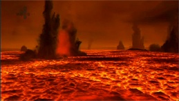
Based on the lower rates of eruptions in the past few millions of years, we know that flood basalts represent highly anomalous rates of volcanic eruption, because they appear to upset Earth’s hydrospheric system. Continental flood basalt eruptions, which degas to the atmosphere when erupted, are associated with ecosystem mass extinctions. (see figure at left).
The link between eruption and extinctions is thought to be CO2 and sulfur releases associated with eruption as the magma degasses and SO2 is converted to sulfuric acid aerosols which linger and affect the solar energy flux to earth atmosphere and surface, cooling the surface. The huge volume of sulfur rich magma (estimated at 170,000 km3), erupted in a short time (~2 my) is what brings the levels of “natural pollution” to deadly levels.
Artist’s view of a magma ocean. http://www.kabrna.com
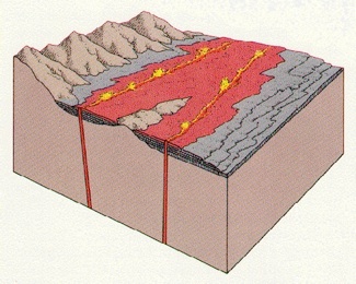
When flood basalts are forming above continents they fill rift valleys via giant fissures that split the continent. Magma migrates to the surface following these fissures, which are preserved as dikes. Sometimes the continents separate into separate pieces, forming an ocean basin between. In the case of the Keweenawan flood basalts, a basin which encloses Lake Superior formed before rifting ended.
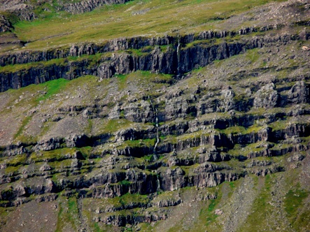
A cliff exposure in Eastern Iceland, showing flood basalts as flat-lying layers with variable thicknesses. This photo shows how we envision the rock below us in the Keweenaw and Isle Royale, except our rocks have been tilted to angles ranging from 20-60 degrees, facing north in the Keweenaw and to the south on Isle Royale.
Vertical dikes project as ridges in the photo.
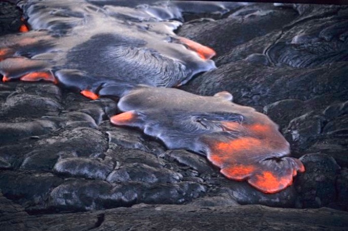
Lava fills a rift through fissures.
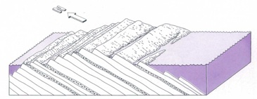
Although they formed as horizontal layers, the Keweenawan flows are now tilted as shown above.
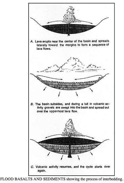
When they formed in the rift valley, fissures fed flows from the valley center, and the lava filled the valley like a bathtub (see right). Then the weight of the lava caused the valley to sink, and sediments fell into the valley carried by rivers. When eruptions resumed, more lava layers were laid down and the cycle went on and on. There are hundreds of lavas and ~20 sedimentary layers in the Portage Lake sequence.
NK Huber, 1983
NK Huber, 1983


Michigan Geo Map sources: