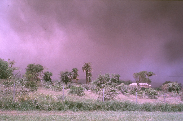
July 27, 1996, ~1730H
Ashfall. Picture taken from Old Towne looking south. Under the ash
cloud is Plymouth. The hillside is known as Garibaldi Hill The cloud of
ash produced a directional light such as one would experience during a
solar eclipse. The bright colours of the tropics contrasted by the
backdrop of black and gray ash . The light became very directional and
hastened the short twilight of the tropics.

July 27, 1996, ~1730H
Ashfall. Picture taken from Old Towne looking south. Under the ash
cloud is Plymouth. The hill side is known as Garibaldi Hill. The
residential area behind the hill is know as Richmond Hills which sits on
the outskirts of the evacuation zone and the town of Plymouth.
July 28, 1996
Ash fall heading south. This ash fall fell in the St. Patrick's area.
The deposits were over 8 inches and the ash was a slick black ash. This
was the first major ash fall in this area.
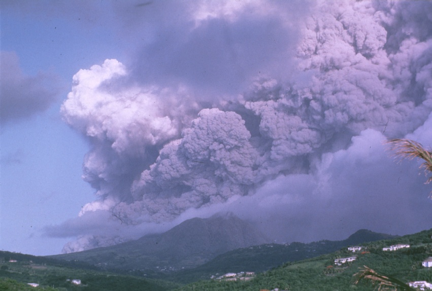
July 28, 1996
Ash fall heading south. This ash fall fell in the St. Patrick's area.
The deposits were over 8 inches and the ash was a slick black ash. This
was the first major ash fall in this area. This photo was taken from Old
Towne looking southwest. The western side shows the pyroclastic flow
which went down the Tar Valley to the sea to start the building of the
peninsula.
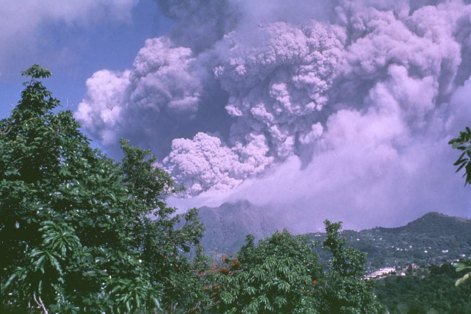
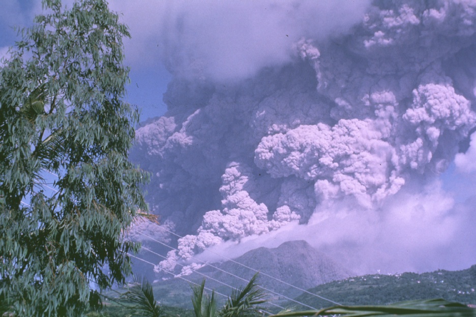
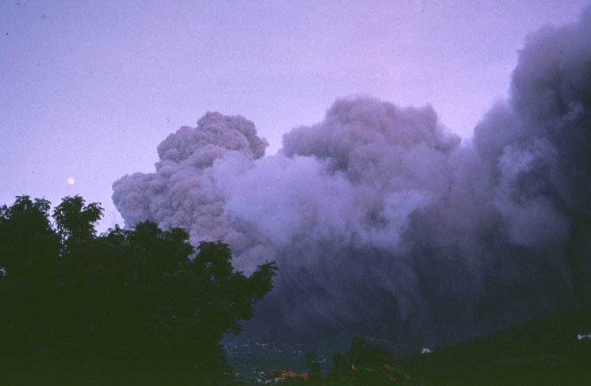
July 26, 1996
The eruption begins. This photo was taken inside the evacuation zone just
outside of Plymouth toward Cork Hill. The eruption had just begun and a
heavy warm black rain has begun to fall. On the south side of the island
near The Great Alps Falls small pellets of ash in the water began to get
larger and the water became a dark gray in colour. 50 minutes later the
ash began to fall.
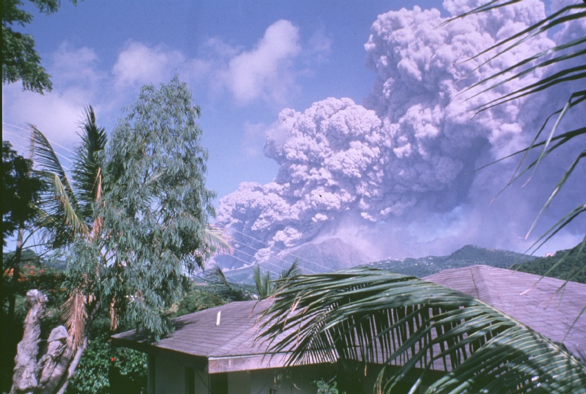
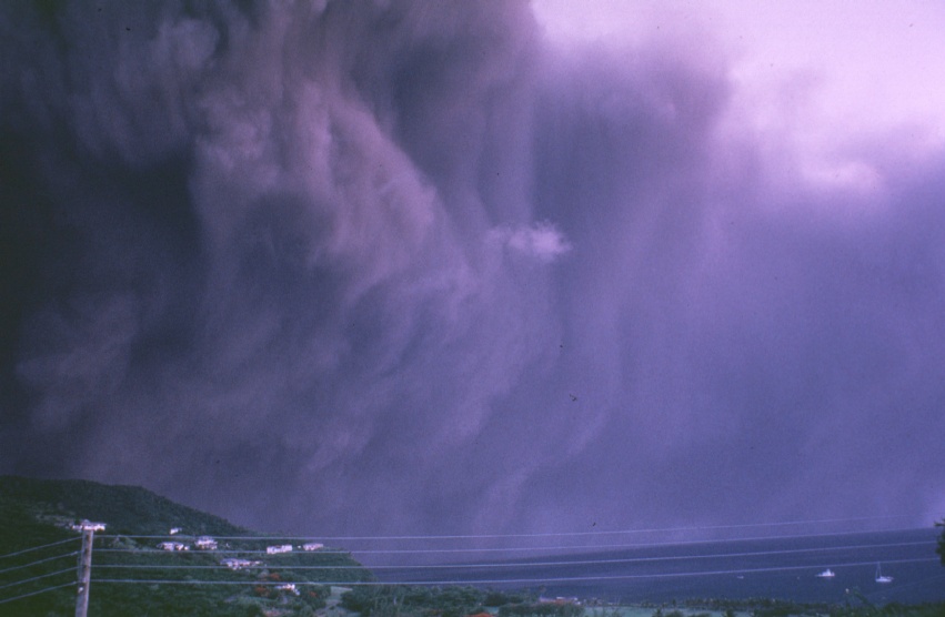
July 26, 1996
Photo taken from Old Towne toward the south west. The ash curtain has
begun to form.
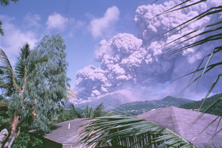
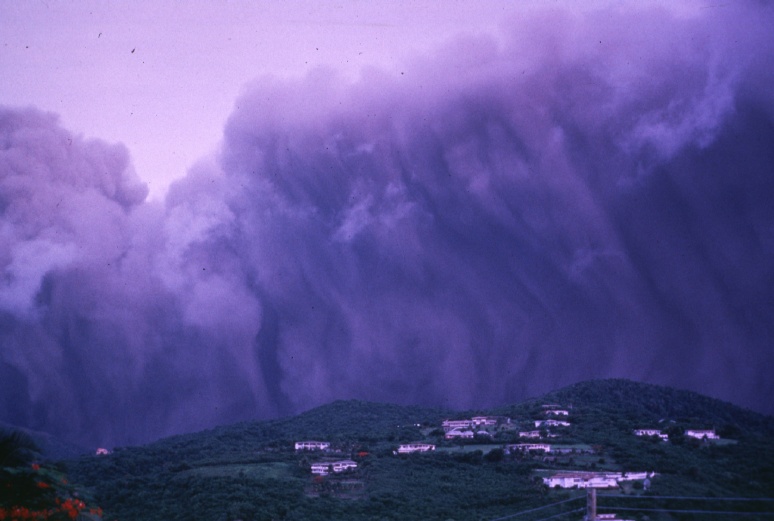
July 26, 1996
About two hours into the ash fall this photo was taken from Old Towne
looking to the South East toward Fox's Bay. The main ash fall was over
the evacuated town of Plymouth.
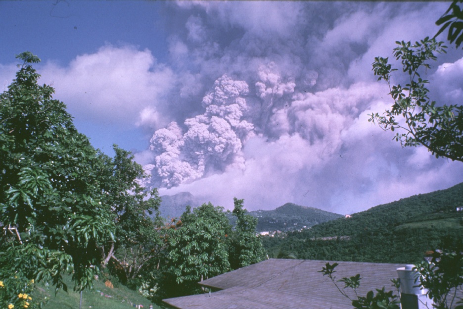
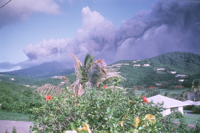
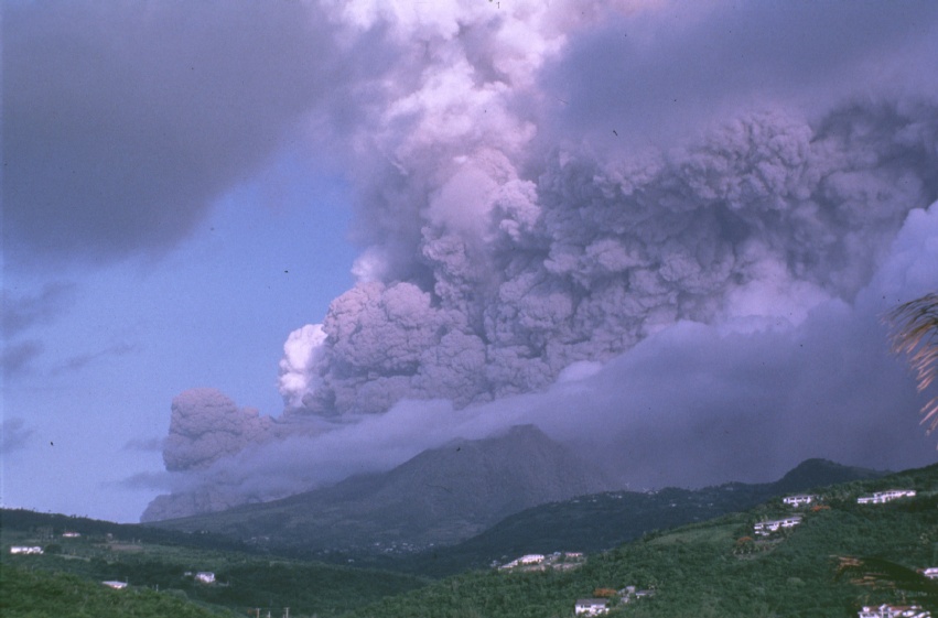
July 27, 1996
This was the day after the heavy ash fall on Plymouth. The ash top was
much higher this day. The direction was not typical as the cloud headed
south rather that its normal eastward track.
This set was taken from the hillside in Old Towne. This set of photos highlight the ash as it rises from the Tar Valley on its way to the sea.