TYPE OF EDIFICE

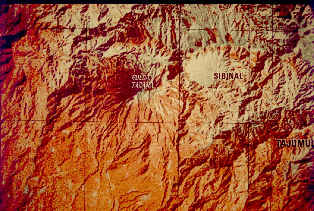
- Detail of shaded relief map of the Tacaná region.
Tacaná is a strato volcano with caldera rings and a small culminating plug. It is a broad, capped symmetrical cone with a diameter of 10 km at the base. At its summit, and especially well-developed on the SE side, are three semi-circular valleys at elevations of 3,800 m, 3,870 m, and 3,960 m. A younger crater exists within each lower older one (caldera), marking a former crater. The uppermost crater has a dimater of about 400 m. Within this last crater, the peak is formed by a small plug with steep fronts of solid lava. A very small funnel-shaped depression 10 m deep occurs on the northeastern side of this plug. 190 m below the summit and on the SW flank there is a small, elliptically-shaped lateral crater 50 m long and 5 m deep, surrounded by a rim of volcanic breccias.
(Mooser et al., 1958).
Lack of geological mapping hinders the interpretation of thie edifice, but the elongation of the volcano in a NE direction suggests that the volcano could have at least two vents along a NE trend. The situation is suggestive of the relationship of Santa María and Santiaguito, and this comparison suggests that the SW part of the edifice is a silicic dome, as was mapped in the photogeologic map by Mercado and Rose(1992). Real geologic mapping is needed.