The climate of the area surrounding Santiaguito is a highland modification of the tropical winter dry season type, but with a strong monsoonal influence. McBryde (1945) classifies the climate of the volcanic chain in southwest Guatemala as Cwbgn (Koeppen Classification), a tropical highland winter dry regime, with the hottest month having a temperature below 22°C and coming before the summer solstice. The climate is also characterized by frequent fog. Individual climate station points for points near Santiaguito are in Table 1. The mean annual temperature is about 15°C and the mean annual rainfall is in excess of 3.75 m, nearly all of it coming between June and October. The individual stations shown in Table 1 are nearby, but do not reflect precisely the conditions at the volcano, which probably has rainfall like Patzulin, and temperature like Quezaltenango.
Prevailing wind patterns are studied because they directly influence the areas affected by ashfall. Mercado et al. (1988) used an INSIVUMEH table of monthly averages (1982-1986) for upper air wind directions over Guatemala City to assess ashfall hazards. As this is only five years of data, it is only a preliminary assessment. Coupled with the fact that wind velocity was not considered, no definite ashfall model can be constructed for these four volcanoes at this time.
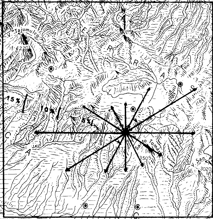
Arrow diagrams for the monthly averages define 4 specific patterns of high altitude wind directions in Guatemala. Westerly winds predominate from January to March. April and May are transition months, where westerly winds still predominate, but other directions become significant. Easterly winds are prevalent from June to October. November and December are transition months, with westerly winds starting to predominate again.


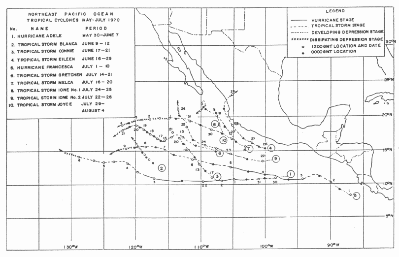
The heavier rainfall in the country is caused by the cyclones which come from the two tropical cyclone zones: namely, the North Atlantic Ocean Zone and the Northeast Pacific Ocean Zone. Tropical storms and hurricanes from the North Atlantic Ocean zone annually rose 8.3 times. Tropical cyclones that hit the country one or two times a year occur from May to mid-December, and the occurrence frequency is at its highest level in mid-September. (Flood Control Project, 1985).