Volcán de Trés Virgenes from the south. Photo by Bill Rose.
Background:To understand the deposits around the Sea of Cortez one needs to understand what was happening in this region during the Cenozoic. Forty million years ago the East Pacific Rise was the spreading center for the Pacific Plate (to the west) and Farallon Plate (to the east). At the same time the Farallon Plate was being subducted under the North American Plate (east of the East Pacific Rise, and Farallon Plate) creating a convergent plate boundary better known now as the Sierra Madre. The rate of subduction was greater than the rate of spreading of East Pacific Rise. So during the Oligocene/Miocene the North American Plate over ran the Farallon Plate and East Pacific Rise. That did three things: 1] It stopped the magma production from partial melting of the subducted Farallon Plate and hence stopped the convergent plate boundary volcanism (the what was producing the deposits of The Sierra Madre Occidental). 2] It released a great deal of pressure that was applied to western North America. This release caused extension of the continent, in the form of basin and range faulting (we can see this now in the US and on either side of the Sierra Madre). 3] As the North American Plate overran the East Pacific Rise it caused a continental rift to begin spreading the Baja away from Sonora and the rest of Mexico and producing volcanic deposits in the Sea of Cortez.
The places we visited in the Baja and the Pinacates are associated with the formation of the continental rift. Volcán Trés Virgenes is an example of a complex volcano that forms on the flanks of a rift. The sedimentary sequence we saw near Puertocitos, is an example of the large amounts of clastic and volcaniclastic sediments filling in a rift basin. And the Pinacates our last stop, is an unique place were magma from the spreading center is erupting through clastic sands and an aquifer of the northern Basin of the Sea of Cortez. Basically the deposits we saw are what happens when you overrun a continental with a spreading center.
Volcán de Trés Virgenes from the south. Photo by Bill Rose.
Location: 27.470°N 112.591°W
Elevation: 1940m
Background:Volcán de Trés Virgenes is unique for two reasons. One reason is it has extruded a wide variety of lava types: dacite, andesite, and basalt. The other reason is an active composite cone with evolved magmas like dacite on the side of a rift zone. Volcán de Trés Virgenes is a dramatic volcano that stands 1500 meters above a desert plateau. The transpenisular highway snakes around the western side of it (30 miles north of Santa Rosalia). The most recent eruptions are basalt, extruded from the base of the volcanic pile. Two dacite coulees or flows are slightly older and flowed out midway up the cone. The younger of the two formed after a white pumice-rich air fall eruption occurred about 1000 years ago. The desert environment preserves the pumice, which is wind reworked (in the form of dunes) and covers much of the plateau around the volcano.
Emily and Darrell digging out a section of the La Virgen pumice fall deposit. Photo by Colleen Riley.
Activities: Our first day we began an exercise on distinguishing volcanic deposits. Volcán de Trés Virgenes has good examples of the common physical characteristics of dacite, andesite, and basalt lava flows. Before lunch, we visited a potential geothermal field, Las Trés Virgenes in between Trés Virgenes and La Reformá. Carlos taught us some basic things about geothermal systems and exploration at the site. On the second day we completed a small stratigraphy project, on the western flank of the volcano.
We found that the cacti (mostly chollas) made it difficult to get around the base of the volcano. We didn't attempt to climb Trés Virgenes, but it would be an all day affair if you started from the highway. Hint: follow the cow paths around the "cactus mine fields."
Volcán de Trés Virgenes from the west, with the two dacite domes in middle-of photograph. Photo by Carlos Pullinger.
Website: I encourage you to look at the Volcano World website for more information on this volcano.
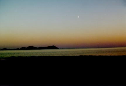
After a long drive from Scammon's Lagoon. We camped under a full moon at a beautiful spot looking out at Isla de San Luis Gonzaguo, 4 km north of Punta Bufeo on the sea of cortez. Photo by Collen Riley
Isla de San Luis Gonzaguo is a volcanic island 4 km off the coast. It includes a couple of volcanic domes and a tuff cones.
Lenny, Amanda, and Darrell checked out a great sequence of submarine rift sedimentation. Photo by Bill Rose.
Background: At this point on the trip, we were on one of the worst roads we had seen, we had no shocks on the van, and Marcia was feeling pretty sick. But the geology and outcrops were abundant. In this area, there were many examples of Miocene (23-6 Ma) rift deposits. It was slightly different than what we see in the Keweenawan rocks of Michigan which are Proterozoic (1,100 Ma). The major difference is that over the last 20 million years. The Cortez region was periodically filled with water, so some of the rift deposits show signs of being reworked or cooled by water. Extensional faulting exposed these rift deposits along this rocky stretch of the desert coastline. Poor field guide directions kept us from doing a planned mapping project but we were introduced to some of the deposits that may be found in a volcaniclastic rift sequence of rocks.
A panoramic of the Sea of Cortez on the road from Punta Bufeo to Puertocitos. Volcán Prieto (5 Ma old) is in the distance. Photo by Bill Rose
View from the top of the El Tecolote cinder cone looking north. Photo by Carlos Pullinger.
Location: 31.8° N, 113.3° W
Elevation: 0-1200
Background: The Pinacate Volcanic Field was about as close to the center of the rift system as we were going to get. The Pinacates are the northern most exposure of the deposits from the spreading center or hot spot, called the east Pacific Rise. This international biosphere reserve includes 2000 square km of basaltic volcanic rocks. The volcanic field is centered around Sierra Pinacate, a substantial composite of cinder cones and lava flows with a maximum elevation of 1200 meters. Cinder cones and lava flows are the most common feature in the Pinacates. Multiple lava flows can be traced back to a single vent or cinder cone. Is is unusual to find a single vent opening for multiple eruptive events, suggesting multiple events from a single vent. The dessert park is most widely known for its well preserved collapsed depressions and exposed tuff breccias. We visited two of the collapsed depressions (Cerro Colorado, Crater Elegante), a lava / cinder cone complex (El Tecolote), and hiked on a portion of Sierra Pinacate. This was a rugged and exciting place to end our field trip.
Lesson: The Pinacate volcanic field shows an interesting evolution from older alkaline rocks to younger tholeiitic rocks, which is seen in other volcanic areas with hot spots, like Hawaii. When the volcanic vent opens it frequently begins to erupt a less evolved alkaline lava. But once its get going in the sense that a hot spot is underneath it the lava flow composition changes to tholeiitic. Tholeiitic lavas are a more evolved than an alkaline lava. When a system evolves to a tholeiitic systems it is suggesting that partial melting of magma is occurring. In the Pinacates, the older Sierra Pinacate are alkaline in composition and the younger cinder cones and lava flows where tholeiitic.
Website: The Volcano World's webpage has a SIR-C/X-SAR radar image and an air photograph of the whole volcanic field, so it is worth a look. The following earth-bound photographs and descriptions are of the places we visited while at the Pinacates.
Location: 31°55.0" N, 113°17.4" W
Cerro Colorado from the southern side looking NE. Far left gray unit is a plastered tuff breccia deposited during the last eruptive sequence. The white blotch on far rim is our van, Mamasitia. Photo by Carlos Pullinger.
Background: Our first stop was Cerro Colorado, a massive rimmed crater, that is elevated above the flat desert floor. Gutmann and Sheridan called Cerro Colorado a partially collapsed tuff cone. The southern, non-collapsed side is composed of a gently sloping outer wall and a steeply sloping inner wall, which is typical of a tuff cone. To the north and east the inner slope of the tuff cone doesn't exist, instead a cliff to the bottom of the crater (35 meters deep) remains. The deposits of the tuff cone are really interesting. We looked at the strike and dip of the tuff breccias to find out whether there was more than one eruptive center. We found out the there are actually four eruptive events and at least three eruptive centers.
The northern rim of Cerro Colorado. Photo by Bill Rose.
The top of the western rim of Cerro Colorado. Photo by Bill Rose.
El Tecolote complex from the north. Photo by Bill Rose.
Location: 113°24.5" W, 31°53.0" N
Background: El Tecolote is one of the youngest volcanic features in the Pinacates. It is a complex of connected cinder cones, lava flows, and a "cinder blanket" (Lynch and Gutmann). The main cone structure is breached to the NW. There are a series of smaller cones in a line along the same NW trend. The lava appears to have flowed from this same linear structure. The lineation of the lava, cone and breech suggest that magma extruded from a NW trending fissure and migrated northwestward during repeated eruptions. The area is known for an enormous pyroclastic bomb, "The Bus Bomb," (although our van, mamasita, was bigger). It is also known for having especially large phenocrysts in the cinders and lava.
Old tuff ring deposits (in shadow) that was halved by the crater explosion of Crater Elegante. Photo by Bill Rose. Location: 113°25.3" W, 31°51.4" N
Background and Activities: Like Cerro Colorado, Crater Elegante has a gently sloping circular outer wall. The crater is an impressive 1.6 km wide and 244 m deep. There is a 50+ meter vertical wall around the entire crater that exposes some fascinating geology. The south side of the crater dissects an intrusive stock (called "the pitchfork" because of its shape) and a tuff cone above it. The east side of the crater dissects a cinder cone with a solidified lava lake. A lava flow can be seen in cross section thinning away from its extrusive origin, near the cinder cone. There are at least four lava flows exposed on the north and west walls. The final structure exposed is a thick wedge of bedded cinders are exposed on the southwestern wall. On top of the exposed strata are about 40 meters of bedded tuff breccia from the eruption. Gullies expose the three principle bed forms in surge deposits; planar, massive, and sandwave (Lynch and Gutmann). We tried to find the transitions between the bed forms by looking at the exposed cross section. We also unsuccessfully tried to climb down to the crater floor.
Surge beds found in a gully south of Crater Elegante. Photos by Bill Rose. Location: 113.3° W, 31.8° N
Elevation: 1200 View from the top of the Pinacates to the south. Sand dunes are in the distance. Sea of Cortez is on the right hand side of the horizon. Photo by Carlos Pullinger. Background and Activities: We had every intention to climb to the top of Pinacate Peak, the highest cinder cone on the composite mass, but we didn't have enough time once we arrived at the base camp, Red Cone. So we split up. Some hiked to a closer cinder cone peak while others hiked around the basaltic lava flows. The views were spectacular, and people found a lot of basaltic lava features.
Sky hole in lava tube on the hike. Photo by Carlos Pullinger.
Crater Elegante
Sierra Pinacate or Volcán Santa Clara
Border Crossing: Day 42
The next day we headed out of the park, and then drove southeast to Sonoyta, Mexico. We crossed the border near Organ Pipe Cactus National Park, exhausted and smelly, but well satisfied. Our trip ended in Tucson, Arizona.