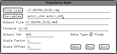
The xvu interface offers an easy way to do mathmatical operations
on the individual bands of data,
under the Transform/Element Math
function button.
If you select that option, a window like this
should appear:
Simply select the input filename and
variables; then enter an output filename,
and variable, and enter
a function like the one shown.
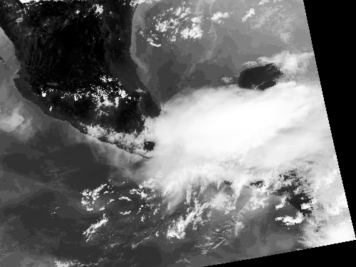
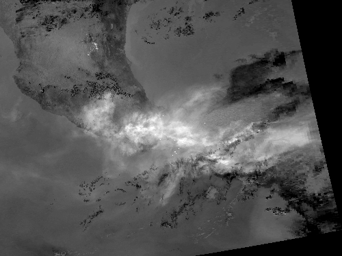
The image on the left is a band 4 image, scaled between -80 C (white) and 48 C (black), and the image on the right is the corresponding band 4 minus 5 image, scaled between -8.3 (white) and 7.75 (black).
In order to visualize the band difference better, an enhancement can be applied to the image. This just changes the appearence of the data, it does not modify the actual values. This can be accomplished using the following processing sequence:
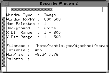
Determine the data range of the image. This is accomplished by putting the cursor over the window of choice, pressing the right button, and selecting the describe option. In this example, you can see that the data range is from -8.34 to 7.76 C.
The next step is to select a color palette which will highlight the data. This is done up at the top of the xvu menu, using the COLOR PAL button. This will give you a number of palette options. Select them by highlighting the palette and pressing the Pal1 button. One of my favorites in the hsl256 palette.
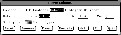
Now that you know the data range and have a palette choosen, select the image enhance button, and select enhance:between values. Enter the min/max values hit run, and then reverse the palette (using the reverse button). The result will be something like this! Note that coastlines were added using the xvu command: Overlay/Coast. You can also add latitude and longitude using: Overlay/ LL grid
This page maintained by Dave Schneider (djschnei@mtu.edu)

