For volcanic clouds, the magnitude of the negative brightness temperature difference is dependent upon the optical thickness of the cloud, the amounts of water, volcanic ash and sulfuric acid in the cloud, the size and size distribution of the particles in the cloud, and the temperature contrast between the cloud and the underlying surface (meteorological clouds, land or water) (Prata, 1989a; Wen and Rose, 1994).
For transparent clouds, the radiance recorded by the satellite sensor is a combination of the radiance of the cloud, and the radiance of the underlying surface. For meteorological clouds, the absorption of the of energy from the underlying surface is greater in band 5 than in band 4, due to a larger refractive indices for water and ice particles in the band 5 region than in the band 4 region. This results in a positive band 4 minus 5 brightness temperature difference.
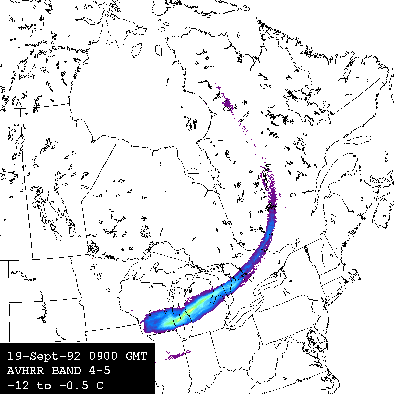
For transparent volcanic clouds, the absorption of energy from the underlying surface is greater in the band 4 region than the band 5 region, due to a larger refractive index for silicates in the band 4 region than in the band 5 region. This results in a negative band 4 minus 5 brightness temperature difference.
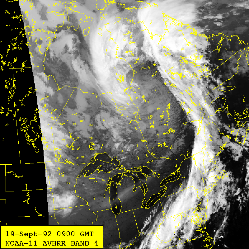
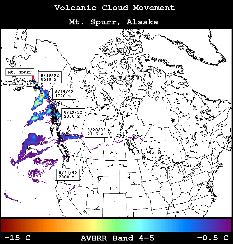
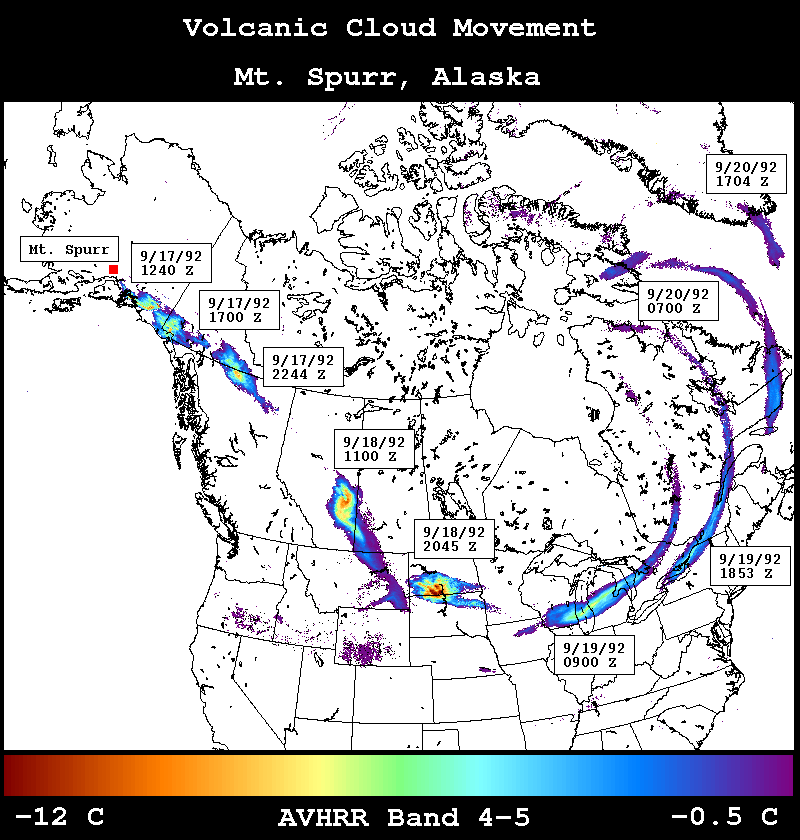
The progression from an opaque volcanic cloud to a transparent one has been observed in part in clouds from Galunggung (Prata, 1989b), Augustine (Holasek and Rose, 1991), Redoubt (Schneider and Rose, 1994), and Pinatubo, but this is the first instance where the full progression has been observed in one cloud.
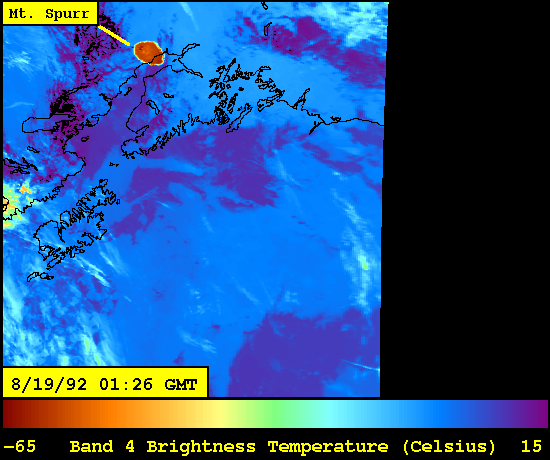
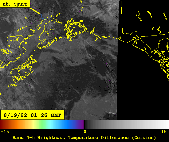
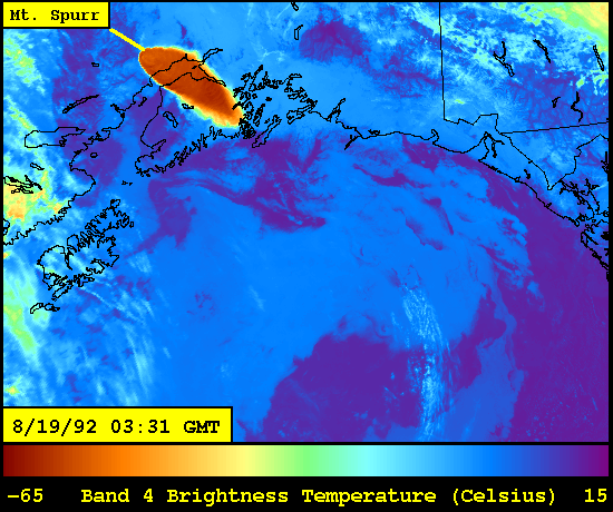
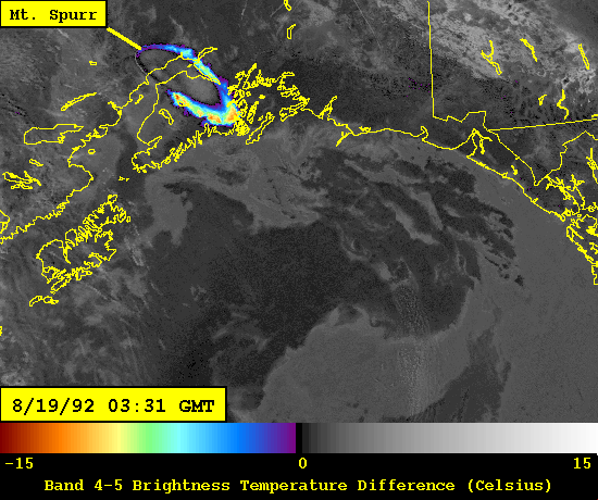
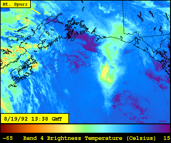
The earliest image, collected about ninety minutes after the start of the eruption (upper left), shows a cold, circular volcanic cloud in band 4, and high thermal contrast between the volcanic cloud and the lower and warmer meteorological clouds. The band 4 minus 5 apparent brightness temperature difference algorithm does not work well on this image (upper right). The second image in this series was collected two hours later and shows a larger cloud in the band 4 image (lower left), and a fringing response from the band 4 minus 5 process (lower right).
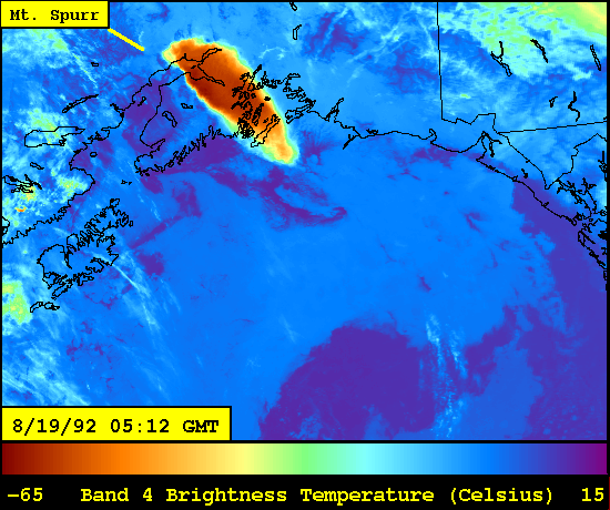
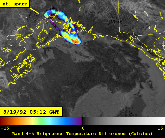

The third image (upper left) was collected ninety minutes later. By this time the eruption had ended, and the fringe of negative band 4 minus 5 values had grown and encircled the entire volcanic cloud (upper right). The fourth image was collected eight hours later. The volcanic cloud is difficult to distinguish from the meteorological clouds in the band 4 image (lower left), but it is discriminated by the band 4 minus 5 operation (lower right), with the entire cloud showing negative brightness temperature difference values.
Neal C.A., R.G. McGimsey, C.A. Gardner, M.L. Hardin, and C.J. Nye, Tephra-fall from the 1992 eruptions of Crater Peak, Mount Spurr, AK: A preliminary report on distribution, stratigraphy and composition, U.S. Geological Survey Bulletin, (ed.) T. Keith, in press.
Prata, A.J., Infrared radiative transfer calculations for volcanic ash clouds. Geophysical Research Letters, 16, 1293-1296, 1989a.
Prata, A.J., Observations of volcanic ash clouds in the 10-12 m window using AVHRR/2 data, International Journal of Remote Sensing, 10, 751-761, 1989b.
Schneider, D.J. and W.I. Rose, Observations of the 1989-90 Redoubt Volcano eruption clouds using AVHRR satellite imagery, Proceedings of the First International Symposium on Volcanic Ash and Aviation Safety, U.S. Geological Survey Bulletin 2047, (ed.) T. Casadevall, 405-418, 1994.
Schneider, D.J., W.I. Rose and L. Kelley, Tracking of 1992 Crater Peak/Spurr eruption clouds using AVHRR, U.S. Geological Survey Bulletin, (ed.) T. Keith, in press.
Wen S. and W.I. Rose, Retrieval of sizes and total masses of particles in volcanic clouds using AVHRR bands 4 and 5, Journal of Geophysical Research, 99, 5421-5431, 1994.
Wen S. and W.I. Rose, Retrieval of particle sizes and total masses in volcanic clouds using AVHRR bands 4 and 5, Poster presented at AGU 1993 Fall Meeting.
Yamanouchi, T., K. Suzuki and S. Kawaguchi, Detection of clouds in Antarctica from infrared multispectral data of AVHRR, Journal of the Meteorological Society of Japan, 65, 949-962, 1989.