Mt. Spurr: Radiannet Example
Images from the September 17, 1992 eruption of the Crater Peak vent of
Mt. Spurr Alaska. The cloud from this eruption was transported in the
jet stream from Alaska, over Canada, the United States, and Greenland.
Note: This data has been posted for collaboration with colleagues
at the CMC. Please do not use the data from this page without asking
for permission.
Thanks, Dave Schneider (djschnei@mtu.edu)
Silicate Mass Retrieval Maps
Click on the same image to download a larger version.
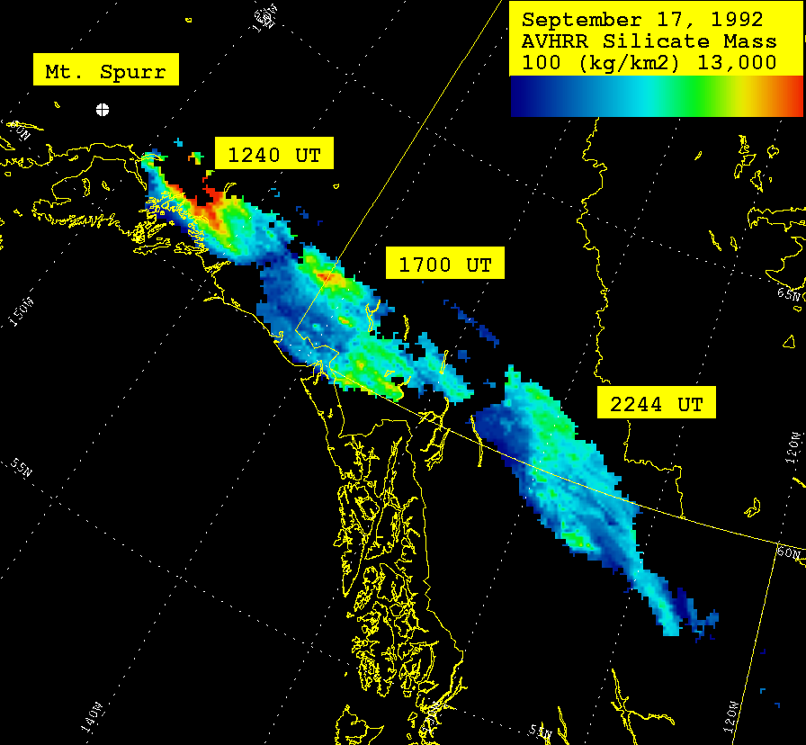
September 17, 1992
Note that in the first image from 1240 UT, that there appears to be an
opaque "core" in the northwest quarter of the image, where the mass could
not be retrieved, due to the high optical depth (>4).

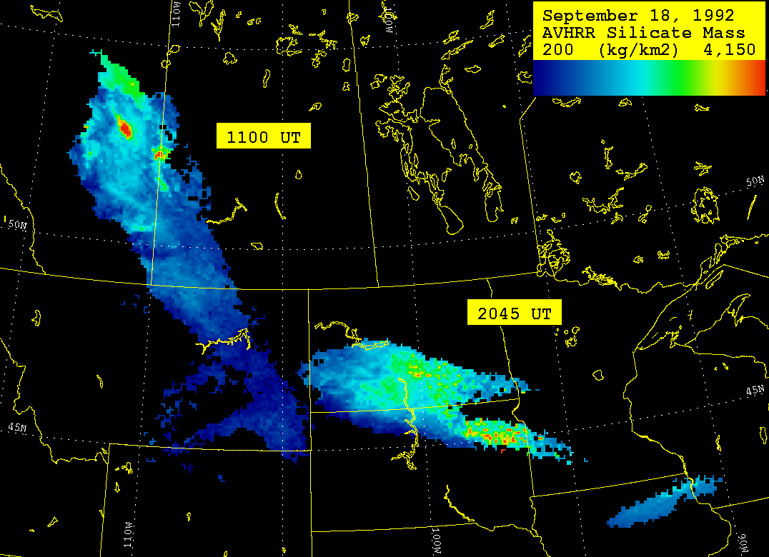
September 18, 1992

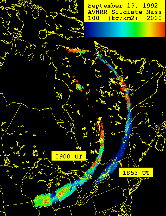
September 19, 1992
Note that the mass retrievals start to become affected by the background
beneath the cloud. Where the cloud passes over Lake Michigan, the mass
decreases, due to the warmer background (ie. the retrieval "thinks" that
the optical depth is lower, than over a cold background). I would treat
all of the mass "patterns" with caution after September 18.
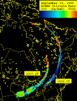
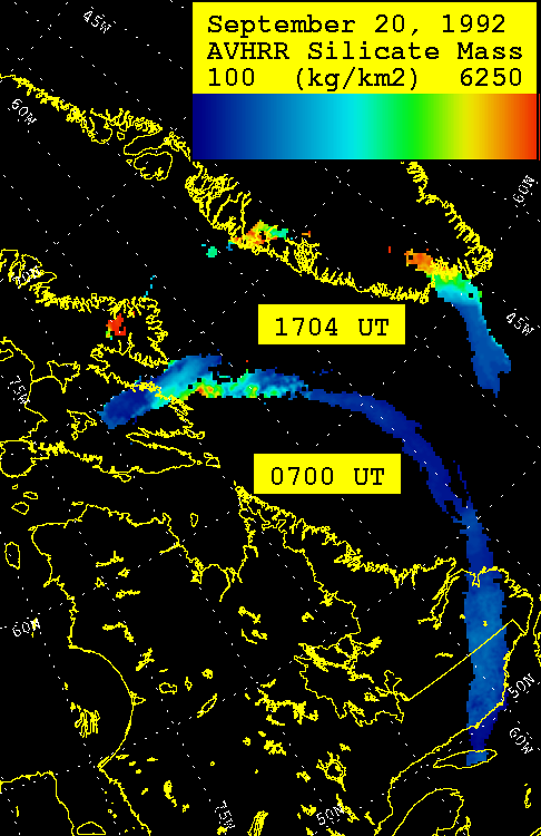
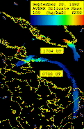
September 20, 1992
Note that the mass retrievals start to become affected by the background
beneath the cloud. Where the cloud passes over Greenland, the mass
increases, due to the colder background (ie. the retrieval "thinks" that
the optical depth is higher, than over a warm background). I would treat
all of the mass "patterns" with caution after September 18.
Mass Retrieval Data Files
Click Here
to ftp the data files. They are organized as latitude, longitude and silicate
mass (in metric tonnes). Note that this is the total mass of silicate in the
pixel, which is 64 km^2. For the maps above, I multiply by 1000 to get kg, and
then divide by 64 to get kg/km^2.