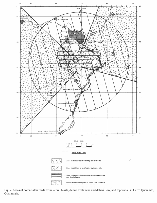
The lateral blast hazard zone is a bullseye pattern with a 10-km radius centered on Cerro Quemado. The bullseye pattern reflects the likelihood of a lateral blast originating from any flank of the dome. The size of the zone is determined by the extent of lateral blast deposits of the 1150 yr. B.P. eruption, but includes a 3-km safety zone reflecting the possibility of an even larger blast at the dome. Because of its size, the upper flanks of Santa María volcano (above 3100 m) are excluded from the lateral blast hazard zone.
Dome formation can be accompanied by explosive blasts that generate tephra, pyroclastic flows, and, under certain conditions, laterally directed blasts. Tephra form vertical pyroclastic eruptions is rare at Cerro Quemado, bu accumulations of up to 1 m occurred during the 1818 A.D. eruption. The primary health hazards associated with tephra are lung and eye ailments from settling hot ash and from contamination of drinking water. Thick accumulations of tephra on buildings could cause collapse or structural damage. In addition, tephra can abrade or corrode mechanical equipment, telephone lines, and radio equipment thus hampering local transportation and communication.
During the lateral blast of 150 yr. BP., projectiles were hurled 7 km and a blast cloud devastated a large part of the Llano del Pinal valley and slopes of Siete Orejas. Should such an event recur tens of thousands of residents of the Quezaltenango Valley could be killed. The principal danger to humans is from impact of rock fragments and asphyxiation and burning in the blast cloud. In addition, buildings could be blown down or burned.
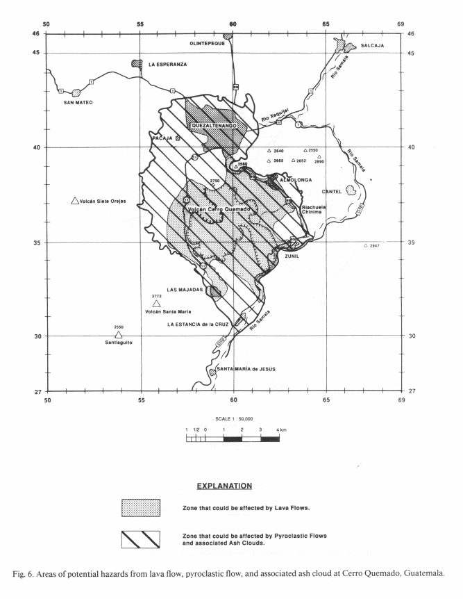
This zone comprises Cerro Quemado and environs withing about a 5-km radius of the dome. Within this zone only the largest topographic barriers, Siete Orejas and the north wall of the Almolongo caldera, are excluded. Major population centers included in the hazard zone are: Quezaltenango (population 125,000), Almolonga, Zuñil, and the Llano del Pinal valley.