Although an edifice collapse and debris avalanche is a rare event, it occurred at Cerro Quemado in the geologic past. Debris avalanches move at speeds of up to 150 km/hr and can cover large areas in minutes, making escape impossible once collapse begins. Because of their enormous momentum and mass, debris avalanches can bury or destroy everything in their paths. Should collapse occur on the east flank of Cerro Quemado, the subsequent avalanche could devastate the Río Samalá valley for many kilometers south of the dome. Moreover, mixing of avalanche debris with river might generate lahars which could travel tens of kilometers farther down river.
(Conway et al., 1992)

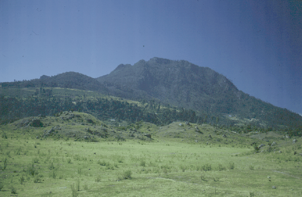
- View of Cerro Quemado from the NW. The rounded hilltop to the left is La Pedrera rhyodacite lava flow and the higher, more rugged hill to the right is Cerro Quemado. The collapse scarp faces the viewer, adn in the foreground are hummocks of the debris avalanche on the floor of the Quezaltenango valley. Photo by Bill Rose, 1989.
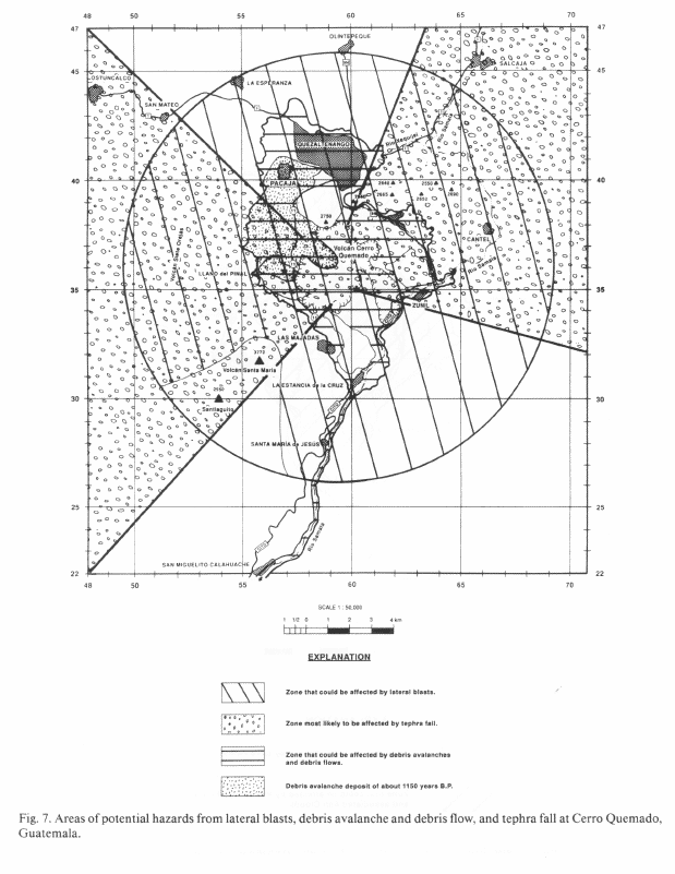
The coefficient of 0.1 for fall height versus runout distance (H/L) best represents small volume debris avalanches from volcanic domes; a coefficient of 0.1 is used to constrain runout of future avalanches at Cerro Quemado. Cerro Quemado rises 800-1000 m above nearby valleys so a coefficient of 0.1 for H/L yields a maximum runout distance of about 9 km. The hazard zone is irregular and asymmetric reflecting the profound influence of topography on the direction and extent of a debris avalanche.

- Areas of potential hazards from lateral blasts, debris avalanche and debris flow, and tephra fall at Cerro Quemado, Guatemala.
The debris flow hazard zone is included with the debris avalanche zone, although areas threatened by debris flows are principally the lower flanks of Cerro Quemado and river valleys downslope from the dome. Debris flows forming in the Río Samalá basin would be particularly hazardous because of the steep gradient, narrow valley bottom, and the presence of water; debris flows here could bulk up and travel tens of kilometers downvalley. Lateral boundaries of the hazard zone are approximate since the size of the avalanche or flow is difficult to anticipate. The hazard zone encompasses Quezaltenango as well as Almolonga, Zuñil, Las Majadas, and the Llano del Pinal valley.

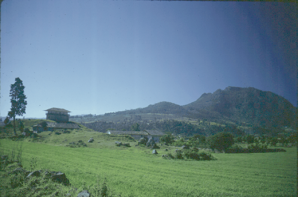
- Hummocky topography on the floor of the Quezaltenango Valley, just SW of the city. The low, rounded hill on the skyline is La Pedrera rhyodacite flow, while irregular-shaped Cerro Quemado is at the right. Photo by Bill Rose, 1989.
(Conway et al., 1992)