 GIFS AND JPGS
Please note all photographs shown on this page were provided by Dr Jerome Lecointre© and Mr Shane Cronin© of this Department, and unless otherwise specified, were taken on 20th and 21st September, 1995
| IMPORTANT: Please note that all graphics on this page are protected by copyright. If you would like to make use of them for any other purpose you should seek permission from the appropriate author |
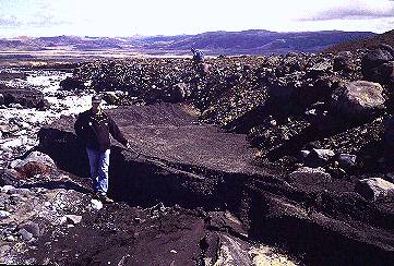 | Early lahar deposit in Whangaehu River on eastern side of volcano |
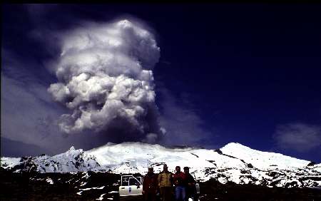
 | SMURRT team watches steam explosions from Crater Lake |
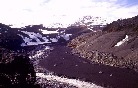 | Lahar deposit in Upper Whangaehu River |
 | SMURRT team member sampling lahar deposits in Whangaehu River |
 | Geometrical measurement on fresh lahar deposits |
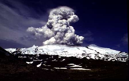
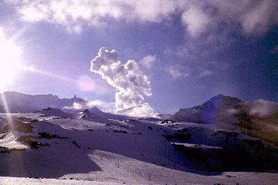 | Steam explosion from Ruapehu's Crater Lake |
a) 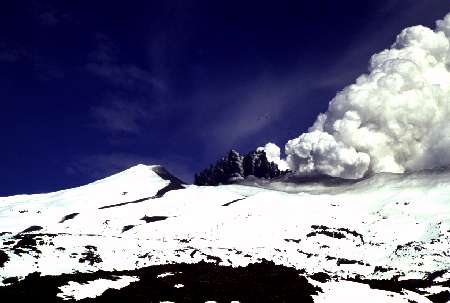 b)
b)  (c)
(c) 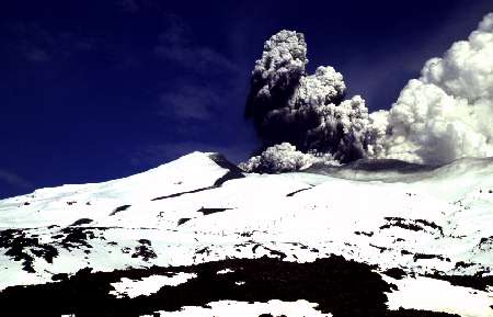
 | The SSMURRT Team from Massey University |
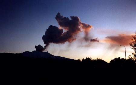
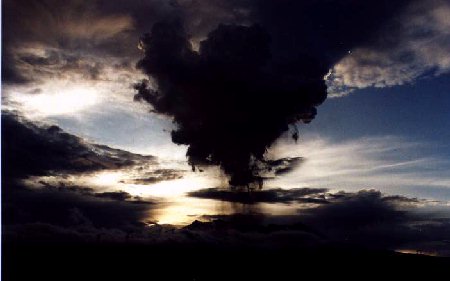 | Loud explosion and ash fall on the Rangipo Desert |
 | Steam plume as seen from Top Of Bruce Rd, Whakapapa (Note the lahar on the western slope of the volcano) |
 | Early ash plume as seen from Ohakune |
| 21 Sept | 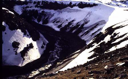 | Lahar in the Upper Whangaehu River (Tukino ski-field) |
| 21 Sept |  | Mudline left by a small lahar in the Upper Whangaehu River |
| 24 Sept |  | Mudline in the lower course of the Whangaehu River (ring plain) |
| 25 Sept | 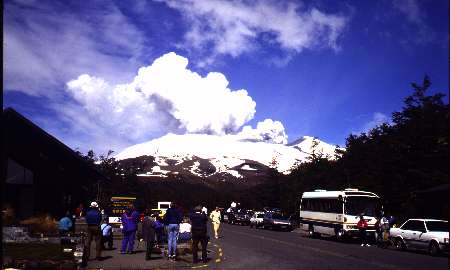 | Active steaming at Ruapehu from Whakapapa village |
| 25 Sept |  | Mudline left by the biggest lahar in the Whangaehu River |
| 25 Sept | 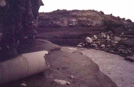 | Damage on siphon pipe for the Tongariro Hydro-electric Power Scheme |
| 25 Sept | 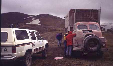 | Ash sampling on Tukino Rd (eastern flank) |
| 27 Sept | 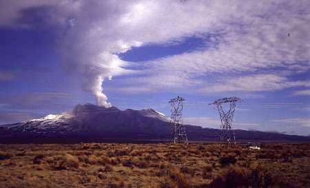 | High voltage power lines affected by ash fall on Rangipo Desert |
| 27 Sept | 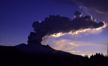 | Ash cloud from Ohakune (06.45am) |
| 27 Sept |  | Active steaming of Ruapehu from Ohakune (06.00am) |
| 27 Sept |  | Ash eruption on eastern slopes of Ruapehu and viscous lahar in Whangaehu River |
| 3 Oct | 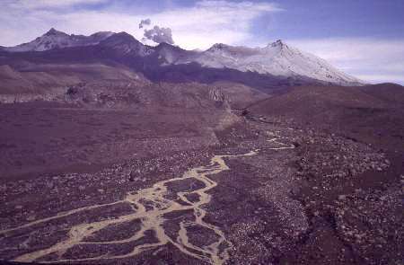 | Aggradation in the Whangaehu River |
| 11 Oct | 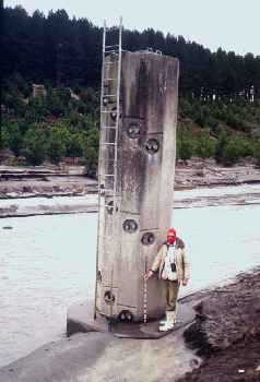 | Checking mudlines left by lahars on the flood warning gauge in Whangaehu River, which triggers the alarm on Tangiwai Bridge |
| 11 Oct | 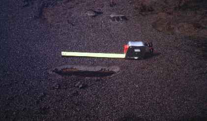 | Sampling ash layers left by 11 October eruption |
| 11 Oct | 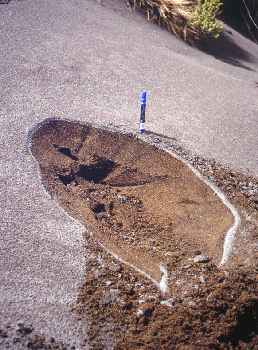 | Further sampling of ash layers |
| 11 Oct | 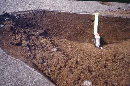 | More ash sampling |
| 12 Oct |  | Slippery ash cover on Desert Road after eruption of 11 Oct |
