 CALENDAR OF EVENTS ON RUAPEHU
WAITING.....
CALENDAR OF EVENTS ON RUAPEHU
WAITING.....
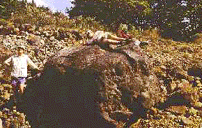
A SSMURRT (Soil Science Massey University Rapid Response Team) led by Assoc-Prof Vince Neall, from the Department of Soil Science, has been studying volcaniclastic deposits (especially lahars) all throughout this current eruptive crisis of Mt Ruapehu. The Massey team has been involved for the last 10 years on lahar studies related to Mt Ruapehu (stratigraphy, sedimentology, tephrochronology and hazard mapping).
Volcanic activity of Mt Ruapehu is being monitored daily by scientists from IGNS (Institute of Geological and Nuclear Sciences), based at Wairakei and Wellington.
 25 September: Ash has been falling in Napier; 140km from the volcano. The airports at Napier and Gisborne have been closed because of possible problems with ash and engines. Airspace over Ruapehu has been closed.
26 September:Evacuation procedures are under consideration and skiers have been warned not to use the ski-fields which have plenty of snow on them at this time of the year.
A plane, carrying several volcanologists from IGNS, Wairakei and Wellington, heading to the area crash-landed due to an engine failure several hundreds of km short of the runway. Although injuries were sustained, fortunately they were not too serious.
This morning the volcano is shrouded in mist and rain but seems to be quieter. Scientists believe it could come back to life later today.
29 September: Activity continues at a lower level which seems likely to continue for many more months if the same pattern of the major eruption of 1945 is followed. One photographer was killed when trying to drive to the mountain to photograph the eruptions, but that appears to be the only other volcano-related casualty to date.
30 September: Activity resumed this morning but seems to be calming down. Scientists report numerous earthquake activity; not abnormal after eruptions of this type have occurred.
There is concern, in New Zealand, about misreporting of events in overseas papers and news media. Reports are suggesting that the North Island is being evacuated. There is NO TRUTH to such rumours. Apart from some minor disruption in power supplies to parts of the North Island, and some revision of flight paths that normally pass close to the mountain, there is hardly any inconvenience to residents in either island. The erupting mountain, located in the Tongariro National Park, is a potential tourist attraction for the surrounding area, which is sparsely populated (approximately 6000 residents within a 30km radius of the volcano). This attraction would replace the more-normal skiing, for which the mountain is renowned, but which appears to have come to a premature end this season. Massey University, which is about 150km from the mountain functions normally, although the activity can be viewed from elevated positions on campus.
3 October: Alert has been reduced from Level 4 to Level 3 as a result of decreased activity over the past 48 hours. Ski operators will be back in business by the weekend in areas not in the path of future lahars.
10 October: The last explosions occurred on Saturday 7 October, at about 1115 and 1500h. These events were accompanied by the release of three lahars into the Whangaehu River. IGNS scientists recorded strong eruption earthquakes and sustained tremor during the events. The volcanic alert level remains at 3.
15-16 October: Heavy ash falls on the eastern and northern sides of Ruapehu caused the premature closure of the main ski-field located on the volcano (Whakapapa). This is a major problem for the local communities involved in the winter tourist industry. Major disruption to flight paths in central North Island and temporary closures of several regional airports (Hawke Bay and Rotorua areas) resulted from the dry explosive activity over the weekend.
20-25 October: The volcano is now in a steady phase of degassing. Huge amounts of sulphur dioxide have been reported and measured by IGNS scientists (10-14,000 tonnes per day).
People are being warned not to try to reach the crater zone as the toxic gas represents a new threat on the upper slopes of the volcano. Sulphurous odours were detected from as far away as Palmerston North (150km south of Ruapehu) on Saturday, 21 October. Very few volcano-seismic events were reported over this period. On the 21st October small quakes associated with the possible extrusion of a new lava dome (yet to be confirmed) in the crater were recorded for the first time at Ruapehu.
1 December: For the last 12 days the level of volcanic activity dropped as a consequence scientists recommended a change in the volcanic alert level from 3 to 2. Isolated explosive eruptions can still occur without specific warnings. A new volcanic hazard map is in place to cover the current distribution and frequency of lahars and potential new ash falls, mainly on the eastern side of the volcano. The seismic activity is at a low level, and equivalent to the situation which pre-existed in mid-September. The latest COSPEC flight revealed an SO2 output of about 1000 tonnes per day. Weak steam plumes are now discrete events on the cone. No major sign of deformation is recorded and no new ash falls have been reported. The crater is now partially refilled. The two small lakes (one grey; one yellow) previously reported are now interconnected.
Last update: 1 December, 1995.
 Return to Ruapehu home page