Thanks to Tomas F J Kriha from Wellington, New Zealand
for scanning these and contributing to the cause.
Ruapehu Eruption Pictures
Last updated: 27 September 1995No new pictures since: 26 September 1995
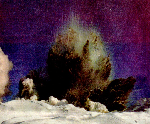
4:57 Saturday (435KB)
The crater lake erupted with little warning on Saturday, less than half an hour after ski lifts closed. A lift may be seen in the lower right-hand corner of the picture. (Just so no one gets anxious about skiers' safety, the skifields will remain closed until the eruptions cease.)
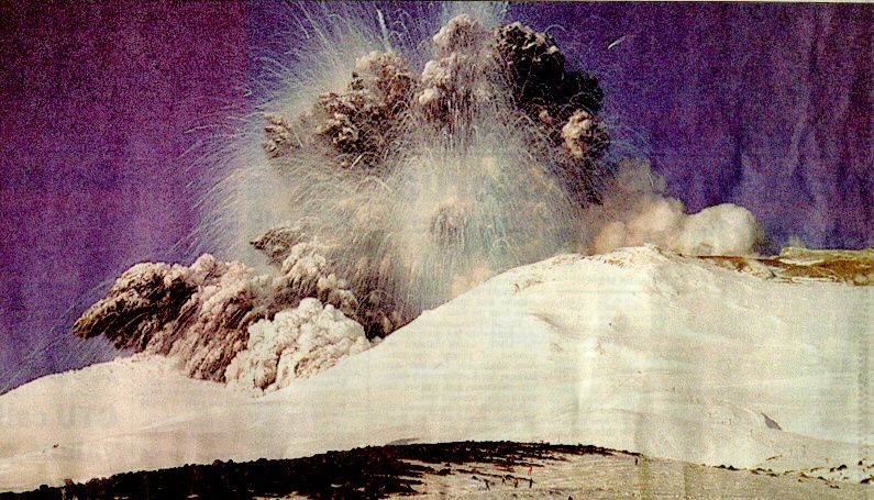
4:57 Saturday on Turoa (614KB)
The eruption from Turoa skifield. The Jumbo and Moro Race T-Bars may be seen in the right-hand side of the image. Rather shocked skiers may be made out in the centre foreground.
There were some skiers on the crater less than 10 minutes before the eruption who are probably feeling pretty bloody lucky today. (Crater excursions are fairly common from Turoa as the crater lip is only a "few minutes" walk from the lifts. On a clear day, the view from the crater lake is spectacular, though it probably doesn't compare with the view during an eruption.)
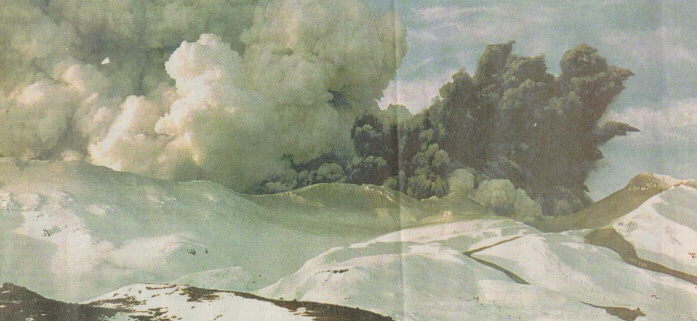
Monday on Whakapapa (256KB)
The third consecutive day of intense volcanic activity sees debris the size of cars thrown from the crater and lahars enter Whakapapa skifield (at right).
These deadly lahar flows are caused by the hot ash and crater lake water mixing with snow. They pick-up a fair bit of momentum and can travel for kilometres down river valleys.
Skiers are constantly reminded that in the event of an eruption we are to "make our way calmly towards a ridge" so as to avoid the lahar flows. After seeing on news broadcasts that they move a damn-sight faster than avalanches I would not advise skiers to move "calmly" towards a ridge; I'd advise them to get the hell out the way as fast as they can.
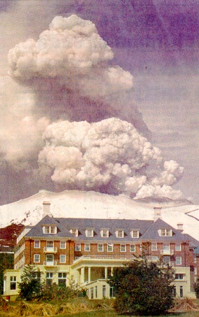
View from the Chateau (182KB)
This shot was taken from the Chateau (some distance from the crater on the north-western slopes of the mountain) on Monday as eruptions continued.