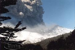
Ruapehu Volcano, New Zealand
© Stimulus (NZ) Ltd. 1996
Last updated 11 July 1996
- North Island, New Zealand
- 39.27S 175.58E
- Summit Elevation 2796m
- Local Time = GMT+12hrs (GMT+13hrs in NZ summer, effective October 1)
- North Island's highest summit, 13 km SSW of Ngauruhoe, is marked by an acidic crater lake of highly variable temperature. This has been the site of more historic eruptions than any other crater lake in the world.
 Eruption Updates
- From New Zealand's Institute of Geological and Nuclear Sciences
- IGNS - ARCHIVED Science Alert Bulletins V95/4 to V96/11 and Media Releases April 1995 to 22 April 1996
- IGNS Volcano Alert System: What do the alert levels mean?
- IGNS - Media Release V95/80 30 November 1995 - 1700 local time
- IGNS - Media Release V96/01 28 March 1996 - 1500 local time
- IGNS - Science Alert Bulletin V96/03 April 22 (Monday) 1000 NZST (UT +12)
- IGNS - Science Alert Bulletin V96/08 June 16 1996 (Sunday) 0830 NZST (UT +13)
- IGNS - Science Alert Bulletin V96/09 June 17 1996 (Monday) 0930 NZST (UT +12)
- IGNS - Science Alert Bulletin V96/10 June 17 1996 (Monday) 1700 NZST (UT + 12)
- IGNS - Science Alert Bulletin V96/11 June 18 1996 (Tuesday) 1145 NZST (UT + 12)
- IGNS - Science Alert Bulletin V96/12 June 19 1996 (Wednesday) 1730 NZST (UT + 12)
- IGNS - Science Alert Bulletin V96/14 June 20 1996 (Thursday) 1600 NZST (UT + 12)
- From The Media
- 1995 News Reports
- TVNZ, New Zealand All material © TVNZ, New Zealand
- CNN - Headline News
- The Press On-Line, New Zealand
- Reuter's International News
Mt Ruapehu Information put together by Ian Sprod at NASA
NOAA Image of Ruapehu Ash Plume From Manaaki Whenua Landcare Research Ltd
The Institute of Geophysics at Victoria University of Wellington has the latest Satellite Images on-line.
Global Volcanism Reports from the Smithsonian Institution
- Reports from 1995
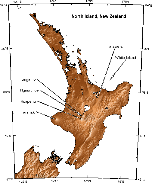
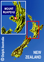
Maps
- A few map perspectives of the North Island and Mount Ruapehu
- 3-d relief map of the North Island, New Zealand showing the major volcanic centers (© RSES, Victoria University of Wellington, New Zealand).
- Regional New Zealand Map with Mount Ruapehu location (© Delphi Australia).
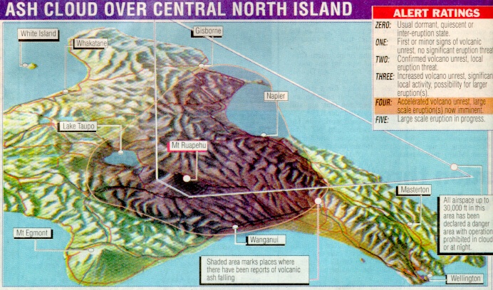
- Ashfall coverage map from the first week of eruptive activity (© The Dominion, © The Evening Post).
Related Sites