Probable Flood Discharge
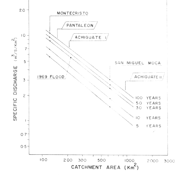
The probable flood discharge at the Montecristo and the San Miguel Moca stations were estimated by the use of the Gumbel Method with the Thomas plotting position from the annual maximum flood.

- Annual maximum discharge at Montecristo and San Miguel Moca stations.
On the basis of the above, the relationship between the probably specific discharge and the catchment areas was drawn in the figure below.
The relationship was checked by the peak discharge of the 1969 flood estimated from the flood mark in Achiguate River, and as a result, the estimated peak discharge of Achiguate River coincides with that of Nahualate River.

- Probable specific discharge and catchment area.
The flood peak discharge at the flood mark at the Achiguate railway bridge (catchment area: 217.0 km²) was estimated at approximately 1,200 m³/s, which corresponds to the 5.52 m³/s/km in specific discharge. The return period of the flood is estimated at 30-year from that of the basin rainfall on the same day. On the other hand, the flood discharge of 30-year return period obtained from teh relationship between the probable specific discharge and the catchment area in Nahualate River is estimated at 1,190 m³/s.
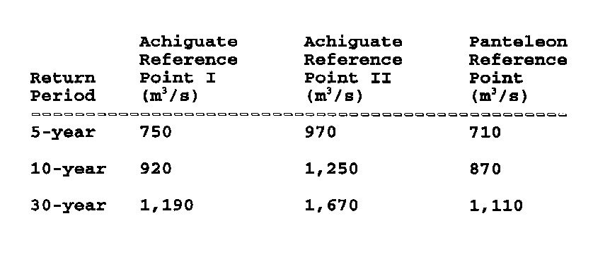
The probable flood discharges of 5-, 10-, and 30-year return periods at the three reference points are as shown in the following table.

- Probable flood discharges.
Flood hydrograph data and prepared graphs were also constructed for the Nahualate River basin. These and associated text can be referenced in the Flood Control Project report.