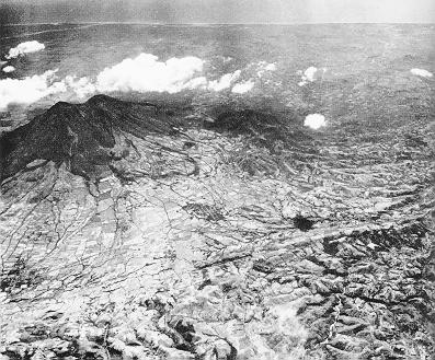
Photo by Williams & Meyer-Abich (1955). Seen from the north. Fault in the foreground represents faults from the central graben of El Salvador and usually have an approximate E-W strike.
Thick, lobate andesite to dacite lava flows surround the volcano, however they are more prominent on the northern and eastern flanks. Large laharic fans also surround the volcano and form the gentle slope topography, characteristic of the lowlands (elevations <500 m).
Immediately east of San Vicente volcano a semicircular structure limits the extents of San Vicente lavas. This structure is believed to define an old caldera structure and encloses several basaltic cinder cones, such as Cerro El Cerrito and Cerro El Cimarr¾n.
Two high temperature fumarolic fields are found on the norhtern slopes of the volcano and are described by Meyer-Abich (1956). These are the fumaroles at San Francisco Agua Agria, which are characterized by emanations of steam and large areas of hydrothermal alteration; and Los Infiernillos, which are somewhat less active.
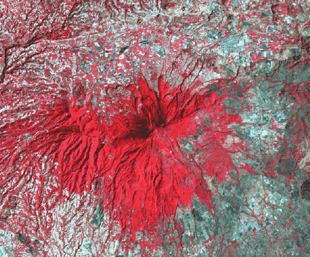
Landsat TM image (bands 2,3,4) of San Vicente volcano. Red represents thick, healthy vegetation.