Location/Geological Setting
Latitude: 13.736 N
Longitude: 89.286 W
Elevation of Boquerˇn: 1893 m.a.s.l
Elevation of Picacho : 1959 m.a.s.l.
Confusion usually exists when referring to San Salvador volcano due to the different names used to identify it. San Salvador volcano is composed of Boquerˇn, which is the central part of the volcano with the large crater; Picacho, being the peak with highest elevation to the northeast of the crater, and Jabali, which is a mountain to the northwest of the crater. All three structures form the San Salvador volcano and describe a complex eruptive history that will be discussed in other sections.
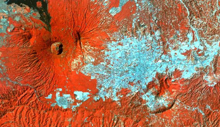
The above image is a LANDSAT image (1986) using bands 4,3,2. In this image it can be seen that the capital city San Salvador (population ~2 million) sits on the western flank of the volcano. Overpopulation of San Salvador has caused people to build at higher elevations. Coffee plantations (in red) cover the greater part of the volcano, while at lower elevations (~500 m) sugar and corn are planted. To the north and west of the volcano the towns of Quezaltepeque and Lourdes respectively, are centers of commercial and agricultural activity.
Geologically, San Salvador volcano is situated towards the southern part of the Central American graben, which in this section runs WNW to ESE and has a width of approximately 20 km. The graben faults are seen just south of the city of Santa Tecla and are also evident by the alignment of four explosion craters west of Boquerˇn. As is the case for most volcanoes in El Salvador, NNW-SSE faults intersect the main graben faults and are reflected by the alignment of radial eruptive fissures north and south of Boquerˇn.