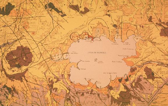
Ilopango caldera, which contains a lake of the same name, is located 10 km east of the capital city San Salvador, next to the heavily populated suburbs of Ilopango, Soyapango, San Bartolo and San Martin. To the east of the caldera the river Jiboa defines the boundary with the San Vicente volcano; south of Ilopango several villages lie on the gentle slopes down to the coastal plains and the western boundary of Ilopango is a series of coalescing dacitic-andesitic domes by the name of San Jacinto. The image below is part of the 1:100,000 Geologic Map of El Salvador that shows the Ilopango caldera and San Jacinto domes on the left.
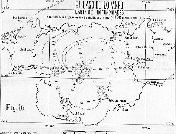
To view a bathymmetry map of Lake Ilopango click here.