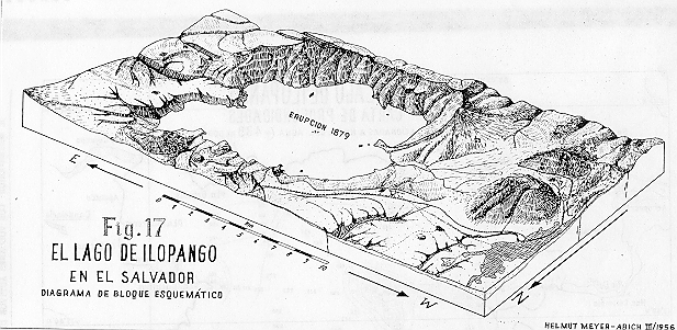
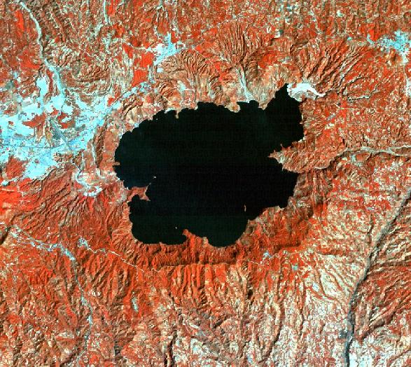
The Ilopango caldera is a depression, which measures 11 km in an E-W direction and 8 km in a N-S direction. The level of the lake is at an elevation of 438 m. The rims of the caldera on the north side are 200-300 m above this level, while on the south side they are 400-500 m higher. The borders of the caldera present a highly irregular surface with several semicircular morphologies. Several resurgent domes associated with various eruptive episodes are found outside the caldera boundaries, within the caldera walls and inside the lake.
Meyer-Abich (1956) refers to the Ilopango caldera as a volcano-tectonic depression, the origin of which differs from other calderas such as the Coatepeque caldera, which was formed by the collapse of a volcanic edifice.
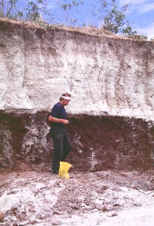
Williams & Meyer-Abich (1953 and 1955) discuss the origin of the caldera and suggest that it is a result of three distinct collapse episodes, each associated with violent volcanic eruptions. The first of these collapses is believed to have occured during the formation of the Central American graben, which has been placed in Pliocene-Pleistocene times. The final caldera collapse is associated to the Tierra Blanca Joven eruption (260 +/- 114 A.D.), which has been studied by Hart (1981).The image below is of a TBJ deposit overlying a thick chocolate brown paleosoil, being studied by Dr. James Vallance.