AVHRR imagery has many different applications. The following
images are examples of band 4 (thermal) data, and show a variety of phenomena
observed in the Lake Superior region.
Click on the small image for a larger version.
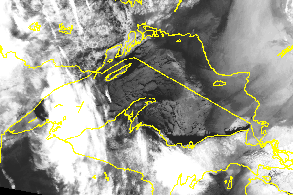
The amount of ice cover on Lake Superior directly effects the amount of lake effect snow we receive. In this image from March 2, 1994, the extent of the lake ice can be seen. It appears as a medium grey tone in this image. Cracks in the ice and (or) open water are dark tones. High clouds are bright white, while low clouds are grey (as seen over the eastern shore).
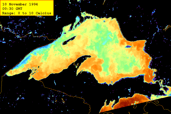
The AVHRR sensor can be used to determine surface water temperature. In this image from November 10, 1994, only the data values from 0 to 10 degrees Celsius are shown. Blue is cold and dark red is warm.
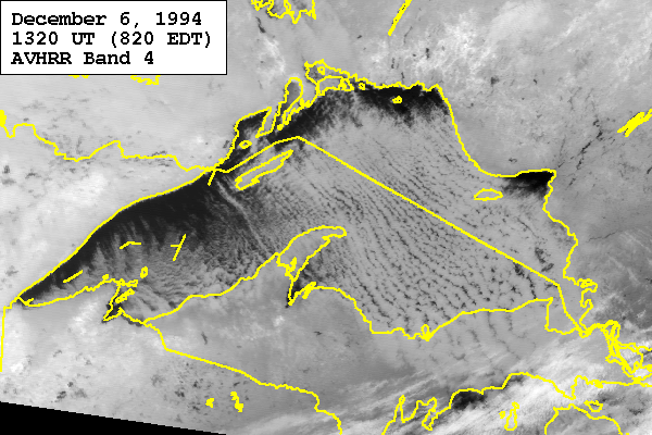
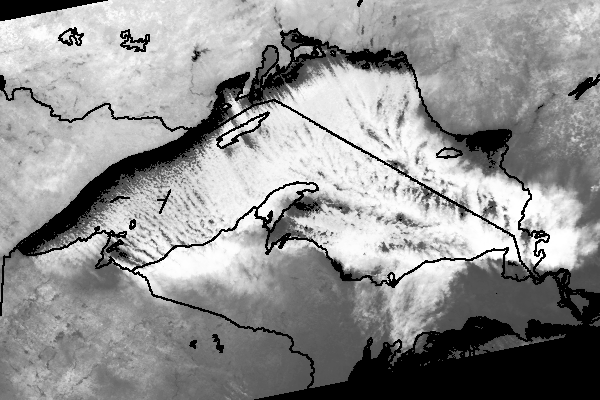
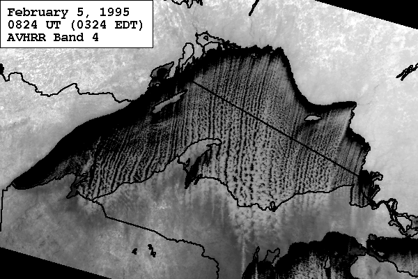
In these images from the winter of 1994-95, lake effect snow squalls can be observed. The snow squalls are generated as point sources in the lake, and allign themselves parallel to the prevailing wind. In both of these images, individual clouds extend for hundreds of miles. In the image on the right, note the effect of topographic barriers on the patterns of cloud formation. There are "snow shadows" in the lee of the Keweenaw, the Apostle Islands in Wisconsin, and Pie Island, northwest of Isle Royale.
 Back up to Home Page