 Characteristics of the AVHRR
Sensor
Characteristics of the AVHRR
Sensor

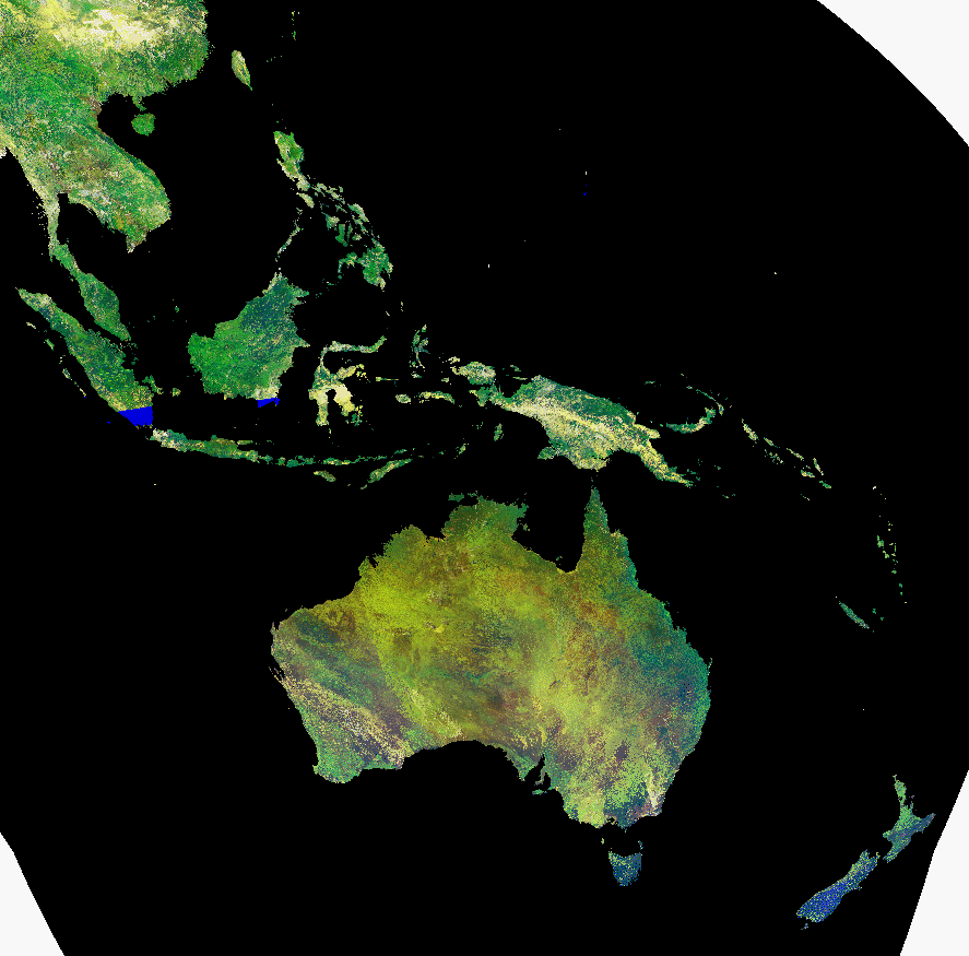
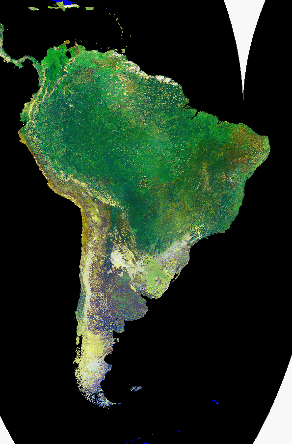
Another useful aspect of remote sensing is that global monitoring can
be conducted from nearly any location on earth. Repeated measurements of
the entire biosphere are needed to assess the impact of human activity on
the planet. The following images are part of a joint project between the
U.S. Geological Survey and the.
It is a composite image taken over the past ten days, using the Advanced Very High
Resolution Radiometer (AVHRR). Hundreds of images need to be collected to produce the
mostly cloud free image. (A typical global "snapshot" is seen on the previous
page, in which much of the earth is covered by clouds.) The data is processed
to produce an image which shows the amount and type of vegitation cover.
Green areas have lush vegitation, while brown areas are barren.
Characteristics of the AVHRR
Sensor
Click on the underlined text to see full sized versions of the following regions:

 Back up to Home Page
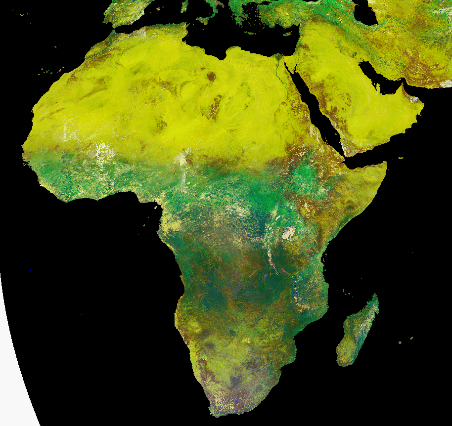