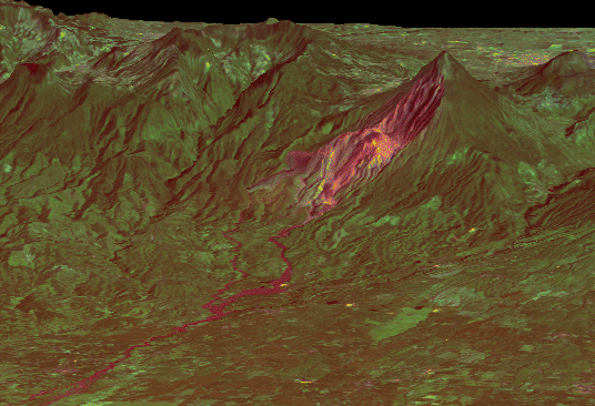
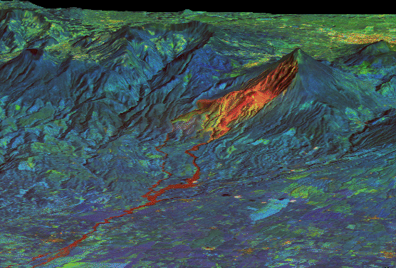
Creating 3-D images
Satellite sensor information (different bands) can be overlayed onto
elevation data (height) to give a 3-D image of a given area.
This first image shows bands 7, 5, and 1 (thermal, infrared and visible red)
 (click on image to see full size)
This images shows bands 4, 5, and 1 (near-infrared, infrared and visible red)
 (click on image to see full size)
red shows fresh volcanic rock
blue shows wet vegetated regions
green shows dry vegetated regions
 (click on image to see full size)