
Archived:
4 February 1996: Ice Covers Much of the Great Lakes
 4 February 1996 Freeze of the Great Lakes (60 kb)
(Huge version of the same (720 kb))
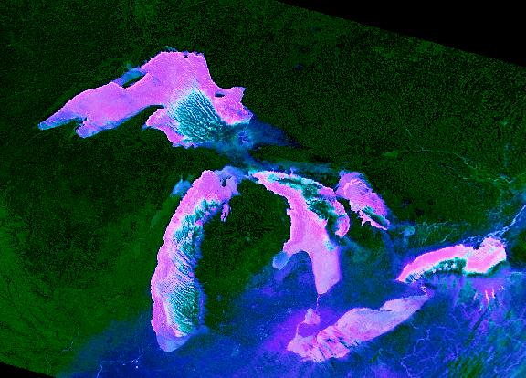
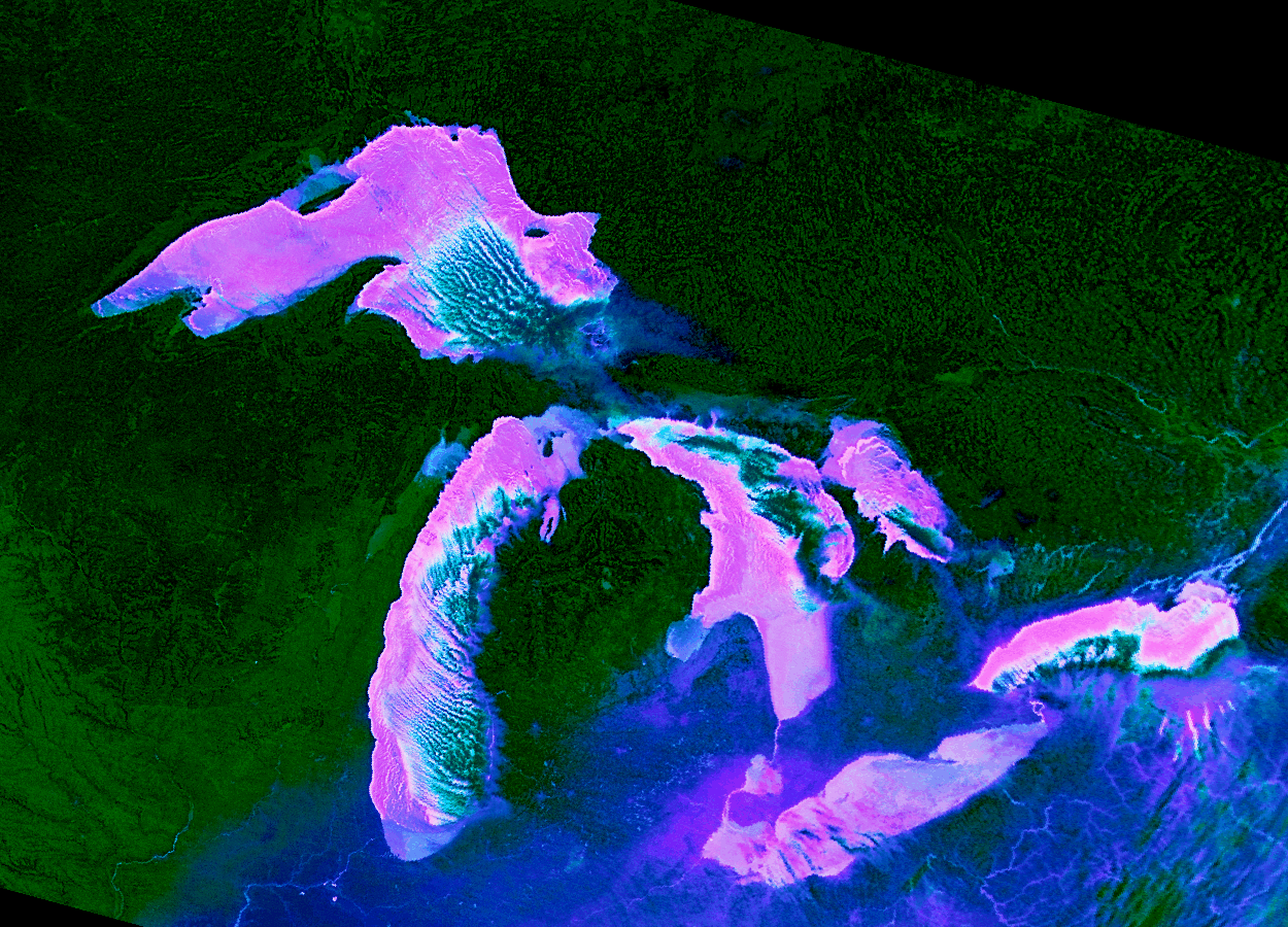
False Color Composite from AVHRR
The first week of February, 1996 brought several consecutive days of extremely low temperatures to the upper midwest, in the range of -29 to -51 C (-20 F to -60 F). The very cold air and mild winds in the Great Lakes region produced conditions favorable to formation of an extensive ice cover.
This image is a composite of two thermal channels and their difference from the AVHRR sensor (ch5/ch4-ch5/ch4 R/G/B). Image color and intensity vary as functions of temperature, allowing discrimination of land (green), old ice (blue), new ice (pink-magenta), open water / ice (white-pink), and clouds (green-blue).
Blue ice. Prior to the cold snap, ice cover on the Lakes was concentrated in relatively quiet bays (e.g., Saginaw Bay, Georgian Bay) or in areas where ice is concentrated by wind and obstructions (e.g., Straits of Mackinac, northwest coast of Keweenaw Peninsula, northwest coast of Isle Royale). Most of this is deformed ice, fractured and thickened by compression. The old ice has varying amounts of snow cover. In places along the Superior shore, and typically other Great Lakes shores with similar conditions, is a band of shorefast ice called the icefoot.
Pink ice. This ephemeral ice cover formed a thin skin (a few mm to a few cm?) over most of the water surface on the Lakes. How do we know that its ice and not water? Two things. First, the calibrated AVHRR channel 4 radiances indicate that the Lakes' surface temperatures are on the order of -20 C. Therefore, we are seeing ice, not liquid water. Second, the patterns look like ice. There are what appear to be fractures/leads (white-pink cracks) in the ice (e.g., north central Lake Superior), and a marginal lead along most of the leeward shores (the winds are dominantly from the northwest).
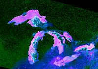
The local view: Lake Superior extensive ice cover

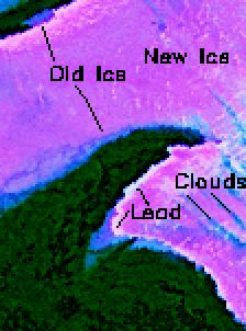
Air temperatures in the Keweenaw region reached lows of around -25 F (-32 C), and even lower in Minnesota (from -40 to -60 F (-40 to -51 C). Winds were relatively calm for a few days (circa Feb. 1 - Feb.4). The combination of very low air temperatures and low winds promoted development of an extensive ice cover.
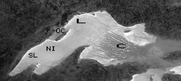
This image is AVHRR band 4 (thermal infrared). Image intensity is proportional to physical temperature (black=cold, white=hot) (the temperature range is approximately -50 to -2.5 C). The apparent new ice is the light grey tone covering most of the lake surface. An older ice (OI) appears in medium gray in more protected areas such as the Apostle Islands, or locked in between Isle Royale and the mainland. Clouds (C) are about the same grey tone, seen in in bands beginning over the eastern basin. The white squigley lines on the new ice are probably leads (L, open water fractures). There is a persistent (white) shore lead (SL) along the leeward coasts (the wind is from the northwest.)
Landscape radiances are converted to physical temperature using a standard AVHRR calibration algorithm in Kidwell's "NOAA Polar Orbiter Data Users Guide" using Terascan software.