Great Lakes Ice Home

Outreach Page     Remote Sensing Institute

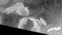
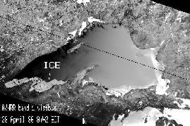
Remote Sensing of the Great Lakes Cryosphere

This page is a collection of links to topics relating to remote sensing of ice and snow phenomena (the cryosphere) in the Great Lakes region, primarily around and on Lake Superior. These web pages are the achives of a part of Professor Drew Pilant's Remote Sensing research group's activities 1995-2000.


Images of Extensive Great Lakes Ice Cover from AVHRR

Radar Links

Air photos of Lake Superior Ice

SSM/I Passive Microwave Images and Animation of Great Lakes Ice

SSM/I Views of Lake Superior, February, 1996

In situ photos of Lake Superior ice

AVHRR Time Series of Great Lakes Ice Conditions

Lake Superior AVHRR and GOES Images: Spring 1996

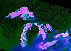
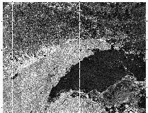
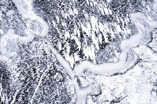
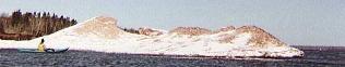
Additional Links:

Lake Superior Ice Volcanoes!!
Department of Geological Engineering and Sciences
Department of Physics
Remote Sensing Algorithms, Procedures and Miscellaneous Notes
NASA Space Shuttle Photos of Michigan (Earthrise)