


http://superiorwatersheds.org/shorelineviewer2011/
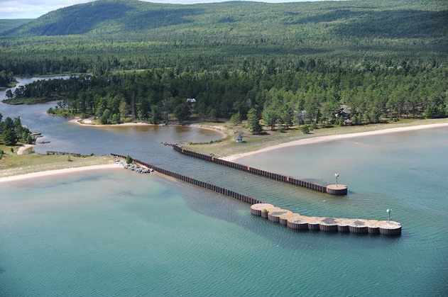
A fine, low energy beach, Bete Grise is sheltered from strong northerly winds by the lavas of the Portage Lake sequence above the Keweenaw Fault. The beach has two access points, one to the North, which is where most of the public goes, and which has parking along the Bete Gris road, and one to the South, accessed along the Gay-Lac la Belle road and a 100 m long trail from the Parking lot N to the shore. The South is much more secluded, park of the Bete Grise South Preserve. Watch for ophite boulders and cobbles, and explore the wetlands west of the beach to see the old shorelines. This is a beautiful place, part of the sacred lands of the Anishinaabe.


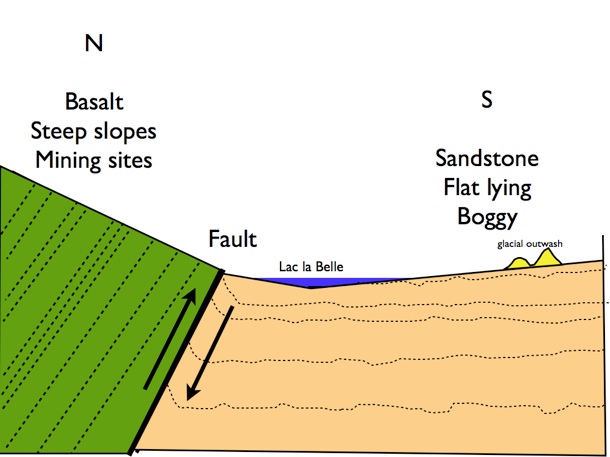
Schematic cross section view of the Bete Gris Wetlands, entirely underlain by Jacobsville Sandstone, looking east.
Bete Grise Wetlands
Jacobsville Sandstone
Portage Lake Volcanics
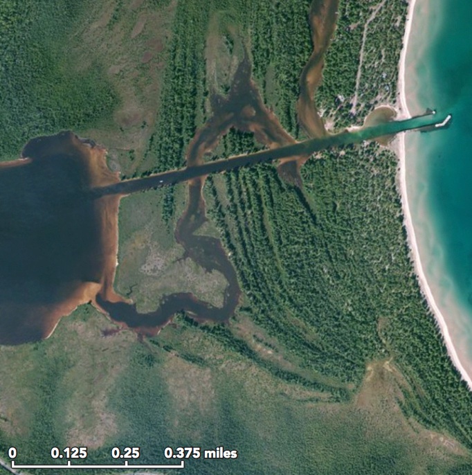
Apple Maps Image
Natural Channel
Man Made Channel
Raised Shorelines