A Rift

Local Rock Formations:
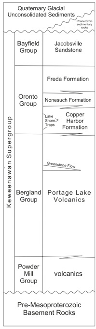
The diagram at right, from Bornhorst & Barron (2011), shows how geologists subdivide this mid-Proterozoic Keweenawan Supergroup, which contains all the formations of the rift. These consist of black lavas from the deep earth and rusty red sediments, shed off of the top of Rodinia into the gaping rift.
On Isle Royale, we find only the Portage Lake Volcanics and the Copper Harbor Conglomerate, while on the Keweenaw we have all the other formations shown here.
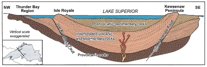
The idea of a syncline comes from observed features in geology. In the Keweenaw we cannot see the whole syncline--far from it! We just see the rocks dipping toward the North at Copper Harbor and to the north we see those dipping to the South on Isle Royale. In between is how geologists earn their money!
Implications of this Hypothesis: 1. Layers of rock extended from the Keweenaw to Isle Royale, apparently filling a basin. 2. Something caused the basin to subside. 3. The basin has influenced the formation of Lake Superior. 4. The basin may continue beyond the lake. 5. Its importance could extend much farther than explaining the tilting.
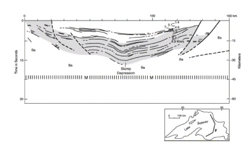
This seismic profile was found by a ship traverse across eastern Lake Superior (see segmented line on inset map), confirming the rift geometry which was predicted by geologists 75 years before (Modified from Behrendt et al. (1988).
NK Huber
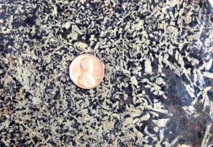
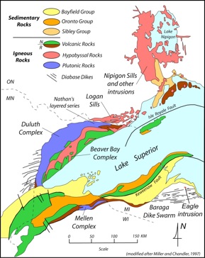
The Green and Blue areas on the map at left display the location of a huge crack in the Earth, where lava poured out for several millions of years. Mostly these rocks are buried deeply below the surface, but in the Lake Superior region and especially in the Keweenaw they are at the surface, where we can see, collect and mine them. We can walk and sleep on them, use them every day. These rocks define the lake itself and affect the character of our lives in many ways. There are black lava rocks and their intrusive equivalents (blue on the map) and red bed sediments (green on the map).
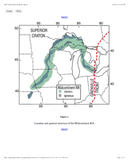
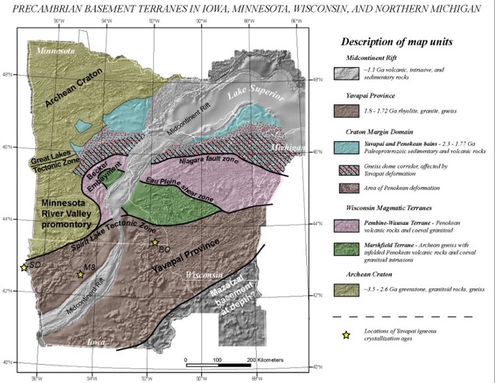
On the map above, the rift is labelled the MidContinent Rift and shown in Grey color. Note how this cuts all the other parts of the map, which represent older rocks, different rock formations which were cracked and jerked apart. The map here shows a much smaller area than the one above, and uses geologic formation names which extend into other parts of North America and even to other continents. At the time of the rift, they were all part of Rodinia, a massive continent which eventually shattered and broke into dozens of pieces. These pieces then became tectonic plates and parts of continents which moved, collided and split again.
When the crack formed and began to spread apart and fill with lava, it sank of its own weight and formed a syncline, a great arcuate feature which has red rocks on top and black ones below.


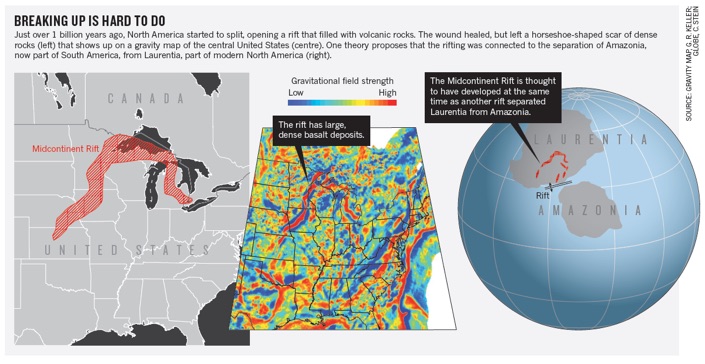
Nature 504: 24-26, Dec 2013


Exposed Keweenaw Rift Rocks: